• Hello, please take a minute to check out our awesome content, contributed by the wonderful members of our community. We hope you'll add your own thoughts and opinions by making a free account!

Pattern Jammin January 2024

1703909812767.png
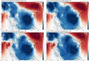
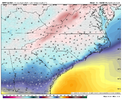
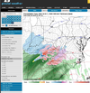
I think you’re about to see some type of CAD event shortly. Deeper 50/50 and stronger S/W. Already can see stronger HP setting in out ahead also. But again the NS is really progressive with no true -NAO in place.
 
View attachment 139407
I think you’re about to see some type of CAD event shortly. Deeper 50/50 and stronger S/W. Already can see stronger HP setting in out ahead also. But again the NS is really progressive with no true -NAO in place.
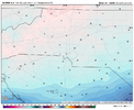
Yeah the height field is less suppressed as well. Not sure I like it 9C25026F-E89F-4E34-839F-E5705849163D.png
 
Yeah you’re probably going to get a cutter with the S/W slowing down and pumping the heights out ahead. We did trend better with bombing out the 50/50 and the overall location of the Low pressure. If you can get the 12Z S/W timing and location with the 0Z Atlantic and you’re getting a pretty significant ice storm for the CAD areas
 
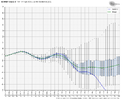
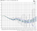
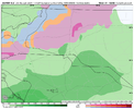
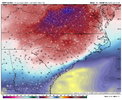
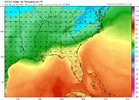
Both the CMC/GFS favors climo favored regions with this look. We gotta speed the wave up or dig that trailing northern stream trough more SE towards the SNE for this to be a big CAD event, that secondary lobe is what has the more legit cold/dry feed. I’d say this is a look that favors climo favored regions for now (I-40 and north/foothills/mountains) B64B3C32-C933-4E3B-9D75-B8117C86916F.png4C8F2553-E247-4095-A2F0-8028B3C7CF55.pngB64B3C32-C933-4E3B-9D75-B8117C86916F.png4C8F2553-E247-4095-A2F0-8028B3C7CF55.png
 
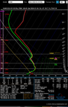
Really need to figure out how to get the S/W to speed up for this to work. Our N/S is just too progressive right now and you’re working with marginal cold. Even if everything went right you’re probably looking at 28-30 degree at best CAD event imby and that’s if we speed the S/W up while continuing the trend of bombing out our 50/50 and building in stronger HP. Right now that 50/50 is really the only cold source we have in this set up so you need it to really turn into a monster that naturally slows its progression as it bombs out over New Foundland and funnel in the cold. But we did overall trend better and didn’t go the opposite direction so far so that’s a positive.
 
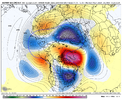
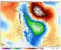
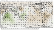
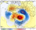
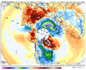
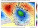
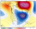
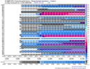
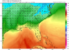
don’t think many want to hear this, but later week 1-week 2 of jan and maybe even a little further past that, it doesn’t look pretty pattern wise. Tropical forcing looks to slow significantly for a while in the Indian Ocean due to the weakening +IOD, which will give it more oomph as well. (basically the IO losing influence from the El Niño). The MJO slowing over the Indian Ocean for the next week and beyond is gonna favor a retracted pacific jet past next week and the semi-permanent Okhotsk low, which favors GOAK ridging/-PNA. Given the HLB/-NAO, the SE ridge might be put at bay at times, but it probably will show up at times. It’s honestly a pretty nina esque look

It’s worth noting, that the original progression that I was banking on, was the IOD collapsing in mid jan as tropical forcing returns to the WPAC, which would have been far more favorable.

Still think later in the month, we extend the jet. It’s a strong Nino after all. Tropical forcing will return in the WPAC eventually. But we timed the IOD crash and MJO somewhat badly.

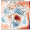
This pattern will definitely bring back legitimate snowpack to areas in NA that are super below average right now. As we can see over the next week, cold is a huge issue, and this issue is likely playing a part, this pattern should bring that back for when we do extend the jet again.
D0190ABB-D236-41CC-AF04-8D14C07891E8.pngE05B4E15-98D4-4860-9F54-1A0C70A2869B.png
 
Last edited:
don’t think many want to hear this, but later week 1-week 2 of jan and maybe even a little further past that, it doesn’t look pretty pattern wise. Tropical forcing looks to slow significantly for a while in the Indian Ocean due to the weakening +IOD, which will give it more oomph as well. (basically the IO losing influence from the El Niño). The MJO slowing over the Indian Ocean for the next week and beyond is gonna favor a retracted pacific jet past next week and the semi-permanent Okhotsk low, which favors GOAK ridging/-PNA. Given the HLB/-NAO, the SE ridge might be put at bay at times, but it probably will show up at times. It’s honestly a pretty nina esque look

It’s worth noting, that the original progression that I was banking on, was the IOD collapsing in mid jan as tropical forcing returns to the WPAC, which would have been far more favorable.

Still think later in the month, we extend the jet. It’s a strong Nino after all. Tropical forcing will return in the WPAC eventually. But we timed the IOD crash and MJO somewhat badly.

This pattern will definitely bring back legitimate snowpack to areas in NA that are super below average right now. As we can see over the next week, cold is a huge issue, and this issue is likely playing a part, this pattern should bring that back for when we do extend the jet again.
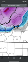
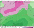
View attachment 139421View attachment 139423
Yeah still got long ways to go . I can’t get to excited yet be honest .
 
Night an day between Euro and GFS. Maybe the American model wins one for a change
 
Back
Top