LukeBarrette
im north of 90% of people on here so yeah
Meteorology Student
Member
2024 Supporter
2017-2023 Supporter
If he’s right then we are certainly in for a snowier look here in VA.
Yea, and at least the euro is on our side for the moment!All we need is a small shift south or weaker shortwave and we get majority snow. If we are not in NAM range then more changes are still possible. Either way I think we see at least a few inches of snow which we should be very grateful.
Euro is my number 1 model this season thus farYea, and at least the euro is on our side for the moment!


i'm not as enthused as you are outside of areas with elevation. The parent high for this storm is well into canada- any CAD will be in-situ in nature. with that you're relying on solid diurnal temp drop friday night with radiational cooling to even give you a shot of something frozen. i made a comment earlier this week mentioning the preceding air mass will be "chilly", and it may be enough to give some novelty sleet/zr, but i think the flip to rain will be quick and widespread.I'm thinking there's going to be widespread icing Saturday morning in CAD regions. Possibly damaging ice along the escarpment in NC. All the models have temps/dews around 35/22 after we cloud up Saturday night. Then precip quickly breaks out and gets heavy before daylight. That sounds like a recipe for wetbulbing down to 27-28 in the prime CAD regions to me, especially considering they never lose northeast winds throughout the day.
Good ole' cold rain
This is actually a situation where snowpack to the north would be helpful, if you desire ice. But since we don't, I agree with your analysis here, and I think it will prove to be spot on. Unless the models turn around on the high pressure strength and placement, about the best one could hope for is a bit of minor icing before the inevitable change over to rain.i'm not as enthused as you are outside of areas with elevation. The parent high for this storm is well into canada- any CAD will be in-situ in nature. with that you're relying on solid diurnal temp drop friday night with radiational cooling to even give you a shot of something frozen. i made a comment earlier this week mentioning the preceding air mass will be "chilly", and it may be enough to give some novelty sleet/zr, but i think the flip to rain will be quick and widespread.
different story for areas of elevation where it will be colder... dependent on the microclimate.
my hedge is that as other have pointed out the piedmont isn't thaaaaat far off. and posting this right before the 12z suite i'm putting myself at risk of looking like a big idiot if there are south shifts. i should also give the CAMs a chance to sniff things before writing it off. but to me this just looks like a storm for coal country and i think any impacts for us will be marginal
Nah you're probably spot on, "damaging" probably wasn't the best word to use, haha, But I think some of the preferred escarpment area's with a little elevation could reach 1/4 inch/warning criteria ice. Advisory ice accumulations are definitely achievable for a wide swath of piedmont NC as well.i'm not as enthused as you are outside of areas with elevation. The parent high for this storm is well into canada- any CAD will be in-situ in nature. with that you're relying on solid diurnal temp drop friday night with radiational cooling to even give you a shot of something frozen. i made a comment earlier this week mentioning the preceding air mass will be "chilly", and it may be enough to give some novelty sleet/zr, but i think the flip to rain will be quick and widespread.
different story for areas of elevation where it will be colder... dependent on the microclimate.
my hedge is that as other have pointed out the piedmont isn't thaaaaat far off. and posting this right before the 12z suite i'm putting myself at risk of looking like a big idiot if there are south shifts. i should also give the CAMs a chance to sniff things before writing it off. but to me this just looks like a storm for coal country and i think any impacts for us will be marginal

Yeah, my thinking is areas 85 and north in NC, brief chance at a quick glaze to rain, areas closer to I-40, glaze to .1, with initial IP, and mountains gets front end snow/sleet to ZR then raini'm not as enthused as you are outside of areas with elevation. The parent high for this storm is well into canada- any CAD will be in-situ in nature. with that you're relying on solid diurnal temp drop friday night with radiational cooling to even give you a shot of something frozen. i made a comment earlier this week mentioning the preceding air mass will be "chilly", and it may be enough to give some novelty sleet/zr, but i think the flip to rain will be quick and widespread.
different story for areas of elevation where it will be colder... dependent on the microclimate.
my hedge is that as other have pointed out the piedmont isn't thaaaaat far off. and posting this right before the 12z suite i'm putting myself at risk of looking like a big idiot if there are south shifts. i should also give the CAMs a chance to sniff things before writing it off. but to me this just looks like a storm for coal country and i think any impacts for us will be marginal
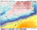
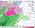
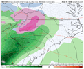
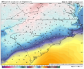
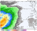
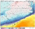
30+ degree Carolina gradient checks outYeah, my thinking is areas 85 and north in NC, brief chance at a quick glaze to rain, areas closer to I-40, glaze to .1, with initial IP, and mountains gets front end snow/sleet to ZR then rain
View attachment 139743View attachment 139744
View attachment 139745View attachment 139746
View attachment 139748View attachment 139747
Yeah, trending in the wrong direction for sure.
Miller B?
GEFS is advertising a significant cold intrusion around 1/10. I don't think it's the much vaulted pattern change, though. If there's a trailing wave after that possible severe weather generator early next week, we might get a "surprise" shot at frozen somewhere in the southeast.Looks like the first few weeks of January are a toss, even for the mountain folks (outside of a trace here or there.) If they can't even score with elevation... Just disappointing to see another dud of a year. At least it's chilly?
Catching up on lunch break today. But Glad you reminded everyone of this, who's not aware. This is always a good metric/valuable and proven toole to use, at least for onset of events when nitpicking surface and BL issues. If this model says you are cold enough at start, its a guarantee. I'd use only for the onset. Its no better than anything else for duration temp profiles, changeover times etc. Its always a notch warm biasedIcon being hi-res and a warm bias at the surface, getting colder at 12Z run puts my interest quite a bit higher now.

Canadian beefed up totals at 12z across Triad. Quick hitter and Ill take .25-.35 usually avoid any problems. Its as you get close to .5 things really start snapping and popping. Shettley and Jimmy would be in dark under this scenerio


Yup. Right in the 1" section down in the foothills on NC.Canadian beefed up totals at 12z across Triad. Quick hitter and Ill take .25-.35 usually avoid any problems. Its as you get close to .5 things really start snapping and popping. Shettley and Jimmy would be in dark under this scenerio


Hope this is more transient as not good for us in the se with that lookFro, Grit , QC,SD anyone get the EPS last night past day 10? Wondering if that lobe gets up under the block any further east toward the lakes region? Thanks in advance

Fro, Grit , QC,SD anyone get the EPS last night past day 10? Wondering if that lobe gets up under the block any further east toward the lakes region? Thanks in advance


Ridging in Alaska, troughing ne of Hawaii and a west based -NAO should be perfect for a trough in the east. Yet there we are. I guess it's a smoothed out mean. Maybe a poorly tiled EPO ridge idk. But if that pattern still doesn't produce an east coast trough with staying power I don't know what will anymore.It's underneath there. But still wants to dump cold out west.

Maybe Dr. No can still be Dr. Yes.
Still a little hope but the trend needs to reverse a little bit.
You're giving the GEFS and its OP way too much credit.Oh Canada eh? It really looks great, but I have a personal prejudice against the model. I think it's cold biased malarkey (I know ensembles are better, but meh). Hopefully it and the EPS is more right with the west based block in a couple weeks.
Even if the GEFS pulls one out and its MJO/forcing shown is correct, the -NAO and the 50/50 not being in a terrible spot may allow us to back into a cold Miller B scenario.
Nice to start January with generally conducive patterns for tracking.
You're giving the GEFS and its OP way too much credit.
