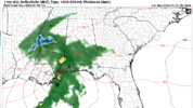
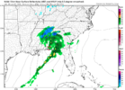
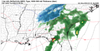
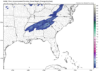
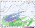
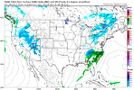
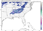
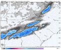
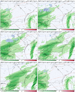
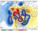
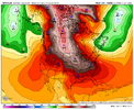
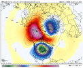
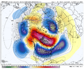
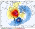
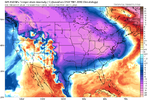
Might have a weenie run incoming on the 18z NAM for those in AL/GA for the 1/3-1/4 system
-
Hello, please take a minute to check out our awesome content, contributed by the wonderful members of our community. We hope you'll add your own thoughts and opinions by making a free account!
You are using an out of date browser. It may not display this or other websites correctly.
You should upgrade or use an alternative browser.
You should upgrade or use an alternative browser.
Pattern Jammin January 2024
- Thread starter SD
- Start date
Flotown
Member
nam looks a little more amped??
NBAcentel
Member
EPS starting to extend the pacific jet close to Hawaii towards mid month ?
ForsythSnow
Moderator
Classic solid 18Z NAMming. Either it breaks soon or the other models start to bend in its favor. Tomorrow it'll be within 48 hours as well.
Now! The NAM has been better than average at 3-4 days out this hear
Ron Burgundy
Member
Those are the most exciting winter weather events around here IMO. Love a good dynamic-cooling snow!
We should know by tonight’s NAM run if it’s on to something. Interestingly the FFC mentioned in the latest discussion some of the global ensembles are NAM like.Classic solid 18Z NAMming. Either it breaks soon or the other models start to bend in its favor. Tomorrow it'll be within 48 hours as well.
Drizzle Snizzle
Member
Time for a storm thread
It's probably going to end up sad but you guys have at itTime for a storm thread
Webberweather53
Meteorologist
When the Pacific Jet Stream starts to retreat again after the extension around mid-January, watch out ?
Makeitsnow
Member
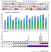
Talk about an i85 special. Its doable if there is enough precip..but the nam is several times heavier with precip totals. However even with lighter amounts i think folks will see flakes falling at least. There is very dry air just off the surface through the mid levels which should result in quite a lot of evap cooling. Even though surface temps will be fairly warm initially low wetbulb zero heights flakes shouldn't have much problem reaching the surface from Atlanta to Athens northward...assuming of course there is enough precip to make it through that dry air. Any enhanced band of precip would go over to snow fairly easily imo. Looking at soundings ..areas as far south as I 20 in ga could be cold enough to see flakes..although wetbulb zero heights are marginal there.The ole 5 inch Atlanta bullseye ??View attachment 139685
Just want to see other models increase overall totals. Nam is a bit north of other models with the surface low so hopefully we will at least see a compromise position.
I would start paying very close attention to the long range HRRR tonight. It will sniff out FGEN forcing better than any other modelWe should know by tonight’s NAM run if it’s on to something. Interestingly the FFC mentioned in the latest discussion some of the global ensembles are NAM like.
Ron Burgundy
Member
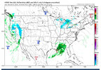
Probably wish casting on my part but it does seem to be picking up some convection on the leading edge of the precip as early as Wed afternoon around Montgomery. As you said, be interesting to see where it goes tonight.I would start paying very close attention to the long range HRRR tonight. It will sniff out FGEN forcing better than any other model
iGRXY
Member
The NAM struggled with the January 22 system with the precip shield and FGEN stuff too at this range so this is honestly isn’t surprising. Different setup but same variablesI would start paying very close attention to the long range HRRR tonight. It will sniff out FGEN forcing better than any other model
You’re right. Heck the 3kNAM lost the February 2021 system until about 5 hours or so before snow broke out in the Upstate…there were a number of people talking about what a joke the HRRR is, which it definitely has struggles on some stuff, but it’s the best at sniffing out a set up like this.The NAM struggled with the January 22 system with the precip shield and FGEN stuff too at this range so this is honestly isn’t surprising. Different setup but same variables
All bs/ joking aside, I’m looking forward to see how the rest of the month plays out and hopefully board wide scores going forward!
NCHighCountryWX
Member
- Joined
- Dec 28, 2016
- Messages
- 699
- Reaction score
- 1,918
W
WSW
Guest
LukeBarrette
im north of 90% of people on here so yeah
Meteorology Student
Member
2024 Supporter
2017-2023 Supporter
I do not have access to this, I steal these images sometimes from other forums…show that furthere west if you dont mind..thanks
Webberweather53
Meteorologist
The coastal mid-Atlantic seems poised to choke next week’s storm away and I find it pretty funny.
LukeBarrette
im north of 90% of people on here so yeah
Meteorology Student
Member
2024 Supporter
2017-2023 Supporter

This is going to be a nightmare of a forecast for DC and for myself. First thoughts for Roanoke is 4-8 inches of snow and sleet. Could be lots of sleet.
NBAcentel
Member
rburrel2
Member
I haven’t felt this good about the long range since 2010/2011. That GFS run is sick! All the ensemble means show roughly the same thing too!
NBAcentel
Member
- Joined
- Jan 23, 2021
- Messages
- 4,602
- Reaction score
- 15,197
- Location
- Lebanon Township, Durham County NC
There was about to be a massive coastal(think 1973) storm at the end, i think.
NBAcentel
Member
Everyone loves some fantasy cold too.


LukeBarrette
im north of 90% of people on here so yeah
Meteorology Student
Member
2024 Supporter
2017-2023 Supporter
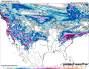
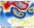
Screams suppression which is exactly what we want!!!this is a pretty classic response to a SSW event View attachment 139701View attachment 139702View attachment 139703
accu35
Member
But is there gonna be any moisture to go with it is the question.
Cad Wedge NC
Member
That screams suppression....

