rburrel2
Member
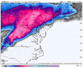
Lots of absolute hammer jobs for South/Central Virginia in the GEFS. They're sitting in a great spot right now.
DeeeeTeeee is out buying pants! He was posting like a crazy on FB about 3-4 in the morning!
Yesterday it was closer to Atlanta I believe. That’s what I mean I’m terms of more north. It did move south up that way.Stevo24 that canadian ice map has actually went south latest run. South an east of 85 in NC. My area went from grey to solid pink from 0z last night runs
Just out of curiosity… what is your confidence level compared to the last two years? I remember that you called the very good pattern we had in January 2022 from back a couple weeks before Christmas and then last year you were very certain by the first week of January that the rest of the winter would torch for us. Both times you were pretty much spot on. How confident are you going forward this year?Things look to be mostly going to plan overall for this winter. Very much are on track for a legitimately good pattern as we approach Feb
I agree but definitely nervous about the the potential for the storm to become amped too earlyLots of absolute hammer jobs for South/Central Virginia in the GEFS. They're sitting in a great spot right now.
You think CMC is so messy because it is so weak that it does not pull the cold in and not have the dynamics?I agree but definitely nervous about the the potential for the storm to become amped too early
It’s messy because the shortwave is a lot stronger when it’s in plains compared to Euro and GFSYou think CMC is so messy because it is so weak that it does not pull the cold in and not have the dynamics?
Still not bad for you guys but better further North on 81. This is gonna go back and forth.View attachment 139660
Boy do I love when the low pressure runs right through mountains???

This would be the most nasty really heavy wet snow + sleet combo of all time. Guess I can’t really complain.Still not bad for you guys but better further North on 81. This is gonna go back and forth.View attachment 139661
It’s been doing this back n forth lately, especially the Euro. 18z or 0z will show different
HAHA. I think you will end up with some good snow. Lots of runs left to go.This would be the most nasty really heavy wet snow + sleet combo of all time. Guess I can’t really complain.
YES. 81 looks to get plastered...View attachment 139664
80% for an inch, i’ll take those odds
Where are you from MB?YES. 81 looks to get plastered...
Born in Leesburg, Loudoun County. Grew up in Lovettsville. Wayyy down south right now, but looking to move back to Virginia or West Virginia.Where are you from MB?
show that furthere west if you dont mind..thanksView attachment 139664
80% for an inch, i’ll take those odds
I don't have access to that but hopefully Luke does.show that furthere west if you dont mind..thanks
its cool thanksI don't have access to that but hopefully Luke does.
Mountains of West Virginia would be a good bet.good night..gonna try to chase this weekend but have no idea where to go...all over the place the models are
i know..been there but just too far right nowMountains of West Virginia would be a good bet.
If you gonna chase you have to travel. I’ve been doing it for 25+ years.i know..been there but just too far right now

oh ,ive done 11 hours but just cant do that for nowIf you gonna chase you have to travel. I’ve been doing it for 25+ years.
