CNCsnwfan1210
Member
Here's the 12z CMC ensemble at 192 hours

Sent from my SM-A136U1 using Tapatalk

Sent from my SM-A136U1 using Tapatalk

Canadian is a cold biased model so yes in the event that it is aligned with other guidance as far as H5, Storm progression, and track then it is a good model to use in the day 3-7 range for temp profiles. GFS is awful with CAD, EURO is in the middle, all models tend to under estimate it. NAM and 3K is good to look at for thermals within the column itself once in range.Canadian does best with CAD right?
Really likes the CAD idea. Seems like the likely solution at this point.Here's the 12z CMC ensemble at 192 hours
Sent from my SM-A136U1 using Tapatalk
timing even spot on..almost scary..oh well long shot i know but something to wtchjust noticed canadian and gfs look almost identical...boy i cant wait for 00 z runs...or can i??lol
Based on...I wouldn’t count on it.
definately not counting on it but they look identical as of nowI wouldn’t count on it.
Mountains sitting pretty. Might be one of those winters where there’s snow on the ground for most of the month along the spine. Gonna be some chase opportunity soon.
yep!View attachment 139400
ICON was much better vs 12Z. And was setting up for some type of wintry weather.
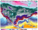
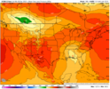
Definitely was going for a Miller B more than likely. You take those surface temps right now at this range with the ICON.Yep icon was a messy setup. Probably onset ice/sleet for Piedmont and a more legit storm in the foothills/mountains View attachment 139403View attachment 139404View attachment 139405
Boy that is close. Real close.Yep icon was a messy setup. Probably onset ice/sleet for Piedmont and a more legit storm in the foothills/mountains View attachment 139403View attachment 139404View attachment 139405
Yeah the height field is less suppressed as well. Not sure I like itView attachment 139407
I think you’re about to see some type of CAD event shortly. Deeper 50/50 and stronger S/W. Already can see stronger HP setting in out ahead also. But again the NS is really progressive with no true -NAO in place.
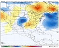
Was just about to say you’re also pumping the heights out ahead of it which is one more obstacle on an already marginal cold sourceYeah the height field is less suppressed as well. Not sure I like it View attachment 139409
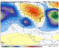
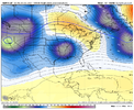


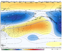
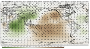
Yeah still got long ways to go . I can’t get to excited yet be honest .don’t think many want to hear this, but later week 1-week 2 of jan and maybe even a little further past that, it doesn’t look pretty pattern wise. Tropical forcing looks to slow significantly for a while in the Indian Ocean due to the weakening +IOD, which will give it more oomph as well. (basically the IO losing influence from the El Niño). The MJO slowing over the Indian Ocean for the next week and beyond is gonna favor a retracted pacific jet past next week and the semi-permanent Okhotsk low, which favors GOAK ridging/-PNA. Given the HLB/-NAO, the SE ridge might be put at bay at times, but it probably will show up at times. It’s honestly a pretty nina esque look
It’s worth noting, that the original progression that I was banking on, was the IOD collapsing in mid jan as tropical forcing returns to the WPAC, which would have been far more favorable.
Still think later in the month, we extend the jet. It’s a strong Nino after all. Tropical forcing will return in the WPAC eventually. But we timed the IOD crash and MJO somewhat badly.
This pattern will definitely bring back legitimate snowpack to areas in NA that are super below average right now. As we can see over the next week, cold is a huge issue, and this issue is likely playing a part, this pattern should bring that back for when we do extend the jet again.
View attachment 139421View attachment 139423
Probably from more of a CAD icing deal than snow.Drop off from 00z.
View attachment 139431
That period is what dreams are made up!Winter reminding me of 87...and we know how good the back half of 87 was.
87 mid-Jan...
It’s not made up. That really was a good stretch.That period is what dreams are made up!
