NBAcentel
Member
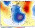
Insert Miller B cad post that's inevitably comingThis GOA ridge should be temporary but still loathe even looking at it even if it's only there for a couple of weeks.
View attachment 139355
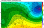
Only a crisp 12 hour wait. Let's hope for some fun trends to round off 2023.Euro is not gonna be good. Onto 00z
Euro is known as Dr. No for a reason!Euro is not gonna be good. Onto 00z
Sho nuff isEuro is known as Dr. No for a reason!
Get ready for 40 degree CAD rains with this lookThis GOA ridge should be temporary but still loathe even looking at it even if it's only there for a couple of weeks.
View attachment 139355
Looks like miller B timeThis GOA ridge should be temporary but still loathe even looking at it even if it's only there for a couple of weeks.
View attachment 139355

Do you have the map?Ensembles still don't look too bad IMO. Praying and hoping for some accumulation.
View attachment 139358
I think it’s game on between the 15th-20th forward. We can go with the 20th just to be safe but we are heading towards a really good looking pattern that we haven’t seen in 2 years. I’d be astonished if we don’t score on something big between the 20th thru February.We continue to get this closer and closer folks.
I am honestly kinda surprised this isn't being talked about more in the weather world. I guess everyone is hung up on the two storm threats, but we continue to make steady moves in the long range. It's not like this has been some sort of long range blimp either. Kinda reminds me of last December when 10-12 days out we gradually worked arctic air into a forecast period. Not saying this is December 2022.
View attachment 139357

Northern stream improvement is huge just need a stronger shortwave nowIt would be nice to see a big event for someone in the east...got to start somewhere. Even if it's JB country...
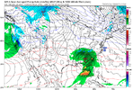
View attachment 139369
Just simply not cold enough .View attachment 139370
Would solve a little bit of our snowpack issue
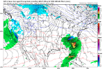
This matches very well with Burrel's ECMWF image from the last page. It would take a lot but then again it wouldn't. Move that 1026 a bit North and make it a 1035 and move that ElPaso low to just off the coast of the other side of TX and we might have something.View attachment 139370
Would solve a little bit of our snowpack issue

It’s trending in the right direction. It seems the “blockbuster” winters we see at least a minor event or two for the MA/NE in early January.Northern stream improvement is huge just need a stronger shortwave now


Snowcover?Might have a good GEFS run coming up soon View attachment 139383
