Snowman63
Member
I remember -50's and -60's in Montana in the 70's.Used to see -30s F temps all the time up in Canada and even in the far northern plains. Not anymore.
Sent from my iPhone using Tapatalk
I remember -50's and -60's in Montana in the 70's.Used to see -30s F temps all the time up in Canada and even in the far northern plains. Not anymore.
Sent from my iPhone using Tapatalk
Nice! Pittsburgh 76-77 never got above 32 between December 26 and January 27. Avg hi/lo was 27/12.I will always remember this one as a kid growing up in northeast Georgia.
Great Falls, MT 2/94
View attachment 139275
View attachment 139276


That winter of January 77. I seen a man drive a Volkswagen a pretty good size pond here west tn. That was one cold n snowy winter for usNice! Pittsburgh 76-77 never got above 32 between December 26 and January 27. Avg hi/lo was 27/12.View attachment 139277
One single member dumps something like 30 inches across North Georgia between two storms. Even with the skew, around 20% of the members show at least a decent event within 10 days.
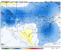
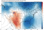
Really nice day 10 mean
Yeah I counted 30% for mby and a couple of near misses. That’s a good percentage at this range. Just need to start a trend and increase over the coming daysOne single member dumps something like 30 inches across North Georgia between two storms. Even with the skew, around 20% of the members show at least a decent event within 10 days.
Heck! I remember those temps in Montana and the Dakotas in the 80's as well. It seemed routine for wind chill temps.I remember -50's and -60's in Montana in the 70's.
Good to note that these GEFS are still based on the old GFS model… not the most reliable.. I would lean on the EPS and GEPS over the GEFS unless they are all in agreement.. and if we did get a storm to track like this I would likely lean towards climo favored regions of the mountains with the limited cold air.Pretty strong signal on the 18z GEFS.

Just curious why do we even bother to post GEFS runs it they suck so bad?Good to note that these GEFS are still based on the old GFS model… not the most reliable.. I would lean on the EPS and GEPS over the GEFS unless they are all in agreement.. and if we did get a storm to track like this I would likely lean towards climo favored regions of the mountains with the limited cold air.
Are you optimistic about any snow for southern Illinois over the next 2 weeks ?Good to note that these GEFS are still based on the old GFS model… not the most reliable.. I would lean on the EPS and GEPS over the GEFS unless they are all in agreement.. and if we did get a storm to track like this I would likely lean towards climo favored regions of the mountains with the limited cold air.
Good question.Just curious why do we even bother to post GEFS runs it they suck so bad?
Even looking at the GEFS verbatim, the pattern really isn't conducive to anything off the coast with low pressure sitting over the Great Lakes. If we see anything, it would likely be along the lines of the Euro with cold rain across the southeast. However, the few ensembles look to be outliers away from the overall mean.Good to note that these GEFS are still based on the old GFS model… not the most reliable.. I would lean on the EPS and GEPS over the GEFS unless they are all in agreement.. and if we did get a storm to track like this I would likely lean towards climo favored regions of the mountains with the limited cold air.

Good to note that these GEFS are still based on the old GFS model… not the most reliable.. I would lean on the EPS and GEPS over the GEFS unless they are all in agreement.. and if we did get a storm to track like this I would likely lean towards climo favored regions of the mountains with the limited cold air.
Even looking at the GEFS verbatim, the pattern really isn't conducive to anything off the coast with low pressure sitting over the Great Lakes. If we see anything, it would likely be along the lines of the Euro with cold rain across the southeast. However, the few ensembles look to be outliers away from the overall mean.
View attachment 139289
Did we change the letters
What? You got something against 1026 HP in Brownsville?Did we change the letters
Need it stronger and it to slow down a bitI stand corrected. Didn't check the mslp. Hopefully that can get stronger.
Need it stronger and it to slow down a bit

I would cash out here and take 30 inches. And would accept no snow forever going forwardOne single member dumps something like 30 inches across North Georgia between two storms. Even with the skew, around 20% of the members show at least a decent event within 10 days.
You are full of it. I have wanted a 93 every year since it happened.I would cash out here and take 30 inches. And would accept no snow forever going forward
GFS probably gonna be to progressive with the northern stream to leave an adequate cold source, but it’s better then before. We could use a CMC like depiction with the northern stream slowing, and digging out aheadStream separation on the GFS with a more consolidated 50/50 would lead to some type of mix bag event dependent on S/W out of the southwest if we could just have some decent cold
