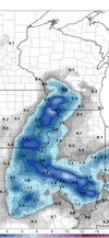
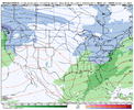
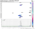
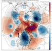
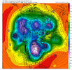
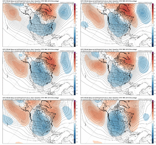
The biggest issue I've seen on the means is a tendency to over spread anomalies as you get further out in time. I'm a big believer in using the plumes if you are looking for a point forecast vs the mean since you can find any clustering or see if a group is skewing the mean. When it goes to the continental or hemispheric scale its hard for a few outliers to skew the mean as a whole but you start to run into spreading of anomalies or washing things out. Remember back earlier this month the means were pretty toasty in that day 7-10 range but we averaged near average mid monthReally enjoy your podcasts Mitch. Quick question.
Like the precip ens means can these larger feature ens means be skewed by just a few members as well?
-
Hello, please take a minute to check out our awesome content, contributed by the wonderful members of our community. We hope you'll add your own thoughts and opinions by making a free account!
You are using an out of date browser. It may not display this or other websites correctly.
You should upgrade or use an alternative browser.
You should upgrade or use an alternative browser.
Pattern Jammin January 2024
- Thread starter SD
- Start date
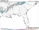
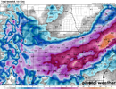
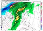
P28 ride or dieBecause the GEFS doesn't show a storm. There are a couple of members that skew the mean, but that is it. The pattern becomes incredibly unfavorable as the jet retracts and leaves a trough to develop over the west coast.
View attachment 139199
View attachment 139198
View attachment 139200
12z euro is the A+ hoping for just enough cold but probably not but maybe if you change the timing around it might work out type system
It's both surprising and unsurprising. It fits the narrative of the year but still, I mean good lord is it ever going to snow again. Everybody is hurting. Staring down January and I think I've only seen winter storm warnings for like, northern Vermont.I hate to be that guy, and I’m not saying for certain this is directly correlated, someone with a much better understanding (and degreed) in this field can correct me, but this barren of snow cover over the eastern seaboard feels unsurprising given how anomalously warm 2023 has been, as well as the record Atlantic temps
Usually the "all rain with thicknesses under 534 decameters" is a look reserved for mid April. If this verified verbatim I think there would likely be some snow mixing in heavier precip pockets but nothing stickin. Rough look for this time of year. This changes if the wave sharpens and there's more of a bona fide cut off but given our history I would imagine this wave flattens in future runs.If only there was just a little cold air around. Perfect track, strong low, north winds and rain in January.

congrats man. all good weather boards need the broadcast met lying around. it's what gave americanwx a lot of spice back in the day. guessing you went to state who i think is uniquely positioned to produce strong broadcasters. the rigor of lackmann and the ludicrous amount of institutional broadcast knowledge NSJ gives you in the broadcast class sets you up really nicely. i doubt this is fresh advice but having not just one, but two suits- highly recommend- and work to join the secret facebook group for broadcasters immediately. chock full of good advice. i'm out of the industry and have been out for a while but still have moles (kat) that keep me abreast to things occasionally- feel free to dm if you have any questionsI think the pattern in January is not perfect but it’s one that can certainly squeeze something out if you get all the right variables working out.
I don’t think you NEED snow pack to the north and west to make something work in the south. But it is MUCH harder to get a cold enough air mass to bring winter precip without that snowpack.
That being said I think it’s more likely we see something late January and into February for many in the SE
February looks like the best month for snow lovers and it’s not even close but January has some potential as well. About all you can ask for when you live in the south.
I’ll be moving to southern Illinois to start my position as a broadcast meteorologist on January 4th so selfishly I hope for the Midwest snow jackpot mid month ?
But you all will get yours as well no doubt about that.
Cheers.
Welcome to living in NE Georgia. When I was a child it snowed regularly. We had pretty significant ice/snow storms in the 70s and 80s, and a blizzard in 1993. We've had a few 2-3" systems but nothing as big as when I was young.It's both surprising and unsurprising. It fits the narrative of the year but still, I mean good lord is it ever going to snow again. Everybody is hurting. Staring down January and I think I've only seen winter storm warnings for like, northern Vermont.
The harsh reality is "climo" is shifting away from us and there isn't a whole lot anyone on this board can do to change that.
Welcome to living in NE Georgia. When I was a child it snowed regularly. We had pretty significant ice/snow storms in the 70s and 80s, and a blizzard in 1993. We've had a few 2-3" systems but nothing as big as when I was young.
The harsh reality is "climo" is shifting away from us and there isn't a whole lot anyone on this board can do to change that.

Probably going to be a pretty epic eps spread late with the mean BN 500mb heights trying to tuck back into the E but 850s still AN
Brent
Member
As someone who grew up in Alabama I remember way more winters as a kid it didn't snow. That's why we remember the big storms so much ?
And like I said the other day my parents live there and had their biggest storm since 93 in 2017... It took 24 years to top the maybe 6 inches we had in 93
And like I said the other day my parents live there and had their biggest storm since 93 in 2017... It took 24 years to top the maybe 6 inches we had in 93
accu35
Member
dsaur
Member
My big hope is the further and further apart the storms are the better the chances for an anomaly storm that blows thru the records for us.Welcome to living in NE Georgia. When I was a child it snowed regularly. We had pretty significant ice/snow storms in the 70s and 80s, and a blizzard in 1993. We've had a few 2-3" systems but nothing as big as when I was young.
The harsh reality is "climo" is shifting away from us and there isn't a whole lot anyone on this board can do to change that.
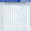
Dallas, GA. Best record keeping anywhere in the W/NW metro, still missing five years of data, I'll add it in manually.
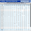
Missing Data:
2010-2011: 12.3"
2011-2012: No data or 0"
2012-2013: No data or 0"
2013-2014: 7.1"
2014-2015: 3.7"
2015-2016: .7"
Sum for 23 Seasons: 73.9"
Mean for past 23 seasons: 3.2" (Which is exactly what I presumed it was before calculations)
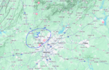
So if you live in the area below, your average annual snowfall is roughly 3".

Drizzle Snizzle
Member
growing up in Carrollton, GA almost every winter we got at least a dusting. We had 10" in 1993 and 6" in 1992. Back to back winters with 6"+ !As someone who grew up in Alabama I remember way more winters as a kid it didn't snow. That's why we remember the big storms so much ?
And like I said the other day my parents live there and had their biggest storm since 93 in 2017... It took 24 years to top the maybe 6 inches we had in 93
I actually could agree with the latest GFS. Shows a trough dig out West, big storm system in the middle with a cold air push behind it. Eric did mention a Winter storm in the Midwest. There it is. Way out there. But I can definitely see how it unfolds like that.
Brent
Member
lexxnchloe
Member
There is going to be an actual winter storm somewhere this winter, might as well be this one.I'd be good with the winter if this verifies ?View attachment 139214
Itryatgolf
Member
I would take my 2inches snow and be happier than a sissy in a boot camp!!I'd be good with the winter if this verifies ?View attachment 139214
Drizzle Snizzle
Member
Congrats STLI'd be good with the winter if this verifies ?View attachment 139214
Brent
Member
Congrats STL
Lmao I can't even imagine 3 feet there
Some data on that chart seems wrong. I had 7" imby in the blizzard of 1993. I remember that well as I was managing a pizza delivery store that day and had to try and make deliveries in it, since none of our employees could make it in. I had a 4wd.
Even taken at face value the chart kind of reinforces what I said, it snowed regularly as a child in my area (which included ATH, ATL, and even Spartanburg, we had 3 houses). "Regularly" probably looks different for you if you grew up further north where even more frequent and bountiful snows happened.
We did sneak out a few inches in early 2022 here, but we haven't seen a decent snow since 1993, or maybe 2009.
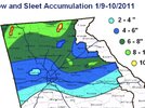
Did you not get hit heavy in the January 2011 storm. A lot of northern GA had 5-10”. Despite ATL getting officially 4” at the airport, downtown had over 6”Some data on that chart seems wrong. I had 7" imby in the blizzard of 1993. I remember that well as I was managing a pizza delivery store that day and had to try and make deliveries in it, since none of our employees could make it in. I had a 4wd.
Even taken at face value the chart kind of reinforces what I said, it snowed regularly as a child in my area (which included ATH, ATL, and even Spartanburg, we had 3 houses). "Regularly" probably looks different for you if you grew up further north where even more frequent and bountiful snows happened.
We did sneak out a few inches in early 2022 here, but we haven't seen a decent snow since 1993, or maybe 2009.
I was living closer to Atlanta then, we got 5" at my house.Did you not get hit heavy in the January 2011 storm. A lot of northern GA had 5-10”. Despite ATL getting officially 4” at the airport, downtown had over 6”
Drizzle Snizzle
Member
Good thing is, we'll keep the rain going. I know y'all need it down your way (and of course, Shetley does too)
dsaur
Member
That's always been a sweet spot when I was growing up. If any flurries were falling the news crews were in Marietta, and if we got flurries in midtown then Marietta got a dusting or more. If only one spot got some snow in Atl, it was Marietta. Gainesville north, or Cleveland north, then Marietta north, then to the Perimeter, lol. then Buckhead. I can't think of how many times your circled area was getting snow and I was getting skunked.Dallas, GA. Best record keeping anywhere in the W/NW metro, still missing five years of data, I'll add it in manually.
View attachment 139209
Missing Data:
2010-2011: 12.3"
2011-2012: No data or 0"
2012-2013: No data or 0"
2013-2014: 7.1"
2014-2015: 3.7"
2015-2016: .7"
Sum for 23 Seasons: 73.9"
Mean for past 23 seasons: 3.2" (Which is exactly what I presumed it was before calculations)
So if you live in the area below, your average annual snowfall is roughly 3".
View attachment 139211
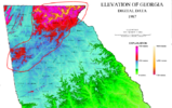
Here is why:That's always been a sweet spot when I was growing up. If any flurries were falling the news crews were in Marietta, and if we got flurries in midtown then Marietta got a dusting or more. If only one spot got some snow in Atl, it was Marietta. Gainesville north, or Cleveland north, then Marietta north, then to the Perimeter, lol. then Buckhead. I can't think of how many times your circled area was getting snow and I was getting skunked.
Drizzle Snizzle
Member
it seems like more times than not areas NW of Atlanta tend to get more snow than areas NE of Atlanta unless there's a wedge involved, and then areas NE get more.That's always been a sweet spot when I was growing up. If any flurries were falling the news crews were in Marietta, and if we got flurries in midtown then Marietta got a dusting or more. If only one spot got some snow in Atl, it was Marietta. Gainesville north, or Cleveland north, then Marietta north, then to the Perimeter, lol. then Buckhead. I can't think of how many times your circled area was getting snow and I was getting skunked.
There's a GEFS member showing 13" for Huntsville and 16" for Chattanooga. I wish! Actually just never seen a GEFS member show that much for my area before.
SnowNiner
Member
One thing I think we're missing so far this year is any high pressure to our north wedging down giving us the lower layer cold we need. I never see any wedging signal on the ensembles. The air is just not cold enough. Even for next week, not sure where the cold feed is other than the general flow from southern Canada. Hopefully later in the month we can get a parade of high pressure to the north to match up well with the constant flow of southern storms that seem to be right where they need to be.


I would expect as the -NAO develops and blocking over Greenland builds, we will start to see a better signal for CAD. If we do, there is still plenty of snow pack over southeast Canada with cold air to tap into.One thing I think we're missing so far this year is any high pressure to our north wedging down giving us the lower layer cold we need. I never see any wedging signal on the ensembles. The air is just not cold enough. Even for next week, not sure where the cold feed is other than the general flow from southern Canada. Hopefully later in the month we can get a parade of high pressure to the north to match up well with the constant flow of southern storms that seem to be right where they need to be.


W
WSW
Guest
I wonder how much snow they get at the highest elevations in N. Georgia?Here is why:
View attachment 139227
The signal with that trough digging out West has been extremely consistent over the last few days. I know we don't live out West, but eventually it's going to have impacts on our weather on down the road.
Yeah, FFC doesn't care about that. You look over at GSP and they have observations at the top of Caesars Head, Mitchell, etc. FFC doesn't even record data for Marietta, its a joke. Blairsville is the only station with any substantial data, and I doubt the snowfall data is that accurate at 3.1" If I had to guess about Brasstown Bald based on observation (they have Axis Cameras up there), my best guess is 15-18" per year at 4700'. Quite honestly, the Cohutta's at 2500' to 4' probably do about as good. The Cohutta's are the mountains just east of Dalton, they actually get northwest flow because they sit about 2-3000' above the valley below. I would bet on them at least getting a dusting Saturday morning.I wonder how much snow they get at the highest elevations in N. Georgia?
So much for no cold feed! That look might even be suppression for y’all!If the nhem blocks up like this we will find the snowView attachment 139256View attachment 139255
Webberweather53
Meteorologist
Mid-January is a good pattern for southern Canada, the Midwest, & Great Lakes. Perhaps the interior NE US as well. I wouldn’t expect much out of this, even in the coastal mid Atlantic, let alone down here over the SE US

