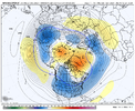
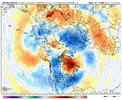
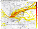
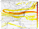
Good or badHilarious amount of changes on the GFS this run
-
Hello, please take a minute to check out our awesome content, contributed by the wonderful members of our community. We hope you'll add your own thoughts and opinions by making a free account!
You are using an out of date browser. It may not display this or other websites correctly.
You should upgrade or use an alternative browser.
You should upgrade or use an alternative browser.
Pattern Jammin January 2024
- Thread starter SD
- Start date
Love the avatar… I still haven’t gotten over the “Groundhogzilla” storm that broke our hearts a few years back. It reminded me that there is no sure thing when it comes to winter weather in the south.I’ll take my 2.8 and run like I stole it!!! I’m desperate! I got my 2 mini Aussie puppies in the Fall of 2019… they have yet to see a trace of snow to play in??
Hopefully many of us can cash in over the next 7-8 weeks. January appears to have potential. My fingers are crossed for Thursday-Friday this week!
tennessee storm
Member
Hint, wasn’t good. But that’s the gfs for uGood or bad
Webberweather53
Meteorologist
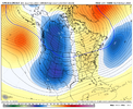
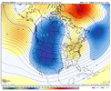
Midwest will cash in before you do sadlyThe superb pattern for January still looks great...no way we don't see snow in January...multiple.
View attachment 139183View attachment 139184
Twister
Member
Who cares what the Midwest gets? Were in the South!Midwest will cash in before you do sadly
Sent from my SM-S911U using Tapatalk
CFS from overnight was not horrible for the next few weeks. No fantasy storms for eastern areas. I-40 folks from Memphis westward had some good outcomes. Almost a la nina look. But the cold was there and with a little wiggling something good could materialize (for more of us). Below is day 19 as an example. CFS is not good with CAD. In a setup like this, there would probably be a more pronounced (colder) CAD. But again the details at this range are useless. We just need a favorable pattern showing.
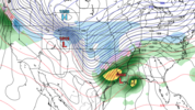
Then to be fair, the last 10 days of the run did look horrible. But, just wait until the 12z run and it could be totally opposite.

Then to be fair, the last 10 days of the run did look horrible. But, just wait until the 12z run and it could be totally opposite.
The plot twist lives on in another episode of As The Vortex Turns.
Webberweather53
Meteorologist
Who cares what the Midwest gets? Were in the South!
Sent from my SM-S911U using Tapatalk
You probably should considering that most every arctic air mass that moves into the southern US usually goes thru there at some point in time
Webberweather53
Meteorologist
Western trough with -NAO is usually when the Midwest rakes in the snow. Not my problem if you don’t like it, that’s just a fact.
The exceptions to this favorability usually occur when the snowpack is deep and extensive over the conus (e.g. Mar 1960). We are obviously a very long ways off from that
The exceptions to this favorability usually occur when the snowpack is deep and extensive over the conus (e.g. Mar 1960). We are obviously a very long ways off from that
Webberweather53
Meteorologist
384 hr gfs. ?
Webberweather53
Meteorologist
They already have. Big blizzard past couple days.
Need western canada to whiten up and the lakes
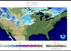
View attachment 139188
Most of Minnesota, Iowa, Wisconsin, and Illinois is still barren as is the entirety of the Great Lakes.
tennessee storm
Member
Be honest with you , this is about as bad I have seen this kind of lack of snow cover up there. Almost scary. This late in DecemberMost of Minnesota, Iowa, Wisconsin, and Illinois is still barren as is the entirety of the Great Lakes.
mydoortotheworld
Member
I hate to be that guy, and I’m not saying for certain this is directly correlated, someone with a much better understanding (and degreed) in this field can correct me, but this barren of snow cover over the eastern seaboard feels unsurprising given how anomalously warm 2023 has been, as well as the record Atlantic tempsBe honest with you , this is about as bad I have seen this kind of lack of snow cover up there. Almost scary. This late in December
lexxnchloe
Member
If only there was just a little cold air around. Perfect track, strong low, north winds and rain in January.


LukeBarrette
im north of 90% of people on here so yeah
Meteorology Student
Member
2024 Supporter
2017-2023 Supporter
Yep, cant draw it up any better. Puking snow above our heads on Jan 1, peak climo. And its a furnace lower 3000ft. Storm track with these 850s in peak climo is dreamworthy. Rarely have it line up like this. Why super el ninos suck for winter wx lovers. Pac firehose surface air wall to wallIf only there was just a little cold air around. Perfect track, strong low, north winds and rain in January.

I think the pattern in January is not perfect but it’s one that can certainly squeeze something out if you get all the right variables working out.
I don’t think you NEED snow pack to the north and west to make something work in the south. But it is MUCH harder to get a cold enough air mass to bring winter precip without that snowpack.
That being said I think it’s more likely we see something late January and into February for many in the SE
February looks like the best month for snow lovers and it’s not even close but January has some potential as well. About all you can ask for when you live in the south.
I’ll be moving to southern Illinois to start my position as a broadcast meteorologist on January 4th so selfishly I hope for the Midwest snow jackpot mid month ?
But you all will get yours as well no doubt about that.
Cheers.
Jan88
Member
Reminds me of the super nino in the 90s. Rained s lot but never got much below 40.this year is a little more cold .at the mountains are getting some snowI think the pattern in January is not perfect but it’s one that can certainly squeeze something out if you get all the right variables working out.
I don’t think you NEED snow pack to the north and west to make something work in the south. But it is MUCH harder to get a cold enough air mass to bring winter precip without that snowpack.
That being said I think it’s more likely we see something late January and into February for many in the SE
February looks like the best month for snow lovers and it’s not even close but January has some potential as well. About all you can ask for when you live in the south.
I’ll be moving to southern Illinois to start my position as a broadcast meteorologist on January 4th so selfishly I hope for the Midwest snow jackpot mid month ?
But you all will get yours as well no doubt about that.
Cheers.
tennessee storm
Member
Yeah the pacific jet is kicking our a$$. At the momentI think the pattern in January is not perfect but it’s one that can certainly squeeze something out if you get all the right variables working out.
I don’t think you NEED snow pack to the north and west to make something work in the south. But it is MUCH harder to get a cold enough air mass to bring winter precip without that snowpack.
That being said I think it’s more likely we see something late January and into February for many in the SE
February looks like the best month for snow lovers and it’s not even close but January has some potential as well. About all you can ask for when you live in the south.
I’ll be moving to southern Illinois to start my position as a broadcast meteorologist on January 4th so selfishly I hope for the Midwest snow jackpot mid month ?
But you all will get yours as well no doubt about that.
Cheers.
Drizzle Snizzle
Member
At least in the big el-nino of 1997-98 we did get snow in Late December.Reminds me of the super nino in the 90s. Rained s lot but never got much below 40.this year is a little more cold .at the mountains are getting some snow
The NC Piedmont also got a very good one in mid January as well and the mountains and foothills got hammered in a late February stormAt least in the big el-nino of 1997-98 we did get snow in Late December.
packfan98
Moderator
packfan98
Moderator

Twister
Member
GEFS has been pretty solid in showing a Storm. One thing I don't understand and somebody help me, is why the OP GFS never follows what the GEFS shows?Pretty good look here on the GEFS
Sent from my SM-S911U using Tapatalk
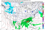
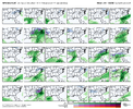
Because the GEFS doesn't show a storm. There are a couple of members that skew the mean, but that is it. The pattern becomes incredibly unfavorable as the jet retracts and leaves a trough to develop over the west coast.GEFS has been pretty solid in showing a Storm. One thing I don't understand and somebody help me, is why the OP GFS never follows what the GEFS shows?
Sent from my SM-S911U using Tapatalk
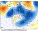
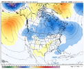
Iceagewhereartthou
Member
It's pretty amazing, and all that in the upper plains just happened. On Christmas the entire Eastern US was in the 50s and 60s. For whatever reasons, almost all the cold has been in Eurasia the past few years, with only a couple of intrusions to the US; Dec 22, Feb 21. Europe has had multiple cold outbreaks each of the past few years and has already had one this year. This past week China has had a historic cold outbreak, and yet we continue to struggle to get anything more than a few days of cool weather. The headlines at WYFF keep talking about this big cooldown coming and then you look at the temps and it gets us to our average. I hope maybe one of these SSWE can impact N America for a change, but other than that I just can't muster much hope. Even the fantasy maps we post don't do much outside the mountains. It's nice we haven't seen a bunch of 70s this month so there's that.They already have. Big blizzard past couple days.
Need western canada to whiten up and the lakes
View attachment 139188
If we score anything over the next 10 days or would take perfect timing. Mediocre cold, no blocking, active flow means no way to really hold any cold in place. I think the best shot to hit is going to be on the front or back of one of these low amplitude waves but without perfect timing it's easy to shear these out or over amp and shoot it north. If you think it's bad now wait about 5-7 days this place is going to get insufferable
Twister
Member
But that Map Pack showed was showing Snow for the SE and that was the GEFS ENS was it not?Because the GEFS doesn't show a storm. There are a couple of members that skew the mean, but that is it. The pattern becomes incredibly unfavorable as the jet retracts and leaves a trough to develop over the west coast.
View attachment 139199
View attachment 139198
View attachment 139200
Sent from my SM-S911U using Tapatalk
It combines all the members together & creates one model run basically. The outlier model members that show a ton of snow are skewing that image you see. Those are ok to look at, but normally don't show the picture very well, especially if you have a couple members dropping massive amounts of snow with 90% or more either showing nothing or rain.But that Map Pack showed was showing Snow for the SE and that was the GEFS ENS was it not?
Sent from my SM-S911U using Tapatalk
The image posted by @packfan98 is basically the mean of the 6hr qpf type. If you have a few members showing snow and the rest showing nothing that averages out as snow. Some of these images are really buyer beware especially as you go out from hour 0But that Map Pack showed was showing Snow for the SE and that was the GEFS ENS was it not?
Sent from my SM-S911U using Tapatalk
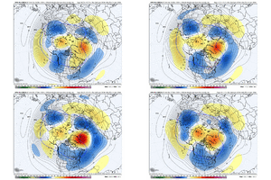
Of course, this is past day 10 but it's slowly looking more and more possible that we are going to get a deep trough in the West. I believe @Webberweather53 mentioned this a few times. It would help our cold air source. If you keep the frames moving into the 300 & further out range, the trough moves East. Cold air gets dislodged & feeds what hopefully will still be energy flying around.
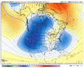


and though there some increased heights in the east you don’t see the SER flexing… also you can see the blocking over Greenland getting stronger… that’s a very similar progression to January 2010 and 2016Of course, this is past day 10 but it's slowly looking more and more possible that we are going to get a deep trough in the West. I believe @Webberweather53 mentioned this a few times. It would help our cold air source. If you keep the frames moving into the 300 & further out range, the trough moves East. Cold air gets dislodged & feeds what hopefully will still be energy flying around.
View attachment 139204View attachment 139202View attachment 139203
It'll be interesting to see if this is the catalyst for a true-nao. On the gefs you can see the heights pumping into Greenland and the heights from the tpv over Hudson Bay pulling SE under the block. Ultimate hope here was to flex this up when the spv got split to hold the -nao in place through the rest of winter and set up fab Feb and mega March but the spv split getting less emphatic has me concernedOf course, this is past day 10 but it's slowly looking more and more possible that we are going to get a deep trough in the West. I believe @Webberweather53 mentioned this a few times. It would help our cold air source. If you keep the frames moving into the 300 & further out range, the trough moves East. Cold air gets dislodged & feeds what hopefully will still be energy flying around.
View attachment 139204View attachment 139202View attachment 139203
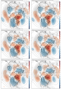
I appreciate that! I've learned a lot of what I know from people on this site. Lot of knowledgeable people in here.Really enjoy your podcasts Mitch. Quick question.
Like the precip ens means can these larger feature ens means be skewed by just a few members as well?
Ensemble means can be skewed by anything on any of the members that are outlier scenarios. Regarding the SSWE, my knowledge on it is still a big work in progress.

