Well lots of depressing outlooks right now going forward. I decided to look back at 2011-12 for some comparison. Obviously that season did not have anything comparable to the Dec cold front this year, and probably not the NWFS event from last night, but for the SE as a whole this season has been pretty absent of winter, much like that year. Here are some numbers for GSP
Dec 2011
| 1 | | 2 | | 3 | | 4 | | 5 | | 6 | | 7 | | 8 | | 9 | | 10 | | 11 | | 12 | | 13 | | 14 | | 15 | | 16 | | 17 | | 18 | | 19 | | 20 | | 21 | | 22 | | 23 | | 24 | | 25 | | 26 | | 27 | | 28 | | 29 | | 30 | | 31 |
|
| Max | Avg | Min | | 55 | 42.2 | 29 | | 63 | 45.9 | 32 | | 58 | 47.3 | 38 | | 57 | 48.9 | 39 | | 56 | 54.2 | 53 | | 65 | 59.6 | 54 | | 63 | 57.8 | 40 | | 52 | 41.1 | 32 | | 54 | 43.1 | 33 | | 54 | 44.0 | 36 | | 47 | 39.0 | 32 | | 45 | 40.8 | 37 | | 65 | 51.9 | 40 | | 66 | 54.5 | 44 | | 67 | 57.7 | 48 | | 69 | 59.5 | 54 | | 58 | 49.5 | 38 | | 55 | 42.4 | 32 | | 58 | 45.3 | 32 | | 55 | 51.7 | 43 | | 63 | 57.0 | 52 | | 65 | 62.6 | 61 | | 64 | 55.9 | 47 | | 53 | 45.4 | 37 | | 50 | 43.7 | 39 | | 55 | 42.1 | 33 | | 52 | 42.5 | 39 | | 51 | 41.1 | 32 | | 55 | 40.4 | 27 | | 54 | 46.3 | 36 | | 63 | 47.3 | 42 |
|
Nothing exciting here but not the worst Dec ever.
Here is this past Dec. Really the only difference at all was the 4 day front surrounding Christmas:
| 1 | | 2 | | 3 | | 4 | | 5 | | 6 | | 7 | | 8 | | 9 | | 10 | | 11 | | 12 | | 13 | | 14 | | 15 | | 16 | | 17 | | 18 | | 19 | | 20 | | 21 | | 22 | | 23 | | 24 | | 25 | | 26 | | 27 | | 28 | | 29 | | 30 | | 31 |
|
| Max | Avg | Min | | 55 | 42.5 | 32 | | 55 | 44.0 | 30 | | 58 | 53.0 | 49 | | 57 | 46.3 | 38 | | 46 | 42.6 | 37 | | 50 | 46.1 | 43 | | 63 | 56.4 | 50 | | 69 | 60.4 | 53 | | 58 | 52.3 | 48 | | 50 | 48.5 | 46 | | 50 | 48.9 | 47 | | 56 | 49.1 | 46 | | 48 | 42.9 | 37 | | 42 | 40.8 | 40 | | 48 | 41.3 | 37 | | 52 | 41.6 | 33 | | 49 | 40.8 | 31 | | 49 | 37.3 | 27 | | 49 | 37.0 | 25 | | 42 | 38.5 | 34 | | 48 | 40.3 | 36 | | 48 | 40.9 | 36 | | 47 | 30.4 | 13 | | 27 | 17.0 | 7 | | 37 | 25.1 | 14 | | 38 | 27.8 | 15 | | 48 | 35.6 | 28 | | 54 | 36.8 | 24 | | 64 | 47.1 | 30 | | 59 | 50.4 | 33 | | 56 | 53.0 | 51 |
|
Here was Jan 2012, again, nothing too exciting either way.
| 1 | | 2 | | 3 | | 4 | | 5 | | 6 | | 7 | | 8 | | 9 | | 10 | | 11 | | 12 | | 13 | | 14 | | 15 | | 16 | | 17 | | 18 | | 19 | | 20 | | 21 | | 22 | | 23 | | 24 | | 25 | | 26 | | 27 | | 28 | | 29 | | 30 | | 31 |
|
| Max | Avg | Min | | 66 | 51.9 | 36 | | 48 | 38.0 | 26 | | 36 | 27.7 | 21 | | 48 | 34.4 | 19 | | 59 | 44.5 | 30 | | 65 | 49.4 | 35 | | 69 | 55.6 | 45 | | 56 | 53.2 | 49 | | 52 | 49.4 | 46 | | 57 | 52.8 | 50 | | 62 | 54.1 | 49 | | 57 | 48.9 | 33 | | 40 | 32.7 | 27 | | 49 | 35.4 | 23 | | 51 | 40.5 | 32 | | 49 | 39.3 | 29 | | 54 | 50.0 | 38 | | 54 | 46.2 | 37 | | 45 | 37.3 | 30 | | 50 | 44.1 | 35 | | 54 | 48.5 | 43 | | 50 | 44.0 | 38 | | 45 | 39.3 | 37 | | 63 | 48.6 | 44 | | 64 | 51.6 | 37 | | 63 | 55.7 | 52 | | 65 | 57.6 | 42 | | 65 | 46.9 | 33 | | 54 | 42.8 | 30 | | 61 | 46.3 | 31 | | 63 | 50.6 | 37 |
|
And here's so far this Jan
|
| Max | Avg | Min | | 58 | 52.5 | 47 | | 71 | 56.5 | 48 | | 63 | 56.4 | 50 | | 64 | 59.6 | 52 | | 63 | 52.2 | 42 | | 58 | 46.3 | 36 | | 53 | 45.8 | 37 | | 50 | 46.4 | 43 | | 54 | 44.2 | 35 | | 60 | 44.3 | 31 | | 58 | 48.4 | 35 | | 67 | 54.8 | 48 | | 53 | 46.2 | 37 | | 43 | 37.8 | 33 |
|
Literally, the only difference b/w the two is the Dec cold front and the accompanying trace of sleet/snow, with this Jan actually looking a tad warmer. Pretty sobering perspective so far.

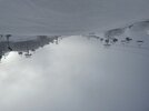


 4 runs and I’m DONE! Frigid

