• Hello, please take a minute to check out our awesome content, contributed by the wonderful members of our community. We hope you'll add your own thoughts and opinions by making a free account!

Pattern Jammin January 2023

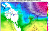
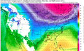
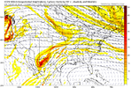
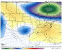
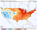
The EPS finally agrees with the GEFS on the return of a more La Niña like pattern near the end of the month, which makes sense given this week’s major -EAMT event with an assist from the MJO and La Niña. Enjoy this weekend’s cold shot, because I doubt we’re gonna see much of that in the SE US in the coming weeks


View attachment 130190

View attachment 130191

A couple caveats with this, for one thing if the trough off Atlantic Canada digs more, could end up seeing some CAD days, which would keep things cooler in cad favored areas of the Carolinas

The other thing is that I mentioned yesterday is that there will at least be cold air in the vicinity (in southern Canada and the conus). If this circulation pattern slips up (which it probably will from time to time), you have a much better chance to score something in this pattern than the one we’ve had the last few weeks (although that isn’t saying a whole lot).

How tall the SE US ridge is and the downstream trough over Atlantic Canada will have a big role in determining whether we see severe weather or CAD (sometimes both happen) in general. Could be lots of variability in parts of the Carolinas going forward
 
A couple caveats with this, for one thing if the trough off Atlantic Canada digs more, could end up seeing some CAD days, which would keep things cooler in cad favored areas of the Carolinas

The other thing is that I mentioned yesterday is that there will at least be cold air in the vicinity (in southern Canada and the conus). If this circulation pattern slips up (which it probably will from time to time), you have a much better chance to score something in this pattern than the one we’ve had the last few weeks (although that isn’t saying a whole lot).
Are you having second thoughts about the incoming torch, and no wintry weather, that you have continually posted about for weeks? That can't be right....
 
A couple caveats with this, for one thing if the trough off Atlantic Canada digs more, could end up seeing some CAD days, which would keep things cooler in cad favored areas of the Carolinas

The other thing is that I mentioned yesterday is that there will at least be cold air in the vicinity (in southern Canada and the conus). If this circulation pattern slips up (which it probably will from time to time), you have a much better chance to score something in this pattern than the one we’ve had the last few weeks (although that isn’t saying a whole lot).

How tall the SE US ridge is and the downstream trough over Atlantic Canada will have a big role in determining whether we see severe weather or CAD (sometimes both happen) in general. Could be lots of variability in parts of the Carolinas going forward
Are you still in the East or back west? Looks like the SW might get some snow this coming week.
 
Are you having second thoughts about the incoming torch, and no wintry weather, that you have continually posted about for weeks? That can't be right....

It looks warm in general especially in early-Mid February as the SE us ridge flexes, but I thought it would be pertinent to mention some caveats as we enter this pattern late in January
 
Are you still in the East or back west? Looks like the SW might get some snow this coming week.

Yep, this is a good pattern for us as we get into late this coming weekend and early next week. For snow events here, usually want a ridge just offshore the Pacific NW and British Columbia, with an upper low diving down the west coast into southern AZ and far northern Mexico. We tend to see these sort of things show up when the Pacific Jet Stream goes from an extended El Niño like state, back to a more typical retracted look with troughing near or west of the Aleutians.


The EPS and GEFS look pretty good down here & I’m really trying to not get sucked in ?

C449FE82-14EF-4EAA-965E-BA1CE0DA006F.png


E40D8E54-50F8-46FA-8ADF-10CD13715C53.png
 
Yeah if you’re in the CAD favorable areas of NeGA, upstate SC, and piedmont NC this isn’t the worst pattern in the world. You can bet your bottom dollar we are going to CAD the hell out of the pattern regardless. You build in a nice 50/50 and you quickly get a great setup for winter weather in the western Carolinas. Problem is it will greatly favor sleet and ZR with standard Miller B’s. Overrunning could really be the best case scenario where we get some nice forcing on the front end to drive front end snows as well. Everywhere else in the southeast outside of the far western areas, good luck.
 
Yeah if you’re in the CAD favorable areas of NeGA, upstate SC, and piedmont NC this isn’t the worst pattern in the world. You can bet your bottom dollar we are going to CAD the hell out of the pattern regardless. You build in a nice 50/50 and you quickly get a great setup for winter weather in the western Carolinas. Problem is it will greatly favor sleet and ZR with standard Miller B’s. Overrunning could really be the best case scenario where we get some nice forcing on the front end to drive front end snows as well. Everywhere else in the southeast outside of the far western areas, good luck.
Yes I've been saying this for awhile, this is a very good pattern to end up with an Ice Storm across CAD areas. And as we all know an ice storm is way overdue. I wouldn't be surprised to see one in the coming weeks.

Sent from my SM-A526U using Tapatalk
 
Buckethead was reporting 11” at Wolf Laurel 9hours ago and some 7” Beech reports already at midnight last night. Leaving in 45 mins. Hope the AWD can manage ?
His latest report is about 15" with 24" drifts! Knoxville area with an impressive radar this morning. I really need to move to the other side of the hills, this area is awful.
 
Trend is the ball has to be punted to atleast post Jan 23rd for any shot at frozen. Trough is gonna dig in SW and its cutter city and no help with any NE confluence. Things can change again,but as of right now next 10 days,minus this weekend are meh.
 
Back
Top