• Hello, please take a minute to check out our awesome content, contributed by the wonderful members of our community. We hope you'll add your own thoughts and opinions by making a free account!

Pattern Jammin January 2023

I'm in a bad geographic spot for NW flow snow showers. Regardless, I'm sitting here wondering if should I have coffee or beer while sitting out on the front porch tomorrow late.
I’m in Forsyth County. We can sometimes do okay with stuff coming from the NW, but most of the time it dries up before getting here. 0z HRRR puts my county in the bullseye, but I’m fully expecting nothing, maybe flurries.
 
I’m in Forsyth County. We can sometimes do okay with stuff coming from the NW, but most of the time it dries up before getting here. 0z HRRR puts my county in the bullseye, but I’m fully expecting nothing, maybe flurries.
OK, I'll fess up. I'm secretly hoping for that vorticity maximum that's progged to come directly overhead around sundown here to seriously overperform lol. I know better, but like a ? to the light, I can't help myself lol.
 
I’m in Forsyth County. We can sometimes do okay with stuff coming from the NW, but most of the time it dries up before getting here. 0z HRRR puts my county in the bullseye, but I’m fully expecting nothing, maybe flurries.

In an average winter, which we don't see very often these days, we see this setup probably 5 or 6 times and record a trace to a dusting.
 
In an average winter, which we don't see very often these days, we see this setup probably 5 or 6 times and record a trace to a dusting.
If I’m remembering correctly, I think I got like half an inch from NW flow last January. It’s never the 1-2” it shows sometimes on the short range modeling.
 
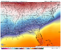
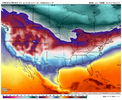
Going to be a lot of snow showers and flurries around tomorrow under the ULL View attachment 130050
What I have to wonder is if these are genuinely convective in nature or not. That might explain why they aren't getting stuck behind the mountains in GA.
 
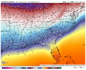
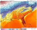
Steep lapse rate late afternoon into the early evening. That's a nice cold pool coming down under that backside vorticity.
nam3km_T700_seus_24.png
 
What I have to wonder is if these are genuinely convective in nature or not. That might explain why they aren't getting stuck behind the mountains in GA.
We had something similar happen way back in April 2009. Can’t remember if it was an ULL involved in the setup, but I remember us having convective showers off and on that produced snow/graupel with temps in the 40s the whole time. That was a wild week in general because 2-3 days later we had a major tornado outbreak.
 
We had something similar happen way back in April 2009. Can’t remember if it was an ULL involved in the setup, but I remember us having convective showers off and on that produced snow/graupel with temps in the 40s the whole time. That was a wild week in general because 2-3 days later we had a major tornado outbreak.
I remember that. It was on a weekend and I was in ATL going to a couple Braves games and there were actually some flurries during one of the games.
 
Back
Top