• Hello, please take a minute to check out our awesome content, contributed by the wonderful members of our community. We hope you'll add your own thoughts and opinions by making a free account!

Pattern Jammin January 2023

I don’t think there’s ever a 10 day snow forecast. There was a 10 day out below normal temperature range forecast which did verify.
GFS has shown 10-15 day out snowstorms for years. Euro used to always show 10 days out. 15 years ago several would verify but now even 72 hours out rarely verify. Been watching models for years and seems that they are getting worse and not better.
 
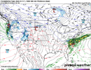
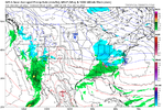
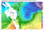
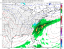
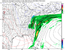
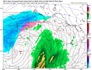
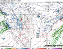
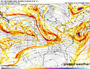
This looks much better. High in a good place with a storm in a good place. Add in a pinch more of cold.

gfs_mslp_pcpn_frzn_us_64.png
 
Nice ensemble looks for that range. In decent agreement

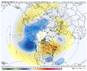
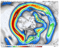
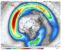
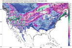
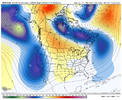
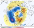
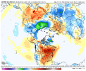
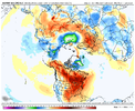
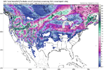
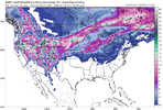
If it's real, I like it, I like it a lot. Seems like the EPS/GEFS both generally agree on the jet being in a nice sweet spot right near Hawaii to give us an Aleutian trough, western ridge/eastern trough. AND, I notice what looks like an active southern jet. Would be great if it verifies, but who knows. Bet this rushes it a bit, but even add a week on to this and we're still near prime climo for us. Keep hope alive! Would it be too much for this to just get closer and closer in time and then to verify? Western troughs do! lol.

gfs-ens_z500a_nhem_65.png

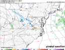
gfs-ens_uv250_nhem_65.png

eps_z500a_nhem_61.png

eps_uv250_nhem_61.png
 
I know we go through this every time about cold/winter patterns not verifying well in the east/southeast but curious if that is just our own bias or do warmer looks in the east and colder looks out west verify with better scores vs any long range favorable winter looks for our region
 
One thing I've been paying attention to is the beginning of a +PNA commencing on or about 01/06 hasn't been pushed out with time on any of the ensembles for days now. So, a flip back to winter fun and games in these parts starting around the 10th continues to look good.
 
GFS has shown 10-15 day out snowstorms for years. Euro used to always show 10 days out. 15 years ago several would verify but now even 72 hours out rarely verify. Been watching models for years and seems that they are getting worse and not better.

Preach! No use in looking at them past 7 days, especially the GFS, and that is pushing it. And you need at least three of the major models to show something 24 hours out to really believe you have a shot, and even then it still might not be as much as the models show.
 
Preach! No use in looking at them past 7 days, especially the GFS, and that is pushing it. And you need at least three of the major models to show something 24 hours out to really believe you have a shot, and even then it still might not be as much as the models show.
Yep just facts. Good ole Bastardi has mentioned cold coming back after Jan 8th for past 2 weeks after the brief torch. He has talked about how inconsistent models have been but also says even euro not as good as it was but still better than the gfs. You would think now in 2022 that the technology would give the models better consistency. But they don't
 
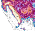
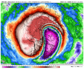
Latest Euro Weekly 7-day average for Jan 10 to Jan 17 looks good (a blue low off the NE Coast would make it better). It does move toward a -PNA late Jan into early Feb as it tries to bring the MJO east into the Indian Ocean. The good news is that the upcoming MJO movement is favorable (2nd image) so mid-Jan into late Jan has potential, and it's at the coldest climo portion of winter. The ensemble means have been backing off a bit on the strong high pressure dropping into E Asia in early Jan, so that could help a bit with calming down the Pac Jet....we'll have to see how that trends going forward

gzQVeQR.png


dw2ANbB.png
 
Last edited:
Latest Euro Weekly 7-day average for Jan 10 to Jan 17 looks good (a blue low off the NE Coast would make it better). It does move toward a -PNA late Jan into early Feb as it tries to bring the MJO east into the Indian Ocean. The good news is that the upcoming MJO movement is favorable (2nd image) so mid-Jan into late Jan has potential, and it's at the coldest climo portion of winter. The ensemble means have been backing off a bit on the strong high pressure dropping into E Asia in early Jan, so that could help a bit with calming down the Pac Jet....we'll have to see how that trends going forward

gzQVeQR.png


dw2ANbB.png

I'm not sure I can remember a storm that delivered for the clt area that didn't have a WAR in some shape or form (in recent memory). We just need the pacific to deliver the cold, a nice steep rockies ridge, and some good timing with the highs moving east along with the moisture underneath. That seems to generally work for us. However it'd be great if we could keep that general pattern around at least a couple weeks to increase our chances. Who knows, maybe we trend to a true -NAO low, but that look could do work I think.
 
I'm not sure I can remember a storm that delivered for the clt area that didn't have a WAR in some shape or form (in recent memory). We just need the pacific to deliver the cold, a nice steep rockies ridge, and some good timing with the highs moving east along with the moisture underneath. That seems to generally work for us. However it'd be great if we could keep that general pattern around at least a couple weeks to increase our chances. Who knows, maybe we trend to a true -NAO low, but that look could do work I think.
If you remember, last January the second of the 3 storms in CLT was actually aided by the WAR flexing more in the last 48 hours
 
Back
Top