• Hello, please take a minute to check out our awesome content, contributed by the wonderful members of our community. We hope you'll add your own thoughts and opinions by making a free account!

Pattern Jammin January 2023

Good read ajr. Looks like PV gets wound up and hits its peak mid to late this upcoming week,then the tearing dow,disruption process begins in earnest by Jan 1. Of course we have a lag time for sensible wx while this unfolds. We want a complete tear down,disruption of pv, not a transitional hiccup. Most are wagering is a complete tear down,but jury is out and we will know with more certainty in about a week. Eitheur way would match up to a Jan 9th time frane to flip, give or take a day or 2.

Grit,Web and Fro will be able to disect this Im sure. Grit laid out 3 possible outcomes yesterday. Hopefully we can get a good second half of Jan window of opportunity to score.
Yeah you can see the way the AO initially starts to spike later this week and early next week coincides with the strengthening PV, however after that the AO falls sharply negative again, which should prevent it from getting too wound up.
 
euro run is - tilt S/W after - tilt S/W after - tilt S/W. Lol so many severe weather setups
Yeah next weekend is showing some bad signals already. Two negative tilt shortwave coming in rapid succession. Temperatures in the upper 60s to low 70s with dews over 60 spread over a wide area. Bears watching500hv.conus.png500hv.conus (1).pngsfctd.conus (1).pngsfct.conus (1).png
 
Yeah next weekend is showing some bad signals already. Two negative tilt shortwave coming in rapid succession. Temperatures in the upper 60s to low 70s with dews over 60 spread over a wide area. Bears watchingView attachment 128556View attachment 128557View attachment 128559View attachment 128558
They look messy, but they look like those setups that produces those notable 1-4 long tracked supercells along the boundary that produce stronger tornadoes before they go QLCS, especially with the -tilt
 
No, no, no, no ,no!!!! This is winter… supposed to be cold.. and we are overdue big time for snow!! We haven’t had a meaningful snow here in 3-4 years!!! Waaaay too long without snow. Take that severe weather out to the fish!
It’s Dixie alley’s time to shine, climo wise Dixie heats up between now-April
 
10 days out warm rain forecast most of the time is right, 10 days out Snow forecast always wrong . . Snow storms are cutting to the North have been for years .
I don’t think there’s ever a 10 day snow forecast. There was a 10 day out below normal temperature range forecast which did verify.
 
This is the reality of situation. Take a break from here because it will be at least until mid January before things look remotely favorable for a return to cold and storminess for our area. Imo of course
 
By Jan 9th ish we should be normal by ens standards. CFS still looks great second half Jan espeacilly week of 20th. I hope we flip in Jan and can run another 15 day streak of BN temps like we are closing out on in DEC. Ill take my chances with that.
 
The polar vortex disruption forecast is really starting to show its face. If we see the type of disruption the models are currently forecasting you can expect some wild weather and possibly quite wintry weather for mid January through late January. It’s an impressive signal but of course the coldest air has the ability to slosh around on all parts of the northern hemisphere not just ours. I still believe though that this is what you want to see for winter weather chances here in the SE after what looks to be a good week or so of warmth. As some like to allude to “kicking the can down the road” it’s really normal for models to jump the gun on pattern changes by a week or so and that’s what happened with this last pattern change. It still happens as it did this year but it’s a normal error in models to turn the pattern too quick. Are we seeing that here? Perhaps. Models shooting for 9-15 change.. I’ll bet on a 15-20th when we change to colder and a better shot for winter precip chances as of right now.
 
Ya gotta love Dixie Alley in the cold season. Remarkable how we can go from an arctic outbreak with consecutive days below freezing to a week later having a moisture and primed atmosphere. As Remarkable as it was to watch the arctic front come through its going to be equally Remarkable to watch the atmosphere do a complete 180 in a very short period of time. We have been in this pattern for most of the fall and winter season of going from one extreme to the other. Can make for some interesting forecasts. I firmly believe we will swing back to the deep freeze sooner rather than later but we may have to go through a rocky patch or two to get there. FWIW GFS still showing a decent environment for storms next weekend sfct.conus (2).pngsfctd.conus (2).png500hv.conus (2).png
 
Hopefully tonight's GEFS Extended run is the truth and nothing but the truth

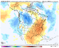
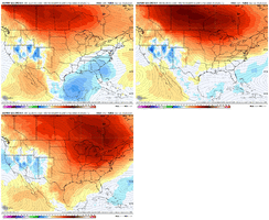
1st loop is 850mb Temp Anomalies in 7-day increments from Jan 1-8 to Jan 21-28.

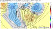
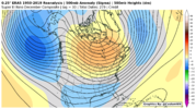
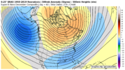
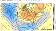
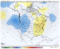
2nd image is 500mb Height Anomalies for Jan 18-25

3rd thru 5th images are MJO RMM plots from Euro, GEFS, and CFS - these couldn't really be any better as we move out into mid-January if we can just get the Pac Jet to calm down a bit and not over-extend

2DzUlxz.gif


C827whu.png


NLKWAW4.png


cjy2aUN.png


fJDdQ0v.png
 
Last edited:
Well looking like the 1st possible stormy weather will get stuck south of Birmingham area looking like storms firing along the gulf will occlude northern development. Seems this is the norm.. still have to watch the other systems set to push through later in the week. still worth watching as there is ample time for changes! Hoping everyone had a Merry Christmas!
 
Back
Top