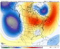
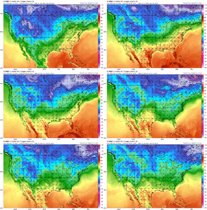
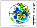
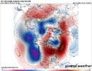
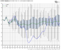
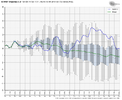
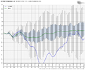
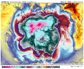
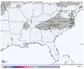
I think that might rushing things by a few days, but I definitely think about the 12th-15th timeframe, we could be back in business. The AO is looking to take another nosedive into negative, the NAO starts to go slightly negative, PNA holds positive throughout and the MJO which goes into low amp phase 7/8.18z GFS op keeps the momentum going. We get back to normal- Below Normal by Jan 7-9 and stay that way throughout run with a nice west to east winter storm in bound at the end of the run
-
Hello, please take a minute to check out our awesome content, contributed by the wonderful members of our community. We hope you'll add your own thoughts and opinions by making a free account!
You are using an out of date browser. It may not display this or other websites correctly.
You should upgrade or use an alternative browser.
You should upgrade or use an alternative browser.
Pattern Jammin January 2023
- Thread starter Goose88
- Start date
Sandbar
Member
We did a workup in that area before an Afghanistan deployment years ago and went through this very thing. Sun shining in a longsleeve watched it roll in like a squall. Paper plate sized flakes to start and had over 4 feet on the ground a day later. It snowed 4 days straight and we made snow caves to sleep in.I did. One model run showed over 60inches within a 24 hour span. Need a wx chaser up there to video.
The GFS gets split flow going as early as Jan 2 with a ridge going up in W Canada, Pac waves hitting California underneath, and Alaska mostly free of low pressure.. It holds this look thru the end of the run. Need to see that across the other model suites, but it's a look that would offer more promise18z GFS op keeps the momentum going. We get back to normal- Below Normal by Jan 7-9 and stay that way throughout run with a nice west to east winter storm in bound at the end of the run
I think that might rushing things by a few days, but I definitely think about the 12th-15th timeframe, we could be back in business. The AO is looking to take another nosedive into negative, the NAO starts to go slightly negative, PNA holds positive throughout and the MJO which goes into low amp phase 7/8.
Add a week to that time frame. Rule of atmo436.
GFS shuts down the warm party after January 6th. Seemed transient there. After that, plenty of opportunities to cash in. Instead of kicking the can down the road we’re reeling the can back up the road. Id still be a bit cautious for the head fake but January 15th still looks like a solid call for good winter weather chances to return to the east.
I thought the GFS was the one that’s always wrong and caves to the rest? What’s the Euro saying?GFS shuts down the warm party after January 6th. Seemed transient there. After that, plenty of opportunities to cash in. Instead of kicking the can down the road we’re reeling the can back up the road. Id still be a bit cautious for the head fake but January 15th still looks like a solid call for good winter weather chances to return to the east.
NBAcentel
Member
Euro shows us back to normal by Jan 8th[corrected]. So the heatwave is over a week from today. No arctic plunge or anything. Then the next piece to figure out is what the pattern is gonna be like after Jan6. Its messy hard to discern look. Its one where you can sneak stuff(frozen) in, but temps will cause usual whalling an nashing of teeth.
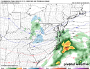
Look no futher than next Friday. 6z GFS buries DC and keeps showing I-40 crowd right on the line.
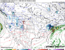
Look no futher than next Friday. 6z GFS buries DC and keeps showing I-40 crowd right on the line.

Latest CFS looks like Hot Garbage for us second half Jan. Hopefully it will change, was looking pretty good. Its a gurantee we roast next 7 days,then catch a break back to normal, but who knows how long and where we go from there. Could just be transient few days. Thats my Modeology take.
This one has my attention it wouldn't take much for the I-40 crowd to cash in. Need that low to develop further south.Euro shows us back to normal by Jan 8th[corrected]. So the heatwave is over a week from today. No arctic plunge or anything. Then the next piece to figure out is what the pattern is gonna be like after Jan6. Its messy hard to discern look. Its one where you can sneak stuff(frozen) in, but temps will cause usual whalling an nashing of teeth.
Look no futher than next Friday. 6z GFS buries DC and keeps showing I-40 crowd right on the line.
View attachment 128966
NBAcentel
Member
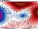
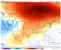
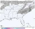
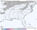
Certainly not thinking snow event here but it will bring cooler air into the region instead of those 60s. January 15th on is again where I’m eyeing legit winter weather chances to start appearing again and the pattern to get much better. Models are bringing cooler air in though earlier which is nice to see.Big red flag here is the lack of a 50/50 low, we need that TPV in SE greenland much further SE. At best this would be an ending as snow with little/no accums outside the mountains. This doesn’t have the look of a SE system and with a WAR that strong, is likely to trend unfavorably View attachment 128968View attachment 128969
NBAcentel
Member
And with it being January now we at least have a better shot at being on the better side of marginal set upsThis is a slighty better look then weve seen the last few days. While not a 50/50 low, you have lower heights in the Atlantic, which promotes NE flow aloft and keeps the cool/marginal airmass in place, parhaps for a dynamical cooling type of setup. It’s better then a WARView attachment 128971
NBAcentel
Member
One thing that’s dependable this winter, western troughing! I think even during the East and SE cold snap last week, it was still there in some form and I think Seattle was still getting frozen precip! Very odd pattern12z Modeology Canadian op looks best. See where Gefs goes. Need Big ridging through plains up in to western canada to be on west coast up into Alaska.
View attachment 128979
- Joined
- Jan 23, 2021
- Messages
- 4,603
- Reaction score
- 15,199
- Location
- Lebanon Township, Durham County NC
Means aren’t really exactly where we want them to be but the variability is there enough to say it could lean either way. Id love to see that control run lol looks like a dooseyAccording to the weeklies, the fundamental indexes look good:
View attachment 128990View attachment 128991View attachment 128992
What am I missing here? The NAO is positive, the PNA goes negative and the AO goes positive around the time everyone says we get colder. Not that it's correct but that doesn't look good to me.According to the weeklies, the fundamental indexes look good:
View attachment 128990View attachment 128991View attachment 128992
Six Mile Wx
Member
AO and NAO drop off a cliff on the control run at least around the 16thWhat am I missing here? The NAO is positive, the PNA goes negative and the AO goes positive around the time everyone says we get colder. Not that it's correct but that doesn't look good to me.
The variability means you could be in either side of what we want. This is months ahead of time which mean little to no accuracy as well. Don’t look into it too muchWhat am I missing here? The NAO is positive, the PNA goes negative and the AO goes positive around the time everyone says we get colder. Not that it's correct but that doesn't look good to me.
dsaur
Member
I like the look when the cold air starts to encroach, with a washed out frontal boundary, and a low forming. Get the old front to be real, and get a low to pop in the gulf and move up the old boundary, instead of off the coast...and get the cold air in place.....lol, yeah it's the south...lots of if, if, if. But whenever I hear "split flow" I know the improbable just got more probablerThe GFS gets split flow going as early as Jan 2 with a ridge going up in W Canada, Pac waves hitting California underneath, and Alaska mostly free of low pressure.. It holds this look thru the end of the run. Need to see that across the other model suites, but it's a look that would offer more promise
Webberweather53
Meteorologist
I still really don't see anything to get excited about until at least mid-month.
NBAcentel
Member
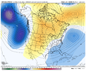
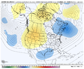
Yep agree, although these are probably the best runs yet on the ensembles with them lowering heights in the Atlantic quite a bit. Still, the airmass is stale around our region so not much to get excited about, but deepening the stuff in the Atlantic wouldn’t hurt. Looks like your classic mountain big dog pattern thoughI still really don't see anything to get excited about until at least mid-month.
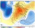
NBAcentel
Member
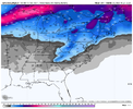
This is not far off. Lowering heights in the Atlantic is crucial here. It’s a pattern that can harbor juicy southern stream waves, we just need a supply of cold (50/50 low/deepening low in the Atlantic around mid month). Without it, we are just gonna get a cold rain. We need some sort of northern stream energy to dig down with a prior wave and phase with a pacific wave best case scenario so it can bomb out around the 50/50 region. then things get interesting. Looks like a MA/NE and mountain pattern for now but the GEFS had a couple big dogs with this look, all thanks to the lower ATL heights 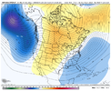


bigstick10
Member
By the looks of things, this winter looks like a disaster, again. If we did not have the cold snap recently it could be the warmest on record, IMO???? Please someone throw me a bone and prove me wrong. I love cold and snow, but it looks dreadful. We are not going to get ice or snow with temps in the 50s/30s.
NBAcentel
Member
Warmest on record ? Are you serious dude ? smh, it hasn’t even hit January yet. Tossing winter in late December is something elseBy the looks of things, this winter looks like a disaster, again. If we did not have the cold snap recently it could be the warmest on record, IMO???? Please someone throw me a bone and prove me wrong. I love cold and snow, but it looks dreadful. We are not going to get ice or snow with temps in the 50s/30s.
bigstick10
Member
I am not the only one on here thinking the same thing, you have no room to talk wishing for warm all the time. Look at your extended maps you slather on here all the time, not a good look for winter fans.Warmest on record ? Are you serious dude ? smh, it hasn’t even hit January yet. Tossing winter in late December is something else
NBAcentel
Member
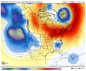
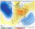
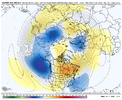
Not a great map, but This is the look I would want to show up on ensembles if you want a good looking snow pattern, note the lower heights in the ATL here is crucial, and a Rockies centric ridge, this is why you get “big dogs” in ninos because of these sorts of looks. You keep an active pacific jet, but if you time right with w SE can vortex/Atlantic low, then you got something. Not there yet on ensembles, but I’m starting to become encouraged by trends, it’s certainly that pattern if we get right, has more big dog potential then usual
What I want to see
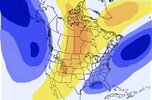
Gefs

What I want to see

Gefs

Last edited:
NBAcentel
Member
@Ollie Williams isn’t that map I made close to your big dog composite ?Not a great map, but This is the look I would want to show up on ensembles if you want a good looking snow pattern, note the lower heights in the ATL here is crucial, and a Rockies centric ridge, this is why you get “big dogs” in ninos because of these sorts of looks. You keep an active pacific jet, but if you time right with w SE can vortex/Atlantic low, then you got something. Not there yet on ensembles, but I’m starting to become encouraged by trends, it’s certainly that pattern if we get right, has more big dog potential then usual
What I want to see
View attachment 129028
Gefs
View attachment 129029
That's a lot of average coming
NBAcentel
Member
Record breaking ? But yeah in all seriousness, it’s a boring pattern after this warmup. Unless we can trend that way ^^^That's a lot of average coming
Six Mile Wx
Member
Webberweather53
Meteorologist
Fwiw, this my general sentiment on January (as things currently stand)
-The first week or so is very likely going to be warm & fairly wet/stormy. Need to be on the lookout for severe weather across the lower MS Valley & Gulf coast especially.
Once we get to/past Jan 10th ish, we should see more of a canonical El Nino/+PNA pattern return. We'll probably progressively step down from this super mild pattern to a seasonable one, that eventually becomes rather cool again as we move into mid-late January.
Imho, after this potential chance ~Dec 26-27th or so, our next best window is probably somewhere in/around the 3rd week of January (~ Jan 14-25 ish). There may very well be a storm or two that shows up between now & then, but the air masses earlier on in January are more liable to be stale, more temperate continental polar ones, capable of delivering snow primarily to climo favored areas of the Appalachian mountains, etc.
I also tentatively suspect we may see the -EPO also make a return sometime late in January and eventually evolve into a more classic -EPO/-PNA/SE ridge La Nina pattern in February (typical evolution for a winter like this).
After blowing our chance for a big winter storm after Christmas, I still definitely think we're going to see the +PNA show up around mid-month as we slowly transition from this +EPO/GOA trough/Super Nino pattern to a more classic -EPO/-PNA/La Nina pattern in February & thus, mid-late Jan (Jan 14-25 ish) is probably our best opportunity for a winter storm in DJF. When the MJO returns to the Warm Pool again, that will probably harken the onset of a -EPO/-PNA/SE ridge pattern & you're starting to see NWP models hint at this in early Feb.
The hope here is w/ West QBO, the Aleutian ridge will be taller than usual and be able to extend into & north of Alaska (allowing for at least more transient shots of brutally cold air and perhaps another opportunity or two for winter weather in Feb), but we'll be fighting against downward coupling from the stratospheric polar vortex by then, which will try to suppress the ridge to the south & keep the heights lower over the polar cap region.

