WFFaithful
Member
Look at the moisture on the west coast!
When is the SSW event supposed to occur? Coupled with -nao/ao ?Yep, not a good trend the last day. as we get closer we’re trending to more pac jet. Lower heights on the EC but it wouldn’t be much cold with this. Like I said not a terrible look, I’m honestly a bit nervous we do the same thing where we get a transient good pattern with legit cold, then return quickly to a more traditional La Niña look View attachment 128775
Sorry, wrong thread.....?My driveway is a sheet of ice..
I’m not honestly that worried about this at this point. For one this is January 11th and I was honestly expecting we get the ball rolling around the 15-20th so the fact that we could get some close calls before then is nice. Also that strat warming is really going to make an impact on our sensible weather in my opinion. Models don’t even pick up on huge things like that until we get down the road from them. Obviously the cold rains aren’t ideal but a close call is a close call and maybe this time around we can lean on the better half of those close calls instead of on the 34 rain side. Agreed for large portion of the board this isn’t the best look. But I think once models reflect strat warming in our weather pattern things will improve everywhere.This look isn’t bad, but isn’t great honestly. This looks very polar pacific esque, that can get the job done now, but lack of 50/50 with a stale airmass isn’t screaming winter storm pattern. Need to see heights build in AK/above AK for any legit cold air. It’s a active look, but I’ve seen more cold rains with this look more then often View attachment 128772
We just saw the coldest air in decades and a few light snow events in part of the SE. press x doubt on “desperate” for some. You was saying the cold wouldn’t show up or was not going past hour 240 your not slick ? you just spent days below freezing manNever fails , lol… you can tell when things start to get desperate … the ole ssw event wording comes out . Lol
Strat PV reflections do lots of workNot always 1:1 but this look in the strat has been seen before we get dunked onView attachment 128778
I wanted to say this winter is really reminding me of 13-14’. In that winter if I have my thoughts right we had a strong cold blast in December and then I definitely remember the killer shot in late January.
Yea no complaints here. Obviously missed on the frozen precip in MBY, save 5 minute snow shower. But we cant ask for much else. The Cold was very Impressive. If we dont avg AN tommorow, it will have been 16 straight days BN. 5 degrees being the coldest morning, with a negative 12 windchill on brown ground. GBORO will end up -4.We just saw the coldest air in decades and a few light snow events in part of the SE. press x doubt on “desperate” for some. You was saying the cold wouldn’t show up or was not going past hour 240 your not slick ? you just spent days below freezing man
It’s generally just how weather works tbh. Equal and opposite reactions. There’s usually always a thaw of sorts after a big time cold period. The atmosphere just likes to even things out in the long run. Obviously there are triggers that can make a pattern last longer than it’s counterpart but it’s all in the science of the atmosphere and very interesting to watch unfold sometimes.How many months have we been in a repeating pattern where the first week of the month is warm and then it gradually gets colder? I think it started in October possibly. Should be easier to cash in if the same thing happens in January I would think.
It’s generally just how weather works tbh. Equal and opposite reactions. There’s usually always a thaw of sorts after a big time cold period. The atmosphere just likes to even things out in the long run. Obviously there are triggers that can make a pattern last longer than it’s counterpart but it’s all in the science of the atmosphere and very interesting to watch unfold sometimes.
We live in the south. The cold periods are longer up North. It does mean it isn't equal or opposite.Agree, sort of. Doesn’t seem equal and opposite. The thaw and warm periods are decidedly longer.
Sent from my iPhone using Tapatalk
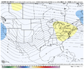
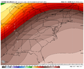
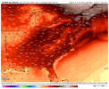 this is gonna feel much better then what we just had. Go outside and flip some burgers, play some golf, actually be able to enjoy the outdoors with this high T looking pattern, get out your heated house and enjoy the outdoors !
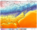
past that though, changes are comingLook at all those 60s !! It’s beautiful. Spring peepers about to sound off at night around the ponds View attachment 128794
Nothing to do with living in the south or north. It's based on a locations average and we're constantly above our average. Take Charlotte for example. It isn't even close to being the same amount of below average days as above average days. And it's been this way for years and years. You'd probably find the same for most locations around the country as well. Especially the east.We live in the south. The cold periods are longer up North. It does mean it isn't equal or opposite.
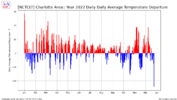
2,453,643.How many years do we have to go back to be able to count 3 below normal winters within that span of time?
Look at Canada !! Nice source region weiner roast. It’s a pacific air sauna into NA with that look, no 50/50 low to even give us hope. We’re getting a tiny taste of polar pacific there. Just enough for a few nicky b type days and a big frosty car topperGEFS is showing a nice trough signal stemming from Cuba late in the run ? ? View attachment 128804
A roasting Canada has produced some huge events for us in the past; especially at peak winter time. IMO, i'll take a warm canada over a big polar vortex spinning over central Canada any day. I'll agree that particular look posted isn't too sexy though.Look at Canada !! Nice source region weiner roast. It’s a pacific air sauna into NA with that look, no 50/50 low to even give us hope. We’re getting a tiny taste of polar pacific there. Just enough for a few nicky b type days and a big frosty car topper
The ole reverse juju strategy for winter weather. I hope it works out!Latest mode runs trending deeper and further east with the GOAK trough mid jan. Pacific jet trending stronger, as mentioned above, that could be a can kicking factor. That’s good. I’m done with cold
I’m sorry, but I’m serious, you can ask folks on here, Im a snow weenie, but I’m the biggest warm weenie here besides lick. look at the Feb/March/April/May threads from last yearThe ole reverse juju strategy for winter weather. I hope it works out!
You'll be back when the first legit threat shows up.I’m sorry, but I’m serious, you can ask folks on here, Im a snow weenie, but I’m the biggest warm weenie here besides lick. look at the Feb/March/April/May threads from last year
Looks like a Super El Nino to a T. Normally we are trying to get the Pac Jet to extend during a Niña, now we are trying to slow it down lol. Oh well, let’s see how this trends going forwardLatest mode runs trending deeper and further east with the GOAK trough mid jan. Pacific jet trending stronger, as mentioned above, that could be a can kicking factor. That’s good. I’m done with cold
Yeah have a good feeling we’re not getting the full picture here. Strat warming will always throw a wrench in trends but you have to wait until models can actually pick up on it. Again we are always expecting a delay with patterns as that’s what models do as they did with this past cold pattern. Nothing I wasn’t expecting here.Looks like a Super El Nino to a T. Normally we are trying to get the Pac Jet to extend during a Niña, now we are trying to slow it down lol. Oh well, let’s see how this trends going forward
Never said anything about winter weather ?.Yes these are dynamite looks ? View attachment 128808View attachment 128809
