• Hello, please take a minute to check out our awesome content, contributed by the wonderful members of our community. We hope you'll add your own thoughts and opinions by making a free account!

Pattern Jammin January 2023

Hit that link and look at the recorded events at GSP since 1879 or so.
What was stunning to me was the lack of big snows & just Snow in the 50's & before all the way back to the late 1800's.
I was under the impression that the western Carolinas & NE GA averaged much more snow before the 60's.
Their was many many years with Trace amounts before AGW.
IMHO there's other things going on than just Climate change.
Cities & population bases are much larger causing more heat islands.


If you take the 30 year data from 1930-1960 you have 123.6 inches for a 30 year average of 4.12 inches. If you take the 30 years from 1992 until now you have 121.5 inches for a 30 year average of 4.05 inches.

That's splitting hairs and suggests averages haven't fallen as much as one would think. The 60s thru 80s skewed the numbers up. But what is missing is the complete lack of big years. Even from 1930 to 1960 there were some very big years in there and that kept the averages up. Otherwise they would have been abysmal. The last 30 years have featured more consistent snowfall than the 30s thru the 50s but complete lack of double digit years. That has to be because we waste a lot of precip on rain changing to snow or the warm nose changing us to sleet on the backside probably because of a warmer climate. If we still have the 15-20 inch years every few years we'd be living in the golden ages of snow.
 
Have to admit I don't read JB anymore so I am surprised we agree on this. Maybe I should go back and re-subscribe? ?
A lot of what JB has said in recent weeks does make sense. Where he lost me is the other day is when he said he expected a cold pattern to set in the rest of the winter… that was 100% playing to his energy clients
 
I agree about Miller As. I can't think of a time we've had a pure one in the last 10 years. At best they're always a CAD hybrid A/B. I've resigned myself to just appreciate a winter storm when we can get it, no matter the type. And there will always be sleet mixed in, one way or another. Fine by me, with the decent ones we always end up with a front end thump of snow, before the sleet mixes in. If it gets me out of work, sled day with the kids, its a win. Last year's B was fine, 2 inches snow, 2 inches sleet. Don't look close you can't tell the difference. Lol.
Exactly. I got 7-8" on frontend FGEN driven snow before I switched over to sleet/ZR. That's just how winter storms go for us around here these days. I think at least the CAD regions of NC/SC/NEGA can score here at the end of the month, but unless it's some ULL driven stuff or FGEN driven stuff it's going to be sleet and ZR.
 
While I know it’s forbidden to look 14 days out it seems that at times colder air looks promising only to see it slowly disappear as we get closer to those dates. I know this is why the 5 day look ahead is better but as is always the case we shall see.


Sent from my iPad using Tapatalk
For days now, ALL of the ensembles have advertised a pattern change beginning the last third of this month. The evolution to a +PNA and a progressively colder CONUS remains on schedule. Whether we can lock this in for a 10-20 period or not, and of course whether we can score a winter storm or two remains to be seen.

Winter is coming.
 
Me too. Guess I need to get out there and clean up that mess.

rebuild.png
 
It sure has been a wet winter...California is nuts. SE has been well above normal too. Models saying it keeps coming....this ain't nina

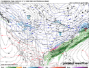
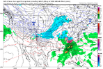
View attachment 129869View attachment 129868
It's a bigger question, but I wonder if anyone really knows what drives weather patterns. It was/is widely expected by many that Nina would be the predominant driver this season and that we would proceed generally along the Nina climo path. That is clearly not the case right now. There is so much we just don't know or fully understand around which forcing mechanism is predominant at which times. Anyway, glad to have the rain.
 
At that one location but those lows aren't too far off from what I posted and it's believable that some isolated locales away from Greensboro proper were a few degrees colder

edit: and 29 this morning at Greensboro, not yet depicted in the chart you share
I live in a local away from Greensboro, and it's not been as cold as you and SD where showing. I only used GSO as a representation of the local area. Yesterday morning was the only night below freezing.
 
For days now, ALL of the ensembles have advertised a pattern change beginning the last third of this month. The evolution to a +PNA and a progressively colder CONUS remains on schedule. Whether we can lock this in for a 10-20 period or not, and of course whether we can score a winter storm or two remains to be seen.

Winter is coming.
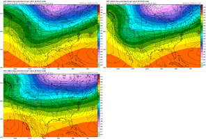
Yep. Jan 20 or 21 is the due date: All 3 ensemble sets agree. That Pac ridge is a beaut on all of them.

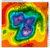
500h_anom-mean.nh.png
 
Back
Top