-
Hello, please take a minute to check out our awesome content, contributed by the wonderful members of our community. We hope you'll add your own thoughts and opinions by making a free account!
You are using an out of date browser. It may not display this or other websites correctly.
You should upgrade or use an alternative browser.
You should upgrade or use an alternative browser.
Pattern Jammin January 2023
- Thread starter Goose88
- Start date
ATLwxfan
Member
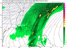
A lot can change from now until then, but verbatim. This is a great set up for much of the southeast except for Georgia of course.
Sent from my iPhone using Tapatalk
Sent from my iPhone using Tapatalk
I bet to differ here in South Carolina.A lot can change from now until then, but verbatim. This is a great set up for much of the southeast except for Georgia of course.
Sent from my iPhone using Tapatalk
SnowwxAtl
Member
And South CarolinaA lot can change from now until then, but verbatim. This is a great set up for much of the southeast except for Georgia of course.
Sent from my iPhone using Tapatalk
DobsonCityWx
Member
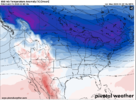
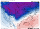
Long term temp maps should be banned when skewed by fantasy accumulations. Let’s hope for temps below 32 and a little winter weather at least for the climo areas north of Huntersville, NC.
I think South Carolina would be okay.. if we get a stronger wedge (CAD) hopefully models trend stronger with time with it.I bet to differ here in South Carolina.
ATLwxfan
Member
I bet to differ here in South Carolina.
Agreed. GSP probably does ok however.
Sent from my iPhone using Tapatalk
NCHighCountryWX
Member
- Joined
- Dec 28, 2016
- Messages
- 699
- Reaction score
- 1,918
NCHighCountryWX
Member
- Joined
- Dec 28, 2016
- Messages
- 699
- Reaction score
- 1,918
ATLwxfan
Member
View attachment 131094WPC says…
This is just something pretty my six year old colored in
Sent from my iPhone using Tapatalk
Cary_Snow95
Member
Cary_Snow95
Member
- Joined
- Jan 23, 2021
- Messages
- 4,602
- Reaction score
- 15,197
- Location
- Lebanon Township, Durham County NC
The GFS dropped two feet of snow in College Station
Cary_Snow95
Member
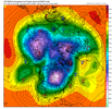
Gfs drops a 1060 HP into the Midwest. That’ll get it done haha
- Joined
- Jan 23, 2021
- Messages
- 4,602
- Reaction score
- 15,197
- Location
- Lebanon Township, Durham County NC
Looks a lot like that 12z control run
Stormlover
Member
That changes drastically sometimes from day to day. They are already looking at the cold plunge

Snownut
Member
Yeah upstate would be very much in playAgreed. GSP probably does ok however.
Sent from my iPhone using Tapatalk
Sent from my SM-A526U using Tapatalk
Webberweather53
Meteorologist
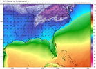
Where's the early February torch? Makes the December outbreak look like child's play.View attachment 131089
Where’s the ensembles at
Webberweather53
Meteorologist
I just can’t that get excited (yet) about a long range day 10+ pattern with a SE ridge lurking and huge +NAO speeding every northern stream trough (& associated cold air) along to the east (instead of holding them in place like -NAO would).
The only thing really going for this pattern in week 2 is high latitude blocking in the Beaufort & Chukchi Sea seeding the CONUS with cold air, so there’s at least an outside chance something shows up, but it’s still not a good pattern to be quite honest.
Not to mention, we still have a mean trough out west/-PNA. Takes threading the needle to a whole new level because the mean flow is very, very fast getting squeezed between the SE ridge and Hudson Bay vortex.
If you want to find modern examples of storms that showed up in patterns like this, Feb 1989 certainly has a few, and Feb 2020 has another one I can think of.
Need to save that map of zr to see if it verifies. Good ole GFS
rburrel2
Member
Looking pretty good to me for a snow threat… not necessarily buying the 100 year cold event.Where’s the ensembles at
Webberweather53
Meteorologist
View attachment 131102Not very torchy at 264 hours...
But looking torcherific at 186 hours.
View attachment 131103
I have a hard time taking anyone seriously who posts day 10+ operational model runs, esp as evidence of a pattern change.
Again this wouldn’t be a pattern change but a stroke of good luck in a crappy pattern. ?? probably won’t happen but it’s nice that we have the ability to track something right now in a pattern like this. Just don’t get your hopes up high at the moment.
Hey, just a small request:
When you post maps, would you please try and make sure the legend and the headers are included in the image? It would be really helpful to know if we're looking at dews, surface temps, 850 temps, etc. Thank you!
When you post maps, would you please try and make sure the legend and the headers are included in the image? It would be really helpful to know if we're looking at dews, surface temps, 850 temps, etc. Thank you!
- Joined
- Jan 23, 2021
- Messages
- 4,602
- Reaction score
- 15,197
- Location
- Lebanon Township, Durham County NC
and to piggy back on that: only kuchera maps, pls.Hey, just a small request:
When you post maps, would you please try and make sure the legend and the headers are included in the image? It would be really helpful to know if we're looking at dews, surface temps, 850 temps, etc. Thank you!
JHS
Member
Maybe not for snow, but certainly for ice or sleet. Hopefully sleet, but we are long overdue for ice and with that much cold air to the north to feed in, it might be a really bad one. Of course, it is way out there though.Yeah upstate would be very much in play
Sent from my SM-A526U using Tapatalk
But when day 15 maps show torch, it’s fair game??I just can’t that get excited (yet) about a long range day 10+ pattern with a SE ridge lurking and huge +NAO speeding every northern stream trough (& associated cold air) along to the east (instead of holding them in place like -NAO would).
The only thing really going for this pattern in week 2 is high latitude blocking in the Beaufort & Chukchi Sea seeding the CONUS with cold air, so there’s at least an outside chance something shows up, but it’s still not a good pattern to be quite honest.
Not to mention, we still have a mean trough out west/-PNA. Takes threading the needle to a whole new level because the mean flow is very, very fast getting squeezed between the SE ridge and Hudson Bay vortex.
If you want to find modern examples of storms that showed up in patterns like this, Feb 1989 certainly has a few, and Feb 2020 has another one I can think of.
It doesn’t take 1000 year cold to get a good event down there! Just need cold enough. I’m excited for y’all down there and think the next 10 days hold a lot of promise!Looking pretty good to me for a snow threat… not necessarily buying the 100 year cold event.
ATLwxfan
Member
But when day 15 maps show torch, it’s fair game??
I mean in a Niña base state with analog support…yeah

Sent from my iPhone using Tapatalk
Yeah… looking at the teleconnections, it’s just hard to imagine that there could be a legitimate threat in that timeframe.I just can’t that get excited (yet) about a long range day 10+ pattern with a SE ridge lurking and huge +NAO speeding every northern stream trough (& associated cold air) along to the east (instead of holding them in place like -NAO would).
The only thing really going for this pattern in week 2 is high latitude blocking in the Beaufort & Chukchi Sea seeding the CONUS with cold air, so there’s at least an outside chance something shows up, but it’s still not a good pattern to be quite honest.
Not to mention, we still have a mean trough out west/-PNA. Takes threading the needle to a whole new level because the mean flow is very, very fast getting squeezed between the SE ridge and Hudson Bay vortex.
If you want to find modern examples of storms that showed up in patterns like this, Feb 1989 certainly has a few, and Feb 2020 has another one I can think of.
Anyone got the teleconnections during feb 2014? Would be interesting to compare and contrast
packfan98
Moderator
Joe Bastardi was citing the EPO and WPO as being favorable for big cold on his Saturday SummaryYeah… looking at the teleconnections, it’s just hard to imagine that there could be a legitimate threat in that timeframe.
. I’m not sure if that’s factoring in to what the models are showing today. What do you think, @Webberweather53?
If I remember correctly, we had a neutral AO, +NAO, and PNA that had just gone negativeAnyone got the teleconnections during feb 2014? Would be interesting to compare and contrast
Webberweather53
Meteorologist
But when day 15 maps show torch, it’s fair game??
Yep because those maps actually have and are still verifying
DobsonCityWx
Member
GSP said stop. 10 day outlook. “You may want to keep scrolling if you're a winter lover.. #scwx #ncwx #gawx”
DobsonCityWx
Member
They said that 20mins ago btw.
Cary_Snow95
Member
Yes the next 10 days is torch. Doesn’t get interesting until potentially 2/2-2/4They said that 20mins ago btw.

