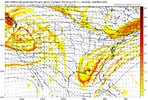
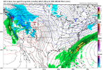
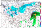
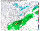
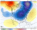
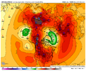
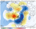
I respect your skill and acumen Webber but if it were clean torching beyond day-10 would you be saying that.Looks like a bunch of noise beyond day 10.
-
Hello, please take a minute to check out our awesome content, contributed by the wonderful members of our community. We hope you'll add your own thoughts and opinions by making a free account!
You are using an out of date browser. It may not display this or other websites correctly.
You should upgrade or use an alternative browser.
You should upgrade or use an alternative browser.
Pattern Jammin January 2023
- Thread starter Goose88
- Start date
- Joined
- Jan 23, 2021
- Messages
- 4,602
- Reaction score
- 15,197
- Location
- Lebanon Township, Durham County NC
Seems to be slowly increasing. Not as much noise on the GEFS but there are close to five really big deals which given the near February 2014 evolution like @Myfrotho704_ mentioned, could stand to reason.Looks like a bunch of noise beyond day 10.
lexxnchloe
Member
Webber is making good points. No need to dump on him. The persistent pattern has been warm and warmer. I will beleive the cold has come when it has come, and for more than 3 days.
AJ1013
Member
Tucson reporting snow right now lol
CltNative90
Member
I remember watching Al Conklin and Eric Thomas the evening before this event. They were only calling for an inch or so in Charlotte, but I specifically remember them mentioning the Canadian model at that time showing an interesting scenario that could produce more. Woke up in the morning to a winter wonderland and school cancelled. Sledding in the 12 degree temps on the evening of the 23rd sure was fun too. Would love to see one like that again.
- Joined
- Jan 23, 2021
- Messages
- 4,602
- Reaction score
- 15,197
- Location
- Lebanon Township, Durham County NC
I dont think that was the point he was making.Webber is making good points. No need to dump on him. The persistent pattern has been warm and warmer. I will beleive the cold has come when it has come, and for more than 3 days.
znel52
Member
One of the top storms of my lifetime. I lived in extreme Eastern Carteret County tiny town of Atlantic where that 9 inches of snow is. Man me and my friends had a blast in that storm. Only 1 or 2 better storms in my lifetime
This has always and will always be a warm pattern but in a pattern that is warm you can get transient periods of favorability for some winter weather. We are tracking those short windows. One was later this week when we will be delivered a good cold shot but tilts and lack of energy that threat died quickly. Even if we do get a favorable period (as models are predicting again at the start of February) I have no doubt we revert back to warm after that period so we’re not going to see long term cold in this pattern but we can still see shots at winter potential which is what most here are interested in and subsequently trackWebber is making good points. No need to dump on him. The persistent pattern has been warm and warmer. I will beleive the cold has come when it has come, and for more than 3 days.
Stormlover
Member
Fox News Channel weatherman actuallySaw on JB's twitter feed Mammoth MTN Ski Area has only had 509 inches of snow so far this year. Can you imagine. He had a retweet of someone up there filming 100mph gust, obviously slopes where closed. Also saw on his feed where the NYC fox station weatherman got mugged/attacked on the subway.
One of the top storms of my lifetime. I lived in extreme Eastern Carteret County tiny town of Atlantic where that 9 inches of snow is. Man me and my friends had a blast in that storm. Only 1 or 2 better storms in my lifetimet
I would love to see that at that location
That town is paradise. They still ferry you out to National seashore, drop you off and come back to get you?
Current Obs: 46 degrees, breezy/Chilly, But we got had Sun for a while. Ground conditions are full on swamp. Sink walking in the yard from all the rain this winter. Yesterday was another big soaker. and it looks like another big round is due in here Wednesday. El nino conditions have been persistent here for weeks.
Greensboro is making a serious run at the wettest January on record
Hey so if you guys want to continue you can take it to the banter thread. Thanks.
This whole right vs wrong warm vs cold crap stops today. I'm tired of having to do this every winter now. Use the ignore button or simply just don't respond to people and move along.
This whole right vs wrong warm vs cold crap stops today. I'm tired of having to do this every winter now. Use the ignore button or simply just don't respond to people and move along.
Im still waiting to see where I called for it? Same applies to you....."If trends" and "could be" are far from a prediction...and yes, at 9:30 in the morning, the system looked extremely unimpressive at that time. Did it improve, absolutely. Was I wrong in saying I was unimpressed, absolutely not, because I wasn't....in the same way that I am unimpressed by your trolling attempts. Maybe others are impressed, maybe others aren't.....doesn't make either of them wrong. Try again later.
Hey so if you guys want to continue you can take it to the banter thread. Thanks.
This whole right vs wrong warm vs cold crap stops today. I'm tired of having to do this every winter now. Use the ignore button or simply just don't respond to people and move along.
DadOfJax
Member
Got it....I was typing and replied before I saw your post.
Lol gfs trying to super cad at D10
Cary_Snow95
Member
Lol gfs trying to super cad at D10
Attachments
- Joined
- Jan 23, 2021
- Messages
- 4,602
- Reaction score
- 15,197
- Location
- Lebanon Township, Durham County NC
Swing and a miss but it was this close.Lol gfs trying to super cad at D10
ATLwxfan
Member
Somebody is about to get crushed. That’s a beast off the coast at Hr 270 on GFS
Sent from my iPhone using Tapatalk
Sent from my iPhone using Tapatalk
ATLwxfan
Member
These are the setups where it snows in Savannah while it’s 40 in Atlanta
Sent from my iPhone using Tapatalk
Sent from my iPhone using Tapatalk
I seem to remember that by the 11pm broadcast, Eric Thomas talked like he wanted to up totals much higher, but GSP was holding firm on a WWA and didn’t upgrade to a WSW in their late evening update… even though a mesolow had formed near Spartanburg, and snow was breaking out a few hours earlier than forecast.I remember watching Al Conklin and Eric Thomas the evening before this event. They were only calling for an inch or so in Charlotte, but I specifically remember them mentioning the Canadian model at that time showing an interesting scenario that could produce more. Woke up in the morning to a winter wonderland and school cancelled. Sledding in the 12 degree temps on the evening of the 23rd sure was fun too. Would love to see one like that again.
Cary_Snow95
Member
LukeBarrette
im north of 90% of people on here so yeah
Meteorology Student
Member
2024 Supporter
2017-2023 Supporter
znel52
Member
Yeah they still do. Beautiful to see the beaches covered in snow. Shame it is such a rare event.I would love to see that at that location
That town is paradise. They still ferry you out to National seashore, drop you off and come back to get you?
Current Obs: 46 degrees, breezy/Chilly, But we got had Sun for a while. Ground conditions are full on swamp. Sink walking in the yard from all the rain this winter. Yesterday was another big soaker. and it looks like another big round is due in here Wednesday. El nino conditions have been persistent here for weeks.
Greensboro is making a serious run at the wettest January on record
rburrel2
Member
12z gfs is a beaut. Happy to see it a little too Far East at this range since we’re way more likely to miss to our west. Cmc still ugly and very far west.
View attachment 131040
I’ll take my chances with this look any day however it seems like GFS may be on an island.
This isn't to far off at H5 from the epic Snowmegadon run the other day. has the pv piece in a good spot, this storm Goes on to pop down east, then has another shot for western NC afterwards.

Hope the NWS Blacksburg office warn the folks in Surry County..........LOL What are the BF, 0 for 4 on the season?


NBAcentel
Member
Yeah it's really amazing how much they grid forecast changes. Like Yesterday the had a chance of sleet and freezing rain. After midnight, Tuesday night and Wednesday morning. Temps in the low 30s Tuesday night. Low 40s Wednesday. I get up this morning. It reads rain, but with the same temps. No mention of sleet and freezing rain? They are just backed and forth every package. And yes, there are at least 0 for 4 This winter. lol Current forecast.Hope the NWS Blacksburg office warn the folks in Surry County..........LOL What are the BF, 0 for 4 on the season?

TUESDAY NIGHT
Partly cloudy in the evening, then cloudy with a chance of rain after midnight. Cold with lows in the lower 30s. South winds around 5 mph, becoming southeast after midnight. Chance of rain 50 percent.
WEDNESDAY
Rain. Highs in the mid 40s. Northeast winds 5 to 10 mph. Chance of rain near 100 percent. sigh...
- Joined
- Jan 5, 2017
- Messages
- 3,774
- Reaction score
- 5,983
And at 282 hours, the ensemble panels are loaded with potential winter storms. That's a crazy difference from 0z 1/23/2023 run.Gefs going with the idea of cutting off ridge over Alaska and speeding up flow under it, this run might end up cold as a result View attachment 131044
- Joined
- Jan 5, 2017
- Messages
- 3,774
- Reaction score
- 5,983
I need to see CMCE or EPS backing this up. It is an encouraging sign thus far.
Yep cut the ridge off and prevent the ability to really dump in the west. Cross polar flow dumps into Canada and we flood Noam with cold with a string of high pressures from siberis to the great lakes. Would be the most fortunate good break winter weather lovers have caught in a long time. I trust it about 10%
CltNative90
Member
Simpler times when I used to get all my winter weather info from flipping back and forth between channels. I’m sure I watched Udelson and whoever was on WCNC that evening too (maybe Teri Bennett), but Thomas and Conklin stuck in my mind as being the only ones to mention the possibility. This event and the other early 2000s events are a big reason behind me becoming a snow weenie lol.I seem to remember that by the 11pm broadcast, Eric Thomas talked like he wanted to up totals much higher, but GSP was holding firm on a WWA and didn’t upgrade to a WSW in their late evening update… even though a mesolow had formed near Spartanburg, and snow was breaking out a few hours earlier than forecast.
I just remember getting home from work about 10:45 that evening and it was already starting to snow very lightly, and I thought to myself that this was really early… it wasn’t supposed to start until 3am and so. When I went in and turned on the TV and looked at the radar, it was looked nothing like what I expected based on the forecast. The snow had developed well ahead of what was coming from the west and you could tell that it was gonna be a much bigger deal that what they had mentioned all day.Simpler times when I used to get all my winter weather info from flipping back and forth between channels. I’m sure I watched Udelson and whoever was on WCNC that evening too (maybe Teri Bennett), but Thomas and Conklin stuck in my mind as being the only ones to mention the possibility. This event and the other early 2000s events are a big reason behind me becoming a snow weenie lol.
- Joined
- Jan 23, 2021
- Messages
- 4,602
- Reaction score
- 15,197
- Location
- Lebanon Township, Durham County NC
We had a guy by the name of ACWeather on WWBB who called it. He said he expected 2-3" but maybe a lot more.Simpler times when I used to get all my winter weather info from flipping back and forth between channels. I’m sure I watched Udelson and whoever was on WCNC that evening too (maybe Teri Bennett), but Thomas and Conklin stuck in my mind as being the only ones to mention the possibility. This event and the other early 2000s events are a big reason behind me becoming a snow weenie lol.
I *think* that was --------'s rookie year but I may be off by a year.
I'd assume there are a number of gefs members with absurd snow/ice totals this run probably centered around 2/1-3 west then 4-6 east. Maybe a few mixed in down or even south of I20. This is an impressive run only have to hold it for 8-12 more days
- Joined
- Jan 5, 2017
- Messages
- 3,774
- Reaction score
- 5,983
Not really that many big dogs over NC... just a few. They occur after 2/4.I'd assume there are a number of gefs members with absurd snow/ice totals this run probably centered around 2/1-3 west then 4-6 east. Maybe a few mixed in down or even south of I20. This is an impressive run only have to hold it for 8-12 more days
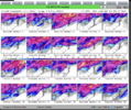
There must be a metwannabe special in there somewhere lolI'd assume there are a number of gefs members with absurd snow/ice totals this run probably centered around 2/1-3 west then 4-6 east. Maybe a few mixed in down or even south of I20. This is an impressive run only have to hold it for 8-12 more days
edit: obviously better than nothing at this lead time, we will take it

CNCsnwfan1210
Member
Maybe
a few similarities there with the mid February 1989 storm in NC

Sent from my SM-A136U1 using Tapatalk
packfan98
Moderator
This shows snow only and not sleet or freezing rain. Most members had some form of a mixed bag slop storm.Not really that many big dogs over NC... just a few. They occur after 2/4.View attachment 131048

