NBAcentel
Member
My Bad, when I flipped tabs on pivotal it must have kicked back, waiting on new 12z update: Here you go.That’s 00z CMC

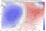
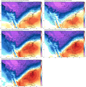
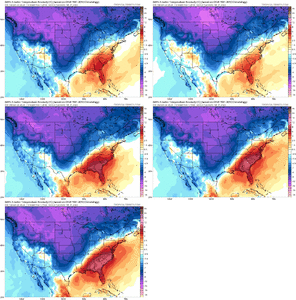
Do the same thing starting at 282hrs and the EPS has trended colder. I guess you if you're interested in tracking warmth then sure, the time period prior to the possible cold/winter threat has trended warmer.I’ve seen there’s no Mention of this, so as someone that’s been saying this is expected, the southeast ridge is trending stronger on modeling as we enter the medium range, and we’re trending to a torch ??View attachment 131152View attachment 131153View attachment 131154
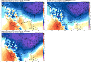
You need to go post Feb 6th. Definitely see that happening. We all chasing the 3-4 day max window hopefully 2/2ish-2/6ish.I’ve seen there’s no Mention of this, so as someone that’s been saying this is expected, the southeast ridge is trending stronger on modeling as we enter the medium range, and we’re trending to a torch ??View attachment 131152View attachment 131153View attachment 131154

Just feels like the same losing battle as usual. Hour 282 winter wx showing up like it always does behind a warming trend. These patterns relying on the western atlantic ridge easily screw the SE esp the eastern SE (dec 2017/Feb 2021). You can already see in those trends the western Atlantic ridge and its associated warmer air aloft nosing in. By tomorrow it’ll probably be over us across the Carolina’sDo the same thing starting at 282hrs and the EPS has trended colder. I guess you if you're interested in tracking warmth then sure, the time period prior to the possible cold/winter threat has trended warmer.View attachment 131162
weren't we closing in on a late january window like 2 weekends ago? i don't like being the heel/wildremann but i am taking the L and will check back in in a few days unless the euro takes a dramatic favorable turnYou need to go post Feb 6th. Definitely see that happening. We all chasing the 3-4 day max window hopefully 2/2ish-2/6ish.
This has 1989 written all over it. Maybe we get a 10 day or so shot in mid to late Feb, but we really have no shot till then.Just feels like the same losing battle as usual. Hour 282 winter wx showing up like it always does behind a warming trend. These patterns relying on the western atlantic ridge easily screw the SE esp the eastern SE (dec 2017/Feb 2021). You can already see in those trends the western Atlantic ridge and its associated warmer air aloft nosing in. By tomorrow it’ll probably be over us across the Carolina’s
Do the same thing starting at 282hrs and the EPS has trended colder. I guess you if you're interested in tracking warmth then sure, the time period prior to the possible cold/winter threat has trended warmer.View attachment 131162
Gfs has been much faster than the rest of the models at beating down the SER this shouldn't be a surprise12z GFS ain’t pretty.
View attachment 131138
Sure, it's generally a losing battle with any setup here.Just feels like the same losing battle as usual. Hour 282 winter wx showing up like it always does behind a warming trend. These patterns relying on the western atlantic ridge easily screw the SE esp the eastern SE (dec 2017/Feb 2021). You can already see in those trends the western Atlantic ridge and its associated warmer air aloft nosing in. By tomorrow it’ll probably be over us across the Carolina’s
Late January never really looked good for winter threats on the ensembles other than trending away from a sustained torch/SER. The February 2-6 timeframe is definitely the best look we've had since the December disappointment. (Not to say this time period won't wind up in the crapper tank too though)weren't we closing in on a late january window like 2 weekends ago? i don't like being the heel/wildremann but i am taking the L and will check back in in a few days unless the euro takes a dramatic favorable turn
Yea we have been in it since this past weekend started. run of mill normal cold for Jan. Plenty of cold rain storms passing by. I watched it pour rain in the mid 30's all day Sunday. Chances are highly likely the Groundhog day/post little window will end up with same result. But I'm not going to be out sunbathing here in Gboro. Yes we will get AN post 2/6ish and most likely out at least till 2/20ish no if an buts from what I'm seeing. After that it may or may not continue. It's a L if we don't score frozen, and chances are 50/50 we do/dont get the bleed east of the apps. Then its another 50/50 to get some timing.weren't we closing in on a late january window like 2 weekends ago? i don't like being the heel/wildremann but i am taking the L and will check back in in a few days unless the euro takes a dramatic favorable turn

pretty much a ice srorm throughout the whole midsouth regionI haven't found the precip maps yet for this time frame, but it's safe to assume that there was accumulating snow from near Shreveport to W. Tennesee at least.

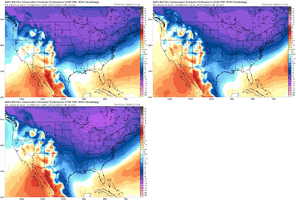
And you just killed it with that jinx. Now it will trend cooler to just above average with tons of rain.Not only that, but the GEFS is following suite. Me and some others (including @Webberweather53 ) have warned the site for a week or 2 these sorts of trends are more favored in the current pattern we’re headed to. It’s been legit 5-7 run trends at this point View attachment 131157View attachment 131158View attachment 131159
yes. Dissemination delays.Euro stuck for anyone else?
Euro stuck for anyone else?
Euro was so disgusted with it's own run, it trashed itself. j/k ?Euro stuck for anyone else?
No, it's a source problem.It's not loading on Pivotal, either.
The NAO being positive doesn't worry me anymore. We've had to snow with a +NAO since 2010. When we have had it lately we've wasted it. The AO is concerning and the MJO certainly is. The MJO has driven the pattern it seems for years now. Earlier this month everyone was thinking cold because of phase 8. Models showed warmth and it never got cold and looking back the MJO never went to phase 8. So the MJO forecast was the one wrong. So once again we have a discrepancy with its temp forecast vs its MJO forecast. Hopefully its colder pattern is correct and its MJO forecast is the one off like it was when it called for phase 8. That's my straw grasping for today. And if it does go the warm phases the 1st week in Feb we know it'll take all month to get out of them. And then we'll, that's pretty much a wrap. Nowhere to kick the can anymore then.Looking at the updated teleconnections today, the only two good things I can say is the PNA looks to go positive again around the 2/5 or so and the MJO while moving into phase 4 looks to be amping down. Both the AO and NAO stay clearly positive. Like I said earlier, we’re really fighting a hard battle to see any potential through the 1st half of February
May I? I know some of you have a proclivity to talk in absolutes which is never, in my opinion, very wise. I always reflect back on this particular event when people start cliff diving over the MJO and AO.The NAO being positive doesn't worry me anymore. We've had to snow with a +NAO since 2010. When we have had it lately we've wasted it. The AO is concerning and the MJO certainly is. The MJO has driven the pattern it seems for years now. Earlier this month everyone was thinking cold because of phase 8. Models showed warmth and it never got cold and looking back the MJO never went to phase 8. So the MJO forecast was the one wrong. So once again we have a discrepancy with its temp forecast vs its MJO forecast. Hopefully its colder pattern is correct and its MJO forecast is the one off like it was when it called for phase 8. That's my straw grasping for today. And if it does go the warm phases the 1st week in Feb we know it'll take all month to get out of them. And then we'll, that's pretty much a wrap. Nowhere to kick the can anymore then.
I've been watching it. 3km NAM has some nice flurry activity all the way to Atlanta! I'm watching Thursday night for my best shot, when temps are cold enough. It's probably technically graupel but I don't care. I'll be watching!While everyone is looking at day 10+ Thursday is going to give a decent amount of people on this board a shot at flurries or snow showers. East of the apps its rain or graupel

