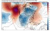
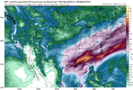
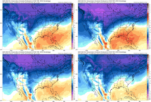
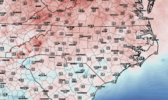
Well that verified.Gfs -7
View attachment 130869
Euro -7
View attachment 130870
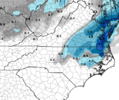
12z analysis today
View attachment 130871
-
Hello, please take a minute to check out our awesome content, contributed by the wonderful members of our community. We hope you'll add your own thoughts and opinions by making a free account!
You are using an out of date browser. It may not display this or other websites correctly.
You should upgrade or use an alternative browser.
You should upgrade or use an alternative browser.
Pattern Jammin January 2023
- Thread starter Goose88
- Start date
Cary_Snow95
Member
- Joined
- Jan 23, 2021
- Messages
- 4,602
- Reaction score
- 15,197
- Location
- Lebanon Township, Durham County NC
Sometimes I wonder what is the real world value in dollars when it comes to the GFS being so awful
JHS
Member
1989 really comes to mind looking at the 18z GFS. A ton of cold air, but warm east of the mountains. The cold goes into TX.
Or the disaster of Feb 2021. Something I never wanted to see again and may have to endure it just 2 years later again. Smh these Ninas have to go1989 really comes to mind looking at the 18z GFS. A ton of cold air, but warm east of the mountains. The cold goes into TX.
Blue_Ridge_Escarpment
Member
Couldn’t even sell it at the flea market.Sometimes I wonder what is the real world value in dollars when it comes to the GFS being so awful
- Joined
- Jan 23, 2021
- Messages
- 4,602
- Reaction score
- 15,197
- Location
- Lebanon Township, Durham County NC
ATLwxfan
Member
Or the disaster of Feb 2021. Something I never wanted to see again and may have to endure it just 2 years later again. Smh these Ninas have to go
Unfortunately they aren’t going anywhere anytime soon. We will have to find ways to make lemonade out of a base state of Nina lemons.
Sent from my iPhone using Tapatalk
JHS
Member
Rd 2 dropping in headed straight for Texas and NM. -40 in the Dakotah's
There has been a Nina 5 of the last 8 years and one of those that wasn't was a super Nino. No wonder winter has been so pathetic since 2015, especially February. Some good periods like Jan 2018 and Jan 2022 but pretty bad winters in general.Unfortunately they aren’t going anywhere anytime soon. We will have to find ways to make lemonade out of a base state of Nina lemons.
Sent from my iPhone using Tapatalk
Where gonna drown in cold rain, literally if the 18z gfs is right. 6 inches of rain.
Gfs going to uncork a day 15/16 bomb but it probably cuts
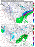
That is one hell of low riding a boundary scenario there. That is about all you can ask for in the weather porn department. A+? see yah in Texas in about 100 hours View attachment 130822
The Russian rubleSometimes I wonder what is the real world value in dollars when it comes to the GFS being so awful
Not sure why anyone would get excited over a gfs run, Over past 5 years I bet it has shown over 200 inches of snow for me. Absolute horrible model for winter
Cary_Snow95
Member
Cad Wedge NC
Member
Why does GSP have "rain and snow likely" in my forecast for Tuesday night?
Webberweather53
Meteorologist
NoSnowATL
Member
- Joined
- Jan 23, 2021
- Messages
- 4,602
- Reaction score
- 15,197
- Location
- Lebanon Township, Durham County NC
I’m headed right to edisto for that event
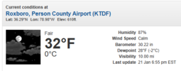
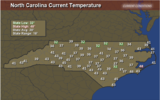
I'm sitting at 36/28I'm down to 38. Roxboro is down to 32. I would expect that they may rise a little before precip comes in tomorrow morning.
View attachment 130900
HRRR back to upping rain totals .. things there’s a good shot for widespread inch precip values
iGRXY
Member
I’m not expecting any winter storm but I hope those of us east of the apps are ready for days on days of 37-42 degree rain, wind, and fog. I see endless chicken and salmon stews in my future with this expected pattern of cold cold rains. Personally I love them because we get plenty of warmth throughout the year so it’s better to enjoy the cold where you can get it.
A few pingers not out the question for a lucky few in the morning
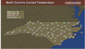
It's actually 40 now in Concord not the 45 shown on this map.. we only reached 48 for a high, about 6 degrees lower then was forecast. However I know how this plays out for my area so absolutely not the least bit looking for snow... just thought I'd correct the temp.
Amen amen and A.M.E.N.... cold cold rains. Personally I love them because we get plenty of warmth throughout the year so it’s better to enjoy the cold where you can get it.
GoDuke
Member
Drizzle Snizzle
Member
I mean if I was in the midwest i'd be a little more confident in the cold, but there's a lot of warmth in FL. Too close for comfort.
You're using FL as a guage? Not a wise move for a volunteer. GA maybe.I mean if I was in the midwest i'd be a little more confident in the cold, but there's a lot of warmth in FL. Too close for comfort.
I’m not expecting any winter storm but I hope those of us east of the apps are ready for days on days of 37-42 degree rain, wind, and fog. I see endless chicken and salmon stews in my future with this expected pattern of cold cold rains. Personally I love them because we get plenty of warmth throughout the year so it’s better to enjoy the cold where you can get it.
Screw that. Rain and temps in the 30s and 40s is miserable.
iGRXY
Member
Anyways. It’s winter. You only get cold a short time out of the year so enjoy itScrew that. Rain and temps in the 30s and 40s is miserable.
GoDuke
Member

