Brent
Member
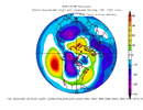
Head fake … mehBig changes on the overnight Euro Op and control. Biggest changes are large height increase over the Arctic and a much weaker SER! Are we seeing the correct solution or another head fake?View attachment 130244View attachment 130245View attachment 130246
Head fake … meh
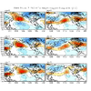
I unfortunately still think we are probably gonna be stuck in this garbage pattern for the long haul. Could be a few bouts of cooler air and maybe a snowball’s chance in hell something shows up, but it’s objectively not a good look to give us a big storm.
Add at least 3-3.5 weeks onto Jan 25-30 & that’s about how long I suspect this is gonna last. We might be able to turn the tables in our favor sometime around the last week of February or early March, but I just don’t see a legit good pattern showing up between now and then.
I don’t think winter is over by any means, seems like it’s going to procrastinate down to the very last minute
View attachment 130248
Yeah I was thinking the same. Even in nature there doesn’t seem to be any rush to prepare for anything cold or stormy. I saw some mention if we were to get any type of winter weather it would be a CAD event and we sometimes score there. The wait and see game continues.
Sent from my iPad using Tapatalk
Frothy 23 this morning..a little taste of spring this week esp down in Brunswick!View attachment 130249
I feel like this is the look models were trying to give us before it got cold around Christmas. Especially in regards to the pacific.What if the AK ridge builds more poleward …we could time something up. Throw us a bone. ?
View attachment 130255
The typical 30 days for cold to return Dec. 24 - Jan 24I feel like this is the look models were trying to give us before it got cold around Christmas. Especially in regards to the pacific.
What if the AK ridge builds more poleward …we could time something up. Throw us a bone. ?
View attachment 130255
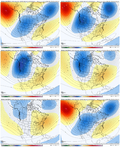
Too early to look at next winter projections?The GEFS extended + ECMWF weeklies going thru mid February make a lot of sense to me in the context of ENSO, subseasonal variability, and just stereotypical planetary wave evolution.
I think this -PNA transitions to more of a +EPO look as we go from early to mid February. Any cold air off to our NW probably gets increasingly bottled up into Alaska + western Canada & the SE US ridge flexes up the East Coast as the first half of February wears on, very typical of La Nina Februarys.
I honestly can't think of a much uglier look than this for the first half of February, but I'm not too surprised by it either given all of these things have seemed pretty evident to me for several weeks. This is the part of the winter where not being in an El Nino often comes back to bite you.
Winter isn't quite over yet tho imho
View attachment 130258
Hit a surprising low of 21 here. I dripped faucets when I went to bed as it was already below my forecast low of 27. Zapped some bugs maybe!Frothy 23 this morning..a little taste of spring this week esp down in Brunswick!
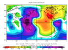
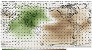
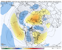
Respectfully, I’ll pass on punting 4 weeks of winter starting mid January. Especially when ensemble means are showing mostly average height anamolies for us with plenty of precipitation.
Look like it be more a severe weather n big rain makerView attachment 130260View attachment 130261Somewhere in between the euro and gfs could yield a winter storm for us around day 9/10. Euro has ridge too far East! Good sign when all other models have it too far west.
Idc what anything shows anyone that punts a whole month of Winter away has lost their Frigging minds. That's just crazy when anyone knows weather and Model data can change in a hurry!MJO or not, we're generally pretty screwed in early-mid February; SE ridge on steroids.
Sure, we could sneak a winter storm by a stroke of amazing unforeseen synoptic luck, but I'd probably punt this winter until at least Feb 20th outside the mountains if you're looking for a consistently decent pattern
View attachment 130264
View attachment 130265
View attachment 130263View attachment 130262
No, I mean average. 00z EPS out to 360hrs looking at 500mb height... if you look from day 7 until the end fo the run my backyard has 16 segments that are neutral, 10 that are just one or two anomalies above average, and 5 days that are one or two anomalies below average.You mean mostly above average.
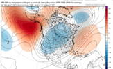
Idc what anything shows anyone that punts a whole month of Winter away has lost their Frigging minds. That's just crazy when anyone knows weather and Model data can change in a hurry!
Sent from my SM-A526U using Tapatalk
No, I mean average. 00z EPS out to 360hrs looking at 500mb height... if you look from day 7 until the end fo the run my backyard has 16 segments that are neutral, 10 that are just one or two anomalies above average, and 5 days that are one or two anomalies below average.
It's fine if you want to think we torch, and maybe we do... you have made some good points. But the ensembles are not even close to showing a torch in the viewable range right now. A torch is getting under a ridge like you see the in the gulf of alaska on this map. Being one anomaly above normal on a 300hr ensemble mean is not torchy. View attachment 130266
Yeah and I know good and well you've been wrong before too quit a bit actually. I don't care how much you know what you're doing you don't always get it right.I hear this all the time from my friends and colleagues. Unfortunately, I think a lot of people here have been in denial for weeks and don’t objectively look at things/ let their own desire for snow/cold muddle how they perceive the extended range. I know very well what I’m doing and we’ll revisit this in several weeks.
Yeah and I know good and well you've been wrong before too quit a bit actually. I don't care how much you know what you're doing you don't always get it right.
Sent from my SM-A526U using Tapatalk
Why do you get so upset when people think positive?Sounds like more wishcasting to me. This objectively isn’t a good pattern we’re going into and it’s not going to get any better for the foreseeable future/next several weeks.
Why do you get so upset when people think positive?
100 percent agree with u webber. as long these storms keep slamming the west coast. winter will be hard to get anywhere east of the ms river. pattern forward looks very la ninish to me. as we go forward i only see the se ridge get even stronger.I’m just trying to set folks straight and give them a dose of reality. “Always being positive” leads to wishcasting and in some cases just flat out denial. That’s fine and all but it’s hard to be objective with that kind of mindset.
If things looked good going forward, I’d be certain to let you know about it like I did in November and December when a legit pattern did show up (but we failed to capitalize)
Forgive me but I don't see any CAD nor any precursor for CAD in that still snap.Welcome to the land of CAD we’re going to see a lot of it in this patternView attachment 130275
