-
Hello, please take a minute to check out our awesome content, contributed by the wonderful members of our community. We hope you'll add your own thoughts and opinions by making a free account!
You are using an out of date browser. It may not display this or other websites correctly.
You should upgrade or use an alternative browser.
You should upgrade or use an alternative browser.
Pattern Jammin January 2023
- Thread starter Goose88
- Start date
Webberweather53
Meteorologist
I know some folks want me to throw them a bone here.
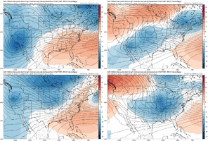
The only thing I could realistically happening is through a stroke of synoptic luck in a sea of warmth, we sneak a CAD event over the Carolinas + VA in/near the end of the month or very beginning of February if the Atlantic Canada trough is as strong as the EPS suggests it will be.
There’s a very fine line between CAD and severe weather with this look tho.
For now, I’d still place my bets on something happening late in February or March over this.

NBAcentel
Member
Atlantic Canada low and of course the -PNA is a noticeable feature with some of more nastier severe weather events across the SE. but Most noticeable thing here is the more westerly flow aloft over the SE here, I know it’s Dampened mean, but we’ve seen these sort of patterns in the past produce some nasty severe weather setups, these flatter/flat wave setups. Cookeville TN and Beauregard AL come to mindI know some folks want me to throw them a bone here.
The only thing I could realistically happening is through a stroke of synoptic luck in a sea of warmth, we sneak a CAD event over the Carolinas + VA in/near the end of the month or very beginning of February if the Atlantic Canada trough is as strong as the EPS suggests it will be.
There’s a very fine line between CAD and severe weather with this look tho
View attachment 130315
Webberweather53
Meteorologist
Atlantic Canada low and of course the -PNA is a noticeable feature with some of more nastier severe weather events across the SE. but Most noticeable thing here is the more westerly flow aloft over the SE here, I know it’s Dampened mean, but we’ve seen these sort of patterns in the past produce some nasty severe weather setups, these flatter/flat wave setups. Cookeville TN and Beauregard AL come to mind
Agreed, that would be a better bet in this sort of look. I can actually recall in doing the ice storm climatology (still in progres), seeing few cases where severe weather occurred almost simultaneously in conjunction with ice in NC. Depending on what part of the state you were in, you were getting thunderstorms or ice
Looks like best case scenario that west Atlantic ridge is going to be close by for quite a while and like Fro alluded to earlier that will favor amplification and a lot of inland solutions. However sometimes if the stars align and we can keep that ridge far enough east we can reel a big dog in for somebody on this board. It’s early, boys.
I can remember in early January 1995, there was an Ice Storm in the NC Piedmont/Foothills and SC Upstate from a system that also produced major severe weather for the eastern Carolinas… I seem to remember there was a tornado near Ft BraggAgreed, that would be a better bet in this sort of look. I can actually recall in doing the ice storm climatology (still in progres), seeing few cases where severe weather occurred almost simultaneously in conjunction with ice in NC. Depending on what part of the state you were in, you were getting thunderstorms or ice
JHS
Member
I think eastern NC may have had some severe weather in January 1999 too, while we had a major ice event in the CAD regions.I can remember in early January 1995, there was an Ice Storm in the NC Piedmont/Foothills and SC Upstate from a system that also produced major severe weather for the eastern Carolinas… I seem to remember there was a tornado near Ft Bragg
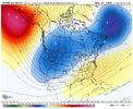
This imminent Pac Jet extension wants to foster the development of ridging going up along and just off the W North American coastline in the Jan 19-25 timeframe. May end up being a big tease, but not out of the question to see a winter storm threat show up in the Jan 24-30 periodYeah the progression of the ECWMFer and the GEPS (and you could argue the GEFS to a degree) isn't in your corner if you're banking on a Nina SE ridge and warm eastern US to cancel the next 6 weeks of winter. Is it right? Hard to tell. But one thing we do know for sure is that seasonal and subseasonal forecasts are fraught with risk and are quite often not as cut and dry as they seem (see the surprise super-Nino response of the past couple of weeks or virtually any 6 week-lead forecast over the last several years). It would be nice if were as simple as looking at MT events, SSWEs, MJO progression, etc.
Anyway, I'd be nervous throwing winter away for the next 6 weeks.
View attachment 130304
View attachment 130305
Think it’s going to take a Flutie to Phelan Hail Mary to see a winter storm threat in the Feb 1-15 timeframe
J1C1111
Member
Same here in NC. Got all our winter in 14-15 from February 16-26th all in a 10 day window. 2 storms in 10 days nothing before or after that winter.Not sure what NC was like in 14-15 but we waited weeks while those NW of us got storm after storm. Finally at the end of February I got 5 or so inches when one finally came south enough. I’ll take a ridge nearby knowing there is cold to the west of me.
Looking back I think your right. I do remember that with that storm, the temperature gradient across the Carolinas was very impressive… mid to upper 20s in CAD areas to mid to upper 70s along the SC coast.I think eastern NC may have had some severe weather in January 1999 too, while we had a major ice event in the CAD regions.
Webberweather53
Meteorologist
Right on cue, as soon as the calendar flips to February, we see the canonical La Nina SE ridge/-PNA really take hold on today's extended GEFS ensemble mean.
Given the depth of cold air to our NW, we might have one very slim chance of a CAD event near the end of January, but that's probably about it until at least late February.
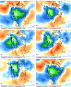
Given the depth of cold air to our NW, we might have one very slim chance of a CAD event near the end of January, but that's probably about it until at least late February.

WEATHERBOYROY
Member
Are the enso tendency influences not in some way programmed into long range models? isn't it a little bit suspect that it is like clock work?Right on cue, as soon as the calendar flips to February, we see the canonical La Nina SE ridge/-PNA really take hold on today's extended GEFS ensemble mean.
Given the depth of cold air to our NW, we might have one very slim chance of a CAD event near the end of January, but that's probably about it until at least late February.
View attachment 130323
Webberweather53
Meteorologist
Are the enso tendency influences not in some way incorporated into long range models? isn't it a little bit suspect that it is like clock work?
It often is like clock work in so many years (maybe not exactly Feb 1, plus or minus a week or two, but it's a very prominent feature). Nearly 75% of La Ninas have above average temps in the SE US during February. It's really just a matter of time in most instances. Even that great winter of 2017-18 burned us in February.
Glad I don’t put any stock on long range models.Right on cue, as soon as the calendar flips to February, we see the canonical La Nina SE ridge/-PNA really take hold on today's extended GEFS ensemble mean.
Given the depth of cold air to our NW, we might have one very slim chance of a CAD event near the end of January, but that's probably about it until at least late February.
View attachment 130323
Webberweather53
Meteorologist
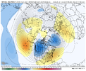
It doesn't matter to me that this is "x" number of hours out, it honestly looks about right in the grand scheme of things.
We're really shooting ourselves in the foot by reinforcing + amplifying the canonical La Nina tropical forcing pattern in February by sticking subseasonal forcing right back into the Eastern Hemisphere early-mid month (whether that's MJO or not doesn't really matter). Seen this occur more than a few times in tracking these kinds of patterns, that rarely (if ever) goes over well.
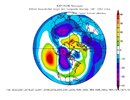
We're really shooting ourselves in the foot by reinforcing + amplifying the canonical La Nina tropical forcing pattern in February by sticking subseasonal forcing right back into the Eastern Hemisphere early-mid month (whether that's MJO or not doesn't really matter). Seen this occur more than a few times in tracking these kinds of patterns, that rarely (if ever) goes over well.


Webberweather53
Meteorologist
Glad I don’t put any stock on long range models.
We're honestly pretty screwed in the grand scheme of things once February comes rolling around.
Sorry, that's the just the facts & @Myfrotho704_ + @griteater have echoed this sentiment in here today.
J1C1111
Member
So what your saying is, if I live in southwest NC once February rolls around I can expect endless days of 60s 70s and possibly 80s with no end in sight with no chance of a possible winter storm or even a borderline cold rain winter storm chance. Is that what your saying. It sounds like it.We're honestly pretty screwed in the grand scheme of things once February comes rolling around.
Sorry, that's the just the facts & @Myfrotho704_ + @griteater have echoed this sentiment in here today.
NBAcentel
Member
More like lots of highs of 50s 60s and 70s with a few colder days where we end up with a low around Atlantic Canada or colder air spills east quickly behind systems rounding the ridge, cold rain is possible if we get a damming setup where a SE Canada vortex ends up winding upSo what your saying is, if I live in southwest NC once February rolls around I can expect endless days of 60s 70s and possibly 80s with no end in sight with no chance of a possible winter storm or even a borderline cold rain winter storm chance. Is that what your saying. It sounds like it.
It would be amazing if we could forecast this well a month and more away. It just isn’t true. We saw last winter long range guidance flip by the time those periods verified. Long way to go folks. Everyone save these images so we can repost when charlotte keeps its streak alive! Cheers!!More like lots of highs of 50s 60s and 70s with a few colder days where we end up with a low around Atlantic Canada or colder air spills east quickly behind systems rounding the ridge, cold rain is possible if we get a damming setup where a SE Canada vortex ends up winding up
NBAcentel
Member
I want a blizzard man, trust me. At the very least, the cold will be on our side, but we have things going against us. Classic case of nina Feb screwing us over is 2021, that January had an overextended pacific jet. And models starting honing in on some legit cold air with a big cold shot that feb, but the MJO was unfavorable and I recall a accuweather met saying that and saying the east would miss out/be warmer ans went against the models because tropical forcing was unfavorable, but I clowned that met because models said the opposite of him. Well I ate those words because over time, models started backing it up west (jet retracted and Aleutian ridge showed up) and matched what you would typically see with a nina Feb/MJO in the maritime continent, and I got absolutely burned. Feb 2021 has a dark place in my brain. I’m not trying to be pessimistic to be a ass, but rather, I’m going with the stacked odds that go against us right now because if something goes right, then it’s a pleasant surprise and a great feeling because nothing was suppose to happen, but if it goes according to plan, then at least I won’t be dissapointed because I kinda figured it wasn’t gonna happen. Living by that mindset saves a lot of doubt and pain. Feb 2021 taught me a lotIt would be amazing if we could forecast this well a month and more away. It just isn’t true. We saw last winter long range guidance flip by the time those periods verified. Long way to go folks. Everyone save these images so we can repost when charlotte keeps its streak alive! Cheers!!
NBAcentel
Member
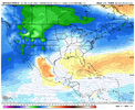
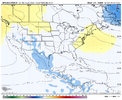
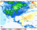
If you’re one of those looking for hope, you can’t be too mad at the 18z gefs. you want that SE Canada vortex to further amplify with this look, and dig more. Personally to me it’s not a great look to me because the -PNA already favors a cutting storm track, but at the very least, the SE Canada vortex would be rooted to some pretty cold air by then. But this is rather a look for ice/sleet if your hoping for wintry. The general H5 pattern favors a WAA regime over the SE aloft. But This look right here, isn’t very warm though honesty at the SFC Initially. That’s a Pretty classic cold rain look based off this exact look. In general though this isn’t a great pattern because the heights out west are lowered (-PNA) and that will always result in a trash storm track 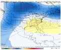


Webberweather53
Meteorologist
It would be amazing if we could forecast this well a month and more away. It just isn’t true. We saw last winter long range guidance flip by the time those periods verified. Long way to go folks. Everyone save these images so we can repost when charlotte keeps its streak alive! Cheers!!
Not every forecast is the anywhere near the same in terms of predictability + difficulty, this one coming up in the first half of February is a high confidence forecast (some like me would argue a slam dunk) relative to the lead time given the alignment of many factors all consistently pointing towards one general outcome (-PNA/SE ridge). In many cases (actually a majority of the time out to week 3-4 over the CONUS) you can forecast w/ skill above climatology out to a month in advance (or better than coin flip odds), as the Subx subseasonal forecasting experiment has proven using bias corrected multi-model ensemble means. Operational models hold very little-no value after several days, while ensembles can be over damped (clustering is important!). Most people who don't grasp the intrinsic value of multi-model ensembles and the basics of subseasonal dynamics + how they interact with weather & climate aren't able to see these sorts of things & just assume every forecast is bad because it's "x" number of days out.
You simply can't look at this time period the same way you would an operational short-medium range forecast. You always have to think bigger, broader picture & how certain phenomena may interact with either climate variability (like ENSO) or potentially influence the probability distribution of planetary waves in certain times of the forecast period & how those planetary waves will self-evolve + interact with momentum sources & sinks.
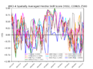
Need to see it continue, but improvement shown here on the GEFS on Jan 27th (trend loop of last 10 runs), particularly over Greenland, 50/50 region, and SE U.S.


NBAcentel
Member
That +SCAND is trying so hard to try and become a Greenland blockNeed to see it continue, but improvement shown here on the GEFS on Jan 27th (trend loop of last 10 runs), particularly over Greenland, 50/50 region, and SE U.S.


28.5 going to be a chilly one tonight
We have had several storms in late February in NC. Just never know around hereSame here in NC. Got all our winter in 14-15 from February 16-26th all in a 10 day window. 2 storms in 10 days nothing before or after that winter.
May warm up but doubt enough to start mowing. Ground temps would have to really increase to before March 1st.
Don't you bring that reality into the conversation. I was expecting my Bermuda to look like July by valentines dayMay warm up but doubt enough to start mowing. Ground temps would have to really increase to before March 1st.
Lol it will if you paint itDon't you bring that reality into the conversation. I was expecting my Bermuda to look like July by valentines day
Been thinking about it. You use it?Lol it will if you paint it
Well you just killed it with a hard frost in April. Thanks for also killing spring severe weather season. I quit….(dots added for dramatic effect).Don't you bring that reality into the conversation. I was expecting my Bermuda to look like July by valentines day
No never have in our business but may look into it. I know some that doBeen thinking about it. You use it?
Cad Wedge NC
Member
We get it already..... can you come back in Late February when you have something positive to say. We have heard enough of how we are going to torch the next 6 weeks. Dear Lord, give it a rest!Not every forecast is the anywhere near the same in terms of predictability + difficulty, this one coming up in the first half of February is a high confidence forecast (some like me would argue a slam dunk) relative to the lead time given the alignment of many factors all consistently pointing towards one general outcome (-PNA/SE ridge). In many cases (actually a majority of the time out to week 3-4 over the CONUS) you can forecast w/ skill above climatology out to a month in advance (or better than coin flip odds), as the Subx subseasonal forecasting experiment has proven using bias corrected multi-model ensemble means. Operational models hold very little-no value after several days, while ensembles can be over damped (clustering is important!). Most people who don't grasp the intrinsic value of multi-model ensembles and the basics of subseasonal dynamics + how they interact with weather & climate aren't able to see these sorts of things & just assume every forecast is bad because it's "x" number of days out.
You simply can't look at this time period the same way you would an operational short-medium range forecast. You always have to think bigger, broader picture & how certain phenomena may interact with either climate variability (like ENSO) or potentially influence the probability distribution of planetary waves in certain times of the forecast period & how those planetary waves will self-evolve + interact with momentum sources & sinks.
View attachment 130328
Man's just telling it like it is. I mean I'm a half full guy but there's not much to be optimistic about currently.We get it already..... can you come back in Late February when you have something positive to say. We have heard enough of how we are going to torch the next 6 weeks. Dear Lord, give it a rest!
WEATHERBOYROY
Member
I believe he is calling like he sees it, but forecast trends within 10 days have improved. Lots to be optimistic about...been below normal last 3 days in BHam.Man's just telling it like it is. I mean I'm a half full guy but there's not much to be optimistic about currently.
tennessee storm
Member
New spring severe season is now.Well you just killed it with a hard frost in April. Thanks for also killing spring severe weather season. I quit….(dots added for dramatic effect).
22 this morning brrrr
lexxnchloe
Member
I think i can make a really safe prediction. Come March the pattern will finally change just in time for lots of cold rain and drizzle thru early May.Man's just telling it like it is. I mean I'm a half full guy but there's not much to be optimistic about currently.
tennessee storm
Member
Bring itI think i can make a really safe prediction. Come March the pattern will finally change just in time for lots of cold rain and drizzle thru early May.

