Webberweather53
Meteorologist
I see the EPS took a nod in this direction at 12Z. That stuff needs to stop lol.
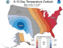
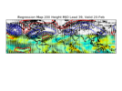
The GEFS could be fast, but that kind of pattern is going to show up sooner rather than later, esp when you get a big -EAMT like this & you stick the MJO in the eastern hemisphere again to sustain this jet retraction into early-mid February. To top it off, we're in a La Nina & nearly 75% of La Nina Februarys are above average in NC. Throw in an unfavorable MJO + AGW on top of that & you're probably talking about at least an 80-90% chance of a mild February in the SE US :/
The chips have been stacked against us for quite some time for all the above reasons & I see some are just finally realizing this.
Not too surprised to see the -PNA appearing in the models during week 2-3 & it's generally legit, although I know some folks in here will probably hold out hope for it to go away or get angry/mock me (again) for just providing my objective take on this pattern. I'll do my best to ignore those folks from here on out because it's pretty clear there are a lot of people here that value what I have to say, even if it's not always what they want to hear. I know it can get really annoying to hear the same thing everyday, esp if you hate me talking about a mild pattern every day, but that's because I am a climate dynamicist at heart & I really love to look at & talk about the subseasonal/week-to-week range every single day. (yes, I don't have a life, but spending this kind of time studying/practicing anything is how you can get good at it).
The only way we can really avoid this fate of -PNA is to get a huge -EPO w/ a ridge centered over-north of Alaska, but that could easily make the SE US ridge even worse because we're entering the part of the winter where the wavelengths shorten & the downstream trough from -EPO is usually further west over the Plains + Lakes. It's the kind of pattern where you'll probably be mild-unusually warm overall, with a couple really intense shots of arctic air potentially interspersed between. There's at least a really small chance of something legit showing up here. The pattern we've had the last few weeks really had no chance at all to produce a big storm because there was no cold air anywhere in sight.
If we hit the accelerator on this Eastern Hemisphere MJO event & the SSWE forecast to occur in early February actually propagates down into the lower stratosphere + impacts the troposphere, then I could see March giving us better looks for wintry weather than either January or February.
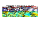
The SubX multi-model ensemble keeps the El Nino gravy train going into mid-late January w/ some semblance of a +PNA. Not a great pattern verbatim though, but probably the best we're gonna see before this Aleutian trough retrogrades even more & allows the -PNA/SE ridge to become re-established sometime near the end of January or early February.
View attachment 129148
View attachment 129149
View attachment 129146
View attachment 129147

