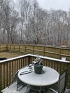
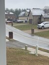
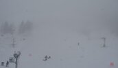
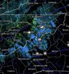
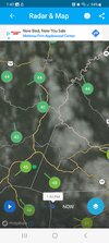
37 degree snow showers will do that sometimesI’m shocked the ground is still bare in Gatlinburg…
-
Hello, please take a minute to check out our awesome content, contributed by the wonderful members of our community. We hope you'll add your own thoughts and opinions by making a free account!
You are using an out of date browser. It may not display this or other websites correctly.
You should upgrade or use an alternative browser.
You should upgrade or use an alternative browser.
Pattern Jammin January 2023
- Thread starter Goose88
- Start date
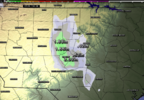
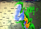
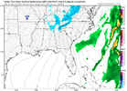
Run-over-run currently seems like Sanford, NC is the sweet spot for any accumulation and maybe even potential thunder snow?Lol the hrrr wants to nuke somebody so bad View attachment 130081
Yep, we were 37 in town and are at 31-32 at the cabin.37 degree snow showers will do that sometimes
Any idea why y’all think the HRRR is trying to focus precip randomly along a band SW of wake? Is there some sort of boundary there maybe?
This feels a little more realistic to me
Effect from Kerr lake but it's not large enough for that I would think.Any idea why y’all think the HRRR is trying to focus precip randomly along a band SW of wake? Is there some sort of boundary there maybe?
Really? I'm in Lavonia and didn't know I should even be on the look out for a flake. LOL. Now I have something to do later. Obsess...LOLHeaded over to Lavonia this evening for dinner...maybe a rogue flake over that way...lol
Harris Nuclear Power Plant...........Any idea why y’all think the HRRR is trying to focus precip randomly along a band SW of wake? Is there some sort of boundary there maybe?
This feels a little more realistic to me
Still same dad-blasted area
BHS1975
Member
lol sb cape
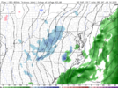
View attachment 130085
Isn't that from some gap in the mountains?
Sent from my iPhone using Tapatalk
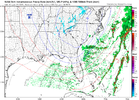
New HRRR looks … meh
BHS1975
Member
We had the same streamer at the tail end of the Crusher.
Sent from my iPhone using Tapatalk
Sent from my iPhone using Tapatalk
Spoke too soon.. we’re back on!New HRRR looks … meh
SnowNiner
Member
Uh, well, should there be a separate thread for the eastern NC flurry watch? I just went through 6 pages of it this morning. I'd like to come to this thread to read about the nonpattern change coming in 10 days. Thanks. Lol ?
I'm not starting it. Nope. I know how bad juju works.Uh, well, should there be a separate thread for the eastern NC flurry watch? I just went through 6 pages of it this morning. I'd like to come to this thread to read about the nonpattern change coming in 10 days. Thanks. Lol ?
Then you have to listen to those clowns @Lickdork and @Myfrotho704 yuck it up all summer about the thread even though their hero webb said that system was going to snow. My line is in the sand
Iceagewhereartthou
Member
For those of us looking beyond this weekend (you know; since we aren't included in this one), The GFS, Euro, and CMC all indicate a return to more normal temps as we get into the 22nd or so. We have a quick couple of cool days now with a quick warm up again and the SER staying put for a bit, keeping us in the predominately warm pattern we've been in all month. The models seem to be showing that potential pattern change as we get farther out, but no fantasy storms showing up yet. For us non mountain peeps, this potential pattern change may be our best window, and possibly last if February goes like most other recent ones.
I'll start oneI'm not starting it. Nope. I know how bad juju works.
Then you have to listen to those clowns @Lickdork and @Myfrotho704 yuck it up all summer about the thread even though their hero webb said that system was going to snow. My line is in the sand
Go for itI'll start one
campamy
Member
Considering driving up there tomorrow early morning and as many times as I've been to Gatlinburg I've never drove in the snow there. Do you know if Ski mntn rd stays clear? I want to avoid the tram if at all possible!There is a large difference between there and once you start heading up ski mountain road.
Edited to add, I can drive in the snow, more a question of if they close that road.
They usually do a wonderful job of keeping Ski mountain road and other roads around it in good shape. We will see what happens tonight.Considering driving up there tomorrow early morning and as many times as I've been to Gatlinburg I've never drove in the snow there. Do you know if Ski mntn rd stays clear? I want to avoid the tram if at all possible!
DoneUh, well, should there be a separate thread for the eastern NC flurry watch? I just went through 6 pages of it this morning. I'd like to come to this thread to read about the nonpattern change coming in 10 days. Thanks. Lol ?
Wintry - The Jan. 14th Central NC Unicorn (just to prove a point) Winter Event
Let'er rip tater chips, may your coffee pots be full and your floodlights be bright!
southernwx.com
campamy
Member
Thank you!! It's going to be hell getting my girls moving in the morning and getting there by open.They usually do a wonderful job of keeping Ski mountain road and other roads around it in good shape. We will see what happens tonight.
Beech webcams are looking gnarly!
Starting to come down a little better in Boone as well: https://www.resortcams.com/webcams/king-street-boone/Beech webcams are looking gnarly!
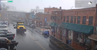
But there will be some wildly different amounts in the mountains (east face compared to west face, and elevation).
olhausen
Member
- Joined
- Jan 2, 2017
- Messages
- 1,566
- Reaction score
- 4,279
I seriously doubt anything gets down to Lavonia but Clayton has a shot at some flurries later this evening.Really? I'm in Lavonia and didn't know I should even be on the look out for a flake. LOL. Now I have something to do later. Obsess...LOL
Its currently in the 50s in NE Georgia.I seriously doubt anything gets down to Lavonia but Clayton has a shot at some flurries later this evening.
ForsythSnow
Moderator
Not here, been between 39 and 41 all dayIts currently in the 50s in NE Georgia.
The SER win is very unfortunate but it is what it is
Yeah me too but it's not going to stop me from staring at the floodlight just in case?I seriously doubt anything gets down to Lavonia but Clayton has a shot at some flurries later this evening.
Also a few days ago, a guy at a local car dealership told my hubby when he was delivering a package that it's going to snow Friday. Hubs said "where you getting your info from (he knows what I already told him...no snow)". Guy said nowhere but we have inventory and every single time we do it snows. Sooo....If we have one stinkin flake it snowed again at inventory time as far as I'm concerned. Bahahahahah
Huge burst of snow right as we pulled up to Ober Gatlinburg about an hour ago.
- Joined
- Jan 2, 2017
- Messages
- 1,566
- Reaction score
- 4,279
It's 44 in Clayton and mid 40's in most places around there.Its currently in the 50s in NE Georgia.
- Joined
- Jan 2, 2017
- Messages
- 1,566
- Reaction score
- 4,279

