Yessir. Looks like some pretty good snow up there already. I’m ready to go. Wish I were in the hot tub at SugarTop Resort right now. 5300’ ?If I win the lottery, I think I'll buy a house on top of Beech Mountain: https://www.beechmountainresort.com/mountain/webcams/
-
Hello, please take a minute to check out our awesome content, contributed by the wonderful members of our community. We hope you'll add your own thoughts and opinions by making a free account!
You are using an out of date browser. It may not display this or other websites correctly.
You should upgrade or use an alternative browser.
You should upgrade or use an alternative browser.
Pattern Jammin January 2023
- Thread starter Goose88
- Start date
WEATHERBOYROY
Member
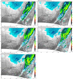
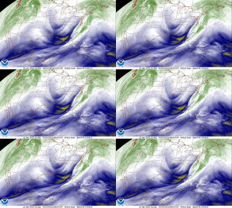
It's interesting to follow the flow of moisture in this system back to it's source. It is coming off of lake Michigan. when you go to the surface you see the winds at 925 are funneling the moisture south. The lake , for the most part is not frozen aiding in the transport of moisture. Maybe we can get a little more activity than forecast


- Joined
- Jan 2, 2017
- Messages
- 1,566
- Reaction score
- 4,279
- Joined
- Jan 23, 2021
- Messages
- 4,602
- Reaction score
- 15,197
- Location
- Lebanon Township, Durham County NC
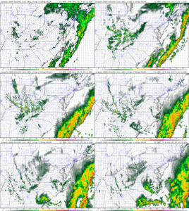
HRRRRRRRRRR seems to really like that little sliver of Chatham between Wake and Harnett
lexxnchloe
Member
Well, the way winter has gone so far it will probably be warmer than that. I hope some members get snow to my NW tomorrow, It still looks promising.Yes because the 384 hr GFS is always spot on accurate
LukeBarrette
im north of 90% of people on here so yeah
Meteorology Student
Member
2024 Supporter
2017-2023 Supporter
Yes it does, it's really annoying....HRRRRRRRRRR seems to really like that little sliver of Chatham between Wake and Harnett
Jorda Lake for the winYes it does, it's really annoying....
RDPS, RAP, HRRR all seem to like SW Wake/Chatham/Harnett ish
And now here comes the 14z HRRR nailing Chatham again, but Orange/Alamance/Durham/Wake certainly in the gameRDPS, RAP, HRRR all seem to like SW Wake/Chatham/Harnett ish
Why am I so worried about being in the jackpot region 12 hours out
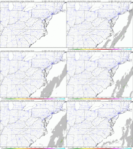
HRRR still has nonzero lighting density in Chatham/Lee lmaoooo
Being in the jackpot is never good but when that jackpot zone is only about 60 mile radius, yeah I'd be worried too lolWhy am I so worried about being in the jackpot region 12 hours out
Another 12 hours of every hour glued to the newest HRRR run .. such torture
packfan98
Moderator
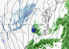
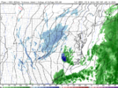
First HRRR that has over an inch of snow depth. Decent chance for the region to at least see some flakes fly.


**IF** the hrrr is close to reality. Some of the soundings on the periphery of the pretty blue on the ptype maps are awfully close to snow. Likely would need rates, it’s all below freezing until right at the sfc, annoyingly.
packfan98
Moderator
And here's the last precip panel on the 14z hrrr. Still showing snow in the Triangle area:


packfan98
Moderator
Yes. I clicked on the soundings for all of those areas in green and it's best guess precip type said snow. Unfortunately the surface was 36-37 degrees.**IF** the hrrr is close to reality. Some of the soundings on the periphery of the pretty blue on the ptype maps are awfully close to snow. Likely would need rates, it’s all below freezing until right at the sfc, annoyingly.
Ya but also again assuming it’s close to real life, someone prolly getting a period of rate driven wet dinner plate flakesYes. I clicked on the soundings for all of those areas in green and it's best guess precip type said snow. Unfortunately the surface was 36-37 degrees.
Yeah, guessing you're even in a better top spot than me and I'm just north of 64.Why am I so worried about being in the jackpot region 12 hours out
Honestly I think many areas where it’s green it’ll most likely be snow. We’re so cold right above our heads I doubt 37-39 degrees is enough to melt those suckers at the surface. And we’re in the middle of the night.. and peak climo? ? who knows manYes. I clicked on the soundings for all of those areas in green and it's best guess precip type said snow. Unfortunately the surface was 36-37 degrees.
ForsythSnow
Moderator
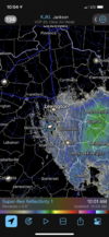
Had some wet small flakes leaving Dahlonega about 40 minutes ago so they're making it over the mountains under the radar.
vsublazer
Member
Just had a few sleet pellets mixed in the light rain and mist I am under at my house. Someone might luck out with this for a surprise.
- Joined
- Jan 2, 2017
- Messages
- 1,566
- Reaction score
- 4,279
Love to see Georgia brethren get some flakage!Had some wet small flakes leaving Dahlonega about 40 minutes ago so they're making it over the mountains under the radar.
- Joined
- Jan 2, 2017
- Messages
- 1,566
- Reaction score
- 4,279
Headed over to Lavonia this evening for dinner...maybe a rogue flake over that way...lol
Darklordsuperstorm
Member
Off and on sleet showers at my location so far this morning. Gotta love them pingers!
HRRR coming in w more precip and sticking to that row of counties west and south of Wake as the best spots
Blue_Ridge_Escarpment
Member
I’m shocked the ground is still bare in Gatlinburg…
I’m shocked the ground is still bare in Gatlinburg…
There is a large difference between there and once you start heading up ski mountain road.
- Joined
- Jan 23, 2021
- Messages
- 4,602
- Reaction score
- 15,197
- Location
- Lebanon Township, Durham County NC
We have flurries in Ellijay and the temp is still 36.7F sooooo. Earlier, the temp would drop as the heavier precip mixed the air down to lower levels. That seems to happen a lot here.
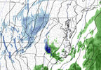
Several runs in a row, still a very outside chance. HRRR output has been very consistent on all fronts this morning tbfSomeone might catch a unicorn tonight:View attachment 130082

