• Hello, please take a minute to check out our awesome content, contributed by the wonderful members of our community. We hope you'll add your own thoughts and opinions by making a free account!

Pattern Jammin January 2023

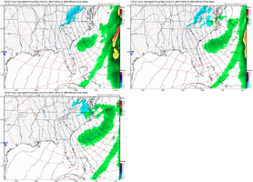
1673697600-AKiDfTUzaUo.png

1673697600-yGSda9dDvPE.png

1673676000-5q6NmNkYwW0.png

Storm is ongoing along the coast.
 
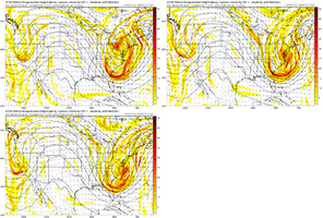
So for several days now at least, the Pacific jet is forecasted to retract substantially in the very long range. If verified, perhaps this is the beginning of a pattern change for the last third of January/early February?

And, do any of our resident long-range gurus have any updates regarding the hoped-for stratospheric warming event progress?

gfs-ens_uv250_namer_65.png
 
Positive is, the pattern is progressive so “NW trending” wouldn’t be the biggest issue imo. But holding on to the 50/50 low would be the biggest issue in a fast flow pattern. The Canadian ridging ensures that the track shoved south so there’s that
 
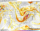
Not a great map, but This is the look I would want to show up on ensembles if you want a good looking snow pattern, note the lower heights in the ATL here is crucial, and a Rockies centric ridge, this is why you get “big dogs” in ninos because of these sorts of looks. You keep an active pacific jet, but if you time right with w SE can vortex/Atlantic low, then you got something. Not there yet on ensembles, but I’m starting to become encouraged by trends, it’s certainly that pattern if we get right, has more big dog potential then usual
What I want to see

View attachment 129028
Gefs
View attachment 129029
Well, we’re definitely far closer to the best case scenario H5 map I made days back on the 12z euro. Maintenance of the 50/50 low/lack of snow cover on top to aid cold feed is the biggest issue to me40F1825B-6121-4495-AEC0-D9D459B84AFB.jpeg8D683512-52B1-4042-BC6C-A8CF44FC8C2E.png
 
I saw the skill scored for the gfs and euro posted the other day. GFS in the tank per usual while the euro is steadily and markedly preforming better. If the euro and its ensembles are the one giving us the goods that’s obviously a great sign. But to be devils advocate we had solid support around Christmas time as well and we know how that panned out. I like where we’re at though every set up is different and this looks like much more of a type of system we’re used to dealing with. (Miller B CAD crusher)
 
I heard plenty of thunder today and those ten day model runs are showing some potential for the Piedmont area as far as winter precipitation.
I know anything ten days out verifying when it comes to winter weather is about as good as my chances of winning the lottery but who knows,
the stars may be lined up right for once.
 
Dont sleep on this amplifying energy as it swings through late Tues into wed. Actually very light ICE northern mtns. This is the key piece that blows up and delivers a 50/50 low for us on Friday off NE coast and supplies the confluence on the most recent Euro Op run to deliver the cold for Frozen. Timing and spacing is everything with this pattern next week

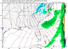
prateptype_cat_ecmwf.us_ma.png
 
I heard plenty of thunder today and those ten day model runs are showing some potential for the Piedmont area as far as winter precipitation.
I know anything ten days out verifying when it comes to winter weather is about as good as my chances of winning the lottery but who knows,
the stars may be lined up right for once.


What?
 
Lets be honest and I hate it for the other areas in the southeast, but 9/10, especially in this decade, we are a CAD/Miller B storm progression. Miller A's are fun for everybody and they tend to get nice paste jobs across the entire south, but those are the old days. I said back during December that I thought we would almost certainly get something (my logic was due to how much noise the ensembles had), and it was a fun thing to see the potential for an old day board wide hit, but that didn't work out. But when you start honking Miller B's, that's when my ears perk because we can get them in even the worst patterns. They're much easier to score and tend to happen more often than not because the ridge has lived on the east coast for 10 years now and we just need a solid 50/50 to anchor is CAA and ridging builds in the HP needed for CAD. Now I won't say we score, but this is one that has a much more realistic shot of happening IMO. Problem is I hope we get a similar scenario like last year with a solid FGEN front thumping or get the low to just ride far enough south we stay mostly snow. But ice would definitely be my biggest concern in a setup like this.
 
I heard plenty of thunder today and those ten day model runs are showing some potential for the Piedmont area as far as winter precipitation.
I know anything ten days out verifying when it comes to winter weather is about as good as my chances of winning the lottery but who knows,
the stars may be lined up right for once.
Yes, and it thunders all the time in the tropics
 
Back
Top