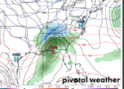
That is beautiful. Idk why were so down if that’s what’s ahead.Where is winter?View attachment 129826
-
Hello, please take a minute to check out our awesome content, contributed by the wonderful members of our community. We hope you'll add your own thoughts and opinions by making a free account!
You are using an out of date browser. It may not display this or other websites correctly.
You should upgrade or use an alternative browser.
You should upgrade or use an alternative browser.
Pattern Jammin January 2023
- Thread starter Goose88
- Start date
D
Deleted member 609
Guest
It lasted like 2 days and goes to this. Oh well it'll be different this afternoon.That is beautiful. Idk why were so down if that’s what’s ahead.


You can see that big pacific wave about to slam the west coast. That cold shot will be here at lunch and gone by 7 o’clock JeopardyWhere is winter?View attachment 129826
The whole damn point was saying that people were mentioning that it wouldn't get below 32 again this winter and it has in a bad pattern. People at this place I swearMaybe the comments above were taken out of context or something. Nobody said it's been "that cold" or below normal, only there was a GFS run (maybe other models as well) that showed no below freezing temps for the next 2 weeks but it's been below freezing the last 4 nights. Daytime highs as Shane mentioned above are a different story, they've been A or AN
I love 300+ hour red gfs maps they are so useful. Winter cancel everyone!It lasted like 2 days and goes to this. Oh well it'll be different this afternoon.
View attachment 129827View attachment 129830
D
Deleted member 609
Guest
Red bad. Blue good.I love 300+ hour red gfs maps they are so useful. Winter cancel everyone!
Need PackBacker to drop by and toss us some real heat maps. He could always find the reddest ones
NBAcentel
Member
Stage 2 weenie roast coming up after little cooldown. Time to light the nicky Bs on fire. Charred lines 


BHS1975
Member
Need to change this to jacked up January.
Sent from my iPhone using Tapatalk
Sent from my iPhone using Tapatalk
ENJOY THAT 48 HOUR 60 DEGREE RAIN 1/18-1/20:

We’ll be aightStage 2 weenie roast coming up after little cooldown. Time to light the nicky Bs on fire. Charred lines View attachment 129831View attachment 129832View attachment 129833
Jan88
Member
Folks act like 10deg above average is a torch.when in reality it's not.just a bunch of noiseThat is beautiful. Idk why were so down if that’s what’s ahead.

12z Euro was a little juicier than 00z
Consistent sweet spot seems to be between Gatlinburg and Newfound Gap. 441 will likely be shut down.
Consistent sweet spot seems to be between Gatlinburg and Newfound Gap. 441 will likely be shut down.
NBAcentel
Member
This is starting to gain consistency on models, CMCE looks the best atm given it starts getting some connection from the TPV 

It has been inching closer in time for the last few days. Nothing bone chilling temperature wise showing up, but we don't need all that in Mid to Late January. I like to think there will be a window somewhere in that last week of January timeframe.This is starting to gain consistency on models, CMCE looks the best atm given it starts getting some connection from the TPV View attachment 129836View attachment 129837
NBAcentel
Member
As long as the ridge stays poleward on ensembles, the cold would show eventually show up before retrogressionIt has been inching closer in time for the last few days. Nothing bone chilling temperature wise showing up, but we don't need all that in Mid to Late January. I like to think there will be a window somewhere in that last week of January timeframe.
NoSnowATL
Member
Only 2 weeks away.......It has been inching closer in time for the last few days. Nothing bone chilling temperature wise showing up, but we don't need all that in Mid to Late January. I like to think there will be a window somewhere in that last week of January timeframe.
NBAcentel
Member
More like day 10 when it changes. It has been speeding up on ensembles. Cutoff ridge north of AK helpsOnly 2 weeks away.......
The late December cold shot was 2 weeks out also & we worked the ensembles into the medium range then into reality & we eventually got the coldest air in years & the opportunity for something to happen, even though it didn't. It's not like we are attempting to work a drunk 324 hour out GFS fantasy run inside the medium range. If this continues to show up to the 240 hour mark, i think it has legs. Just my opinion. Its just a pattern change we are looking for, not some massive fantasy land storm.Only 2 weeks away.......
Honestly I believe we will have more than a week of opportunity. I bet we have the last week of January and first week of February. People act like as soon as the calendar strikes Feb 1 we’re gonna roast. I doubt it will be that quick.Only 2 weeks away.......
Quick get the mallows and Hershey bars
.png")
What makes it look like that?I'm confident this 'cold spell' is coming but it looks transient. Not fast transient mind you but maybe about 5 days? Not a lot of time to score.
Seems like that's normally on average the window we have anyways in the Southeast. You likely aren't going to see a 10 day window. We are kings of threading the needle.I'm confident this 'cold spell' is coming but it looks transient. Not fast transient mind you but maybe about 5 days? Not a lot of time to score.
I guess the way it's behaving towards the end of its run. I'll defer to you grit.What makes it look like that?
")
also shallow cold air trapped west of the apps if I'm seeing it right. It's to much detail to extract at range so that observation comes with a hampster cage salt block
Gfs op extends the pac jet and collapses the west. The ensemble mean says no.
As we get to the end of jan the concern should be the jetbretracting too much not over extending.png")
As we get to the end of jan the concern should be the jetbretracting too much not over extending
Just for the tone you are using and the way you are delivering your message, I'm going to have to say that you deserve to place a marble in your bucket as a reward today. Well done. The poster skittish-ness and gun shy-ness is going to ratchet up this go around given that Dec did not produce a good winter stormThe late December cold shot was 2 weeks out also & we worked the ensembles into the medium range then into reality & we eventually got the coldest air in years & the opportunity for something to happen, even though it didn't. It's not like we are attempting to work a drunk 324 hour out GFS fantasy run inside the medium range. If this continues to show up to the 240 hour mark, i think it has legs. Just my opinion. Its just a pattern change we are looking for, not some massive fantasy land storm.
Here is the 12z GEFS 24-hour member avg snow product for Jan 21-26 on SVista....storm track heading south

Yeah the bonus here is max cold climo in mid to late Jan.....also max climo for farthest south storm trackIt has been inching closer in time for the last few days. Nothing bone chilling temperature wise showing up, but we don't need all that in Mid to Late January. I like to think there will be a window somewhere in that last week of January timeframe.
- Joined
- Jan 5, 2017
- Messages
- 3,808
- Reaction score
- 6,064
I'm liking TN/KY as the most likely snow storm zone in the south during this period. The cold does not look to penetrate as far south as December and timing a low along the boundary that gets to the Apps and stalls is the likely scenario to me. This would place western/middle TN into KY as the best zone. I've seen it so many times. If a storm track like that shows up, I'll seriously think about chasing it.Just for the tone you are using and the way you are delivering your message, I'm going to have to say that you deserve to place a marble in your bucket as a reward today. Well done. The poster skittish-ness and gun shy-ness is going to ratchet up this go around given that Dec did not produce a good winter storm
Here is the 12z GEFS 24-hour member avg snow product for Jan 21-26 on SVista....storm track heading south
Salt blocks are good! Yeah, the positive is that things continue to progess nicely. Just think that all modeling (Op and Ens) can throw head fakes at the ends of their runs (good or bad).I guess the way it's behaving towards the end of its run. I'll defer to you grit.
also shallow cold air trapped west of the apps if I'm seeing it right. It's to much detail to extract at range so that observation comes with a hampster cage salt block
Wonder how much SS energy we forfeit with the pac jet retreating Jan 20 onward. I'm glad to see it, just hope we can find some energy for the NS to work with during this stretch.
And early Kudos to the GEPS as it has been rock steady advertising. Not verified yet, but its getting support as we start getting inside 10 days now.
And early Kudos to the GEPS as it has been rock steady advertising. Not verified yet, but its getting support as we start getting inside 10 days now.
Interesting


- Joined
- Jan 5, 2017
- Messages
- 3,808
- Reaction score
- 6,064
- Joined
- Jan 5, 2017
- Messages
- 3,808
- Reaction score
- 6,064
Yes, but that flip is probably transient. It's going to take perfect timing. I don't buy in to the "staying for the rest of winter". No trough has been permanent in the east since - like 2010-2011.
- Joined
- Jan 23, 2021
- Messages
- 4,604
- Reaction score
- 15,203
- Location
- Lebanon Township, Durham County NC
GEPS and GEFS sure did look stormy towards the end
Nothing about this screams transient to me ?? this looks like a pattern change
this looks like a pattern change ATLwxfan
Member
CFS has a depiction of what I'm looking for and think is the most likely (though not likely overall at this point). This is around 1/23 and 1/24.
The northwest trend should finally give Chicago a nice thump.
Sent from my iPhone using Tapatalk