-
Hello, please take a minute to check out our awesome content, contributed by the wonderful members of our community. We hope you'll add your own thoughts and opinions by making a free account!
You are using an out of date browser. It may not display this or other websites correctly.
You should upgrade or use an alternative browser.
You should upgrade or use an alternative browser.
Pattern Jammin January 2023
- Thread starter Goose88
- Start date
Blue_Ridge_Escarpment
Member
Blue_Ridge_Escarpment
Member
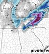
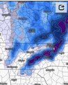
If I were going snow chasing this weekend near Gatlinburg I’d probably try to get somewhere closer to Cosby/Foothills parkway area, unless you can find a cabin up near Ober Gatlinburg with some elevation.
Other areas if I were chasing:
Watauga - Todd
Avery- Elk Park or Banner Elk
Mitchell - Buladean
Yancey/Madison- Wolf Laurel
Other areas if I were chasing:
Watauga - Todd
Avery- Elk Park or Banner Elk
Mitchell - Buladean
Yancey/Madison- Wolf Laurel
Our poster in Erwin has to be licking his chops. From Watuga lake back up to Boone on the west side would cash in nice on the gfsIf I were going snow chasing this weekend near Gatlinburg I’d probably try to get somewhere closer to Cosby/Foothills parkway area, unless you can find a cabin up near Ober Gatlinburg with some elevation.
Other areas if I were chasing:
Watauga - Todd
Avery- Elk Park or Banner Elk
Mitchell - Buladean
Yancey/Madison- Wolf Laurel
Flotown
Member
lord willing ,going to gatlinburg
- Joined
- Jan 23, 2021
- Messages
- 4,602
- Reaction score
- 15,197
- Location
- Lebanon Township, Durham County NC
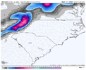
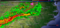
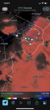
Orange County chase tomorrow morninghrrr has a couple of sleet pockets tomorrow morning
View attachment 129680
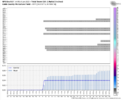
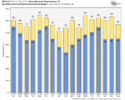
So KATL has started the month at 14.2F above the average. Factoring in the GFS through 1/23 would leave KATL at +9.8F, a solid second to that point of the month if that forecast is in the neighborhood.
I've looked back at the data going to around 1880 or so, and here are the warmest Januarys on record:
1. 1950 +10.6
2. 1880 +9.5
3. 1974 +8.4
4. 1937 +8.2
5. 1907 +7.4
6. 2017 +7.2
7. 1949 +7.0
8. 1890 +6.2
GFS Forecast for KATL
I've looked back at the data going to around 1880 or so, and here are the warmest Januarys on record:
1. 1950 +10.6
2. 1880 +9.5
3. 1974 +8.4
4. 1937 +8.2
5. 1907 +7.4
6. 2017 +7.2
7. 1949 +7.0
8. 1890 +6.2
GFS Forecast for KATL

I got a chance of a pellet or two in morning. Love my freezing rain chances temps in the mid/upper 30s. Lol

Sent from my iPhone using Tapatalk

Sent from my iPhone using Tapatalk
Hands down best setup of the winter so far for the NC mountains. If this doesn’t do it for favored areas then it’s tough sledding from here..and by tough sledding I mean sledding on grass and asphalt
Really pulling for that Canadian crawler solution..that would be a banger
Really pulling for that Canadian crawler solution..that would be a banger
Last edited:
I always laugh when winter is thrown away Jan 7th. Monthly modeling isn’t accurate. If so then we would have our forecasts correct. We can’t trust anything more than 7-8 days out. I’ll stick w Charlotte and our 1848 record of measurable ice or snow every year since then. Look forward to it!!! Cheers all!!Hands down best setup of the winter so far for the NC mountains. If this doesn’t do it for favored areas then it’s tough sledding from here..and by tough sledding I mean sledding on grass and asphalt
Really pulling for that Canadian crawler solution..that would be a banger
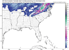
Significant uptick on the 18z GEFS as far as the snowfall mean goes for the mountains. It almost doubled on the mean and is more in line with the EPS.
I read on Ober gatlinburgs website that their last natural snowfall was on 4/10/22…Hands down best setup of the winter so far for the NC mountains. If this doesn’t do it for favored areas then it’s tough sledding from here..and by tough sledding I mean sledding on grass and asphalt
Really pulling for that Canadian crawler solution..that would be a banger
That’s really remarkable considering I’ve seen the mountains receive measurable snow in October, November, and a December many times. Just shows how bad it’s been for the mountains so far
Last edited:
Hankjones
Member
That's incredibly depressingI read on Ober gatlinburgs website that their last natural snowfall was on 4/10/21…..
That’s really remarkable considering I’ve seen the mountains receive measurable snow in October, November, and a December many times. Just shows how bad it’s been for the mountains so far
I read on Ober gatlinburgs website that their last natural snowfall was on 4/10/21…..
That’s really remarkable considering I’ve seen the mountains receive measurable snow in October, November, and a December many times. Just shows how bad it’s been for the mountains so far
I'm quite surprised they are still in business as their peak elevation is only something like 3k I believe. Cataloochee struggles for natural snow at 5600', but at least they invested heavily in their snowmaking capabilities.
They had snow almost 2 weeks ago.I read on Ober gatlinburgs website that their last natural snowfall was on 4/10/22…
That’s really remarkable considering I’ve seen the mountains receive measurable snow in October, November, and a December many times. Just shows how bad it’s been for the mountains so far
Thankfully its ensemble doesn't agree. But yeah, this feels like we are being sent to a Pac Jet Rehab Center, and we're trying to take our first steps toward recovery

Last edited:
Here are days 9 to 15 on the Euro Control RunGood to see consistency from the eps getting the building blocks in place. We'd still need time after this image to get the ridge poleward and tap some real cold but I'm not discouraged
View attachment 129692

We couldn't ask for more than that. A good 5-7 day window to end the month. Might be seeing the end of the pattern across Asia by the end but the table would already be setHere are days 9 to 15 on the Euro Control Run

Blue_Ridge_Escarpment
Member
Webberweather53
Meteorologist
- Joined
- Jan 23, 2021
- Messages
- 4,602
- Reaction score
- 15,197
- Location
- Lebanon Township, Durham County NC
CFS has now had five cold runs in a row for late January and February.
A few thoughts on this...We couldn't ask for more than that. A good 5-7 day window to end the month. Might be seeing the end of the pattern across Asia by the end but the table would already be set
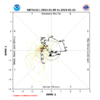
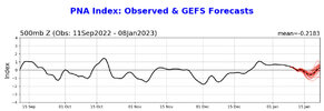
MJO should work its way thru Phases 1-2-3 during the Jan 15-31 period. Typical response to this is Pac Jet retraction (seen in purple here)...

But the effects of forecasted +EAMT surface high pressure cold surges into E Asia during this same timeframe may act as counterbalance to prevent a big jet retraction and Aleutian High / -PNA pattern as we go into the late Jan / early Feb timeframe.
We can see here the EPS and EPS Control holding surging E Asia high pressure thru to the end of the run out to Jan 22, with an Aleutian Low developing, and High Pressure on the west coast...


Comment here from Jim Yang on the predicted flip from warm to cold in China with the surging high pressure

Last edited:
33/30 with a Full Moon
Webberweather53
Meteorologist
A few thoughts on this...
MJO should work its way thru Phases 1-2-3 during the Jan 15-31 period. Typical response to this is Pac Jet retraction (seen in purple here)...

But the effects of forecasted +EAMT surface high pressure cold surges into E Asia during this same timeframe may act as counterbalance to prevent a big jet retraction and Aleutian High / -PNA pattern as we go into the late Jan / early Feb timeframe.
We can see here the EPS and EPS Control holding surging E Asia high pressure thru to the end of the run out to Jan 22, with an Aleutian Low developing, and High Pressure on the west coast...


Comment here from Jim Yang on the predicted flip from warm to cold in China with the surging high pressure

We’ll see. You’re gonna be fighting not just the MJO, but ENSO also trying to pull the jet back as well as typical planetary wave variability (large scale high amplitude planetary waves like this tend to retrograde over time, more so with blocking highs because the westerly jet underneath them is weaker). It’s a very delicate balance here indeed between going from a warm continental-wide super Nino look to -PNA/-EPO/SE ridge because we’re not in a favorable seasonal state for +PNA. I hope you get at least one more chance here in late January.
This is actually a really big negative EAMT next week until about day 10, because high MSLPa is west of the Tibetan Plateau (and lower MSLPa is to the east) & I suspect whatever +EAMT comes after this will be a net wash overall on how it impacts the Pacific jet, at least until about day 16-18
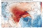
Truth Eric, yeah agree on the current and upcoming -EAMT period. My focus was out past that (post Jan 15) where we have to live out at range far too often unfortunately. But tough call going forward as usualWe’ll see. You’re gonna be fighting not just the MJO, but ENSO also trying to pull the jet back as well as typical planetary wave variability (large scale high amplitude planetary waves like this tend to retrograde over time, more so with blocking highs because the westerly jet underneath them is weaker). It’s a very delicate balance here indeed between going from a warm continental-wide super Nino look to -PNA/-EPO/SE ridge because we’re not in a favorable seasonal state for +PNA. I hope you get at least one more chance here in late January.
This is actually a really big negative EAMT next week until about day 10, because high MSLPa is west of the Tibetan Plateau (and lower MSLPa is to the east) & I suspect whatever +EAMT comes after this will be a net wash overall on how it impacts the Pacific jet, at least until about day 16-18
View attachment 129697
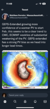
As much as these can go either way.. this always raises my eyebrows when we get an actual SSWE going .. could certainly help in some mischief in February even when we’re battling background Niña stuffTruth Eric, yeah agree on the current and upcoming -EAMT period. My focus was out past that (post Jan 15) where we have to live out at range far too often unfortunately. But tough call going forward as usual
Webberweather53
Meteorologist
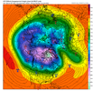
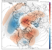
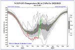
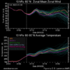
Is this sudden enough to be classified as a SSWE yet? Things seem to be slowly but surly healing for something more favorable. View attachment 129708View attachment 129712View attachment 129713View attachment 129714View attachment 129715
No. SSWEs are defined by zonal wind anomalies being < 0 (or reversed) near the polar cap region, or more specifically at 60N around 10mb.
https://journals.ametsoc.org/view/journals/clim/31/6/jcli-d-17-0648.1.xml
We are still nowhere close to that
Fountainguy97
Member
LukeBarrette
im north of 90% of people on here so yeah
Meteorology Student
Member
2024 Supporter
2017-2023 Supporter

