ForsythSnow
Moderator
Sally seems to be a bit better on recon's first pass this morning. Pressure is also falling now. Extraps in the upper 970s vs low 980s
Sally seems to be a bit better on recon's first pass this morning. Pressure is also falling now. Extraps in the upper 970s vs low 980s


My wild guess is for it to be a little stronger than Gordon of 2018, which was at a similar strength at this point. It was also going over similarly very warm 30C SSTs and had similar shear to deal with. The track was very similar and it was also during the heart of the season. Gordon ended up at 70 mph at peak, which included landfall strength. I'm guessing Sally will peak as a cat 1 around 85 mph with very heavy rainfall from a slow mover being the biggest danger.
If she weren't as sheared as she is now, I might have gone near 100 mph/cat 2. Regardless, even then flooding from rainfall would likely still have been the biggest danger. And I'm not saying 100 mph is impossible. I'm saying I'm not expecting it to be that strong as of now.
Gordon of 2018:
https://en.wikipedia.org/wiki/Tropical_Storm_Gordon_(2018)

967What is the gfs seeing? 965mb?
Down to 80
Definitely gonna be a water storm
Looks like the center is firing up storms. Wouldn't be surprise if theres an uptick in intensity right at before LF.
I have my doubts but there is that chance with what the models show. I don't expect anything over 100.Most models have been showing a uptick before landfall
Sent from my iPhone using Tapatalk
Dang sure is, right over Pensacola also still very slow, doesn't get the rain out of here until early morning hours on SaturdayEuro with a Florida landfall
The only way this strengthens is if it moves NE prior to lf and soon, this would lessen the effects of shear and get it away from what is most likely cooling waters. Either way, proximity to land, some dry air intrusion, slow movement all are against any uptick in intensity.Looks like the center is firing up storms. Wouldn't be surprise if theres an uptick in intensity right at before LF.
The only way this strengthens is if it moves NE prior to lf and soon, this would lessen the effects of shear and get it away from what is most likely cooling waters. Either way, proximity to land, some dry air intrusion, slow movement all are against any uptick in intensity.
It ain't over, till its over.....Give Sally a round of applause. We finally have a eye visible on IR.
Really? Reading on other forums that winds are increasing at FLIt's probably not even a hurricane anymore looking at recon anyway I bet it stays around 75-85 mph generously unless some better reports come in
Can you post imageGive Sally a round of applause. We finally have a eye visible on IR.
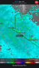
I see 981mb
It ain't over, till its over.....
Yeah, the flood watches came up about an hour ago for Wednesday noon through Friday in Atlanta.And it won't be over for several days. Based on model consensus as well as NWS forecasts, ATL is facing a decent chance for a top 10 wettest tropical system going back to 1879 and top 3 or higher for Sep, alone! More later if I get some time.
Really? Reading on other forums that winds are increasing at FL

At the moment I don't see any model support for that idea, but who knows, its crazy times......JB says sally might stall out in the atlantic and come back west ala doria