accu35
Member
Nate center is still deepening atm, banding is becoming evident on IR. Could very well see a cat 2
Courtesy: Dr. Greg Forbes. TORCON IndexWhat is everybody thinking about the tornado threat with this?

Looks like JB be right after all
Sent from my SM-J320VPP using Tapatalk

Yes sir eye trying to clear out but not been able to the hour or soDefinitely still on the RI trend.
Yeah just goes to show storm overall got it's act together today and got a lil more to growRecon pass into the NW eyewall and flagged 64+knot winds that’s a first

The forward speed reminds me of Opal. She flew up through AL. Of course, Opal was much larger and more intense.This thing will be on land by late afternoon it's flying
Sent from my SM-J320VPP using Tapatalk


Landfall should be west of MobileLatest fix shows it has wobbled 13 miles west of NHC track. Also the faster it speeds up forward the more west it will likely be given the trough will fully catch it at a later time.
Yeah, the 10am NHC track gives the landfall point at Biloxi, MS.Landfall should be west of Mobile
Puts me on the right dangerous sideYeah, the 10am NHC track gives the landfall point at Biloxi, MS.

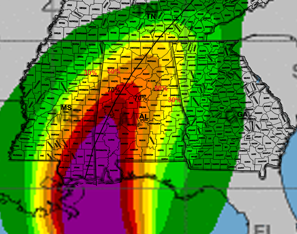
Yeh Champ you beat me to it..lol...Updated slight risk for tornadoes across Alabama.
Looks like it includes GA too if i'm looking at the map right.Updated slight risk for tornadoes across Alabama.

That's crazy, it's gonna be moving at close to 30 mphMRX isnt going to issue a Tropical storm product. They claim the cyclone rapidly weakens at state lines. Absurd. Nhc has it a trop storm right over us 7PM SUN
Wow, 24 mph in Hamilton and 69 in Tuscaloosa ?More from kbmx
Sent from my SM-J320VPP using Tapatalk
Yeah gonna be a massive cutoff nw and west of the center. It's a tiny storm with a tiny wind fieldWow, 24 mph in Hamilton and 69 in Tuscaloosa ?
There already finding winds close to cat 3
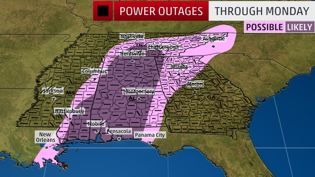
Latest weather channel power outage map: