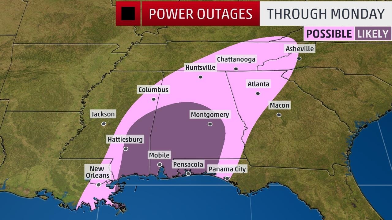
Well that moved WAY WEST from the previous issue
from BMX
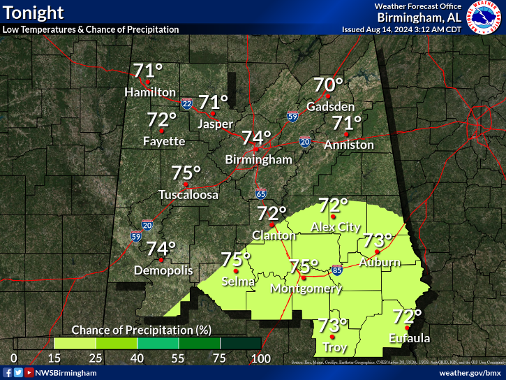
from BMX
Last edited:

I bet the NHC goes cat 2 at landfall
Sent from my SM-J320VPP using Tapatalk


some areas they cover are under a TS Watch still, though Birmingham is under a Warningtropical storm warning moved further north and includes all areas covered by the BMX NWS market

Ya models nailed that part very lopsidedRecon is crazy. FL winds near 90knts in the eastern side with 20knts on the western side.


.GIF")
There is nothing to slow this down. It's embedded in a very fast flow
I agree, it will make landfall before midnight no doubtExactly. I think it could make landfall much sooner than midnight as predicted.
Yes they have and I'm a little surprised to be honest . I still Think there is a little more room east but I could be wrong. Happens all the tineExactly. I think it could make landfall much sooner than midnight as predicted.
Last 2 NHC updates have shifted the cone ever so slightly west.

nothing has changed, why would they drop it?Doesnt appear that there will be much impact from wind here in west ga. FFC says 10-20 mph sustained with gusts to 35. Im surprised they havent dropped the TS Watch with winds that low.
Yea I agree. For a good portion of the watch only predicting like 2 inches of rain and 25 mph gust. Doesn't really warrant a watch IMODoesnt appear that there will be much impact from wind here in west ga. FFC says 10-20 mph sustained with gusts to 35. Im surprised they havent dropped the TS Watch with winds that low.
Im not sure but yesterday they said 20-30 mph sustained winds and now its 10-20 mph. Maybe tonight they will lower it to calm winds. Who knows.nothing has changed, why would they drop it?

Just as you predictedSlight west shift inland
Sent from my SM-J320VPP using Tapatalk
No I've been wrong , I though it would shift east. Still feel that wayJust as you predicted