Storm5
Member
Another look at the 00z Euro winds

Sent from my SM-J320VPP using Tapatalk

Sent from my SM-J320VPP using Tapatalk
Yeah its starting to move north movement now. Still think MS/Al landfall.Imo it's almost a due North movement right now
Your prob right, unless it keeps it north movement now. If any shift west shouldn't be muchNHC will probably shift track a little west at the 11am update , not based off the NAM. But the fact they are on the east side of guidance
Sent from my SM-J320VPP using Tapatalk
I agree and it's all a moot point for sure. Either way it's a very lopsided storm and small one. But hope many get rain. We all need itThese west east shifts are small at this point
Sent from my SM-J320VPP using Tapatalk


Are you still expecting big impacts for us?Looks like recon found stronger winds again. 95 mph unflagged.
Noticed over 100knt winds just above the surface on E side pass as mentioned earlier CDO looking better and cloud tops blossoming once again last 2 hoursLooks like recon found stronger winds again. 95 mph unflagged.
Charlie, you think my area and yours will see some great impact? Even if it hits west MS landfall?These west east shifts are small at this point
Sent from my SM-J320VPP using Tapatalk
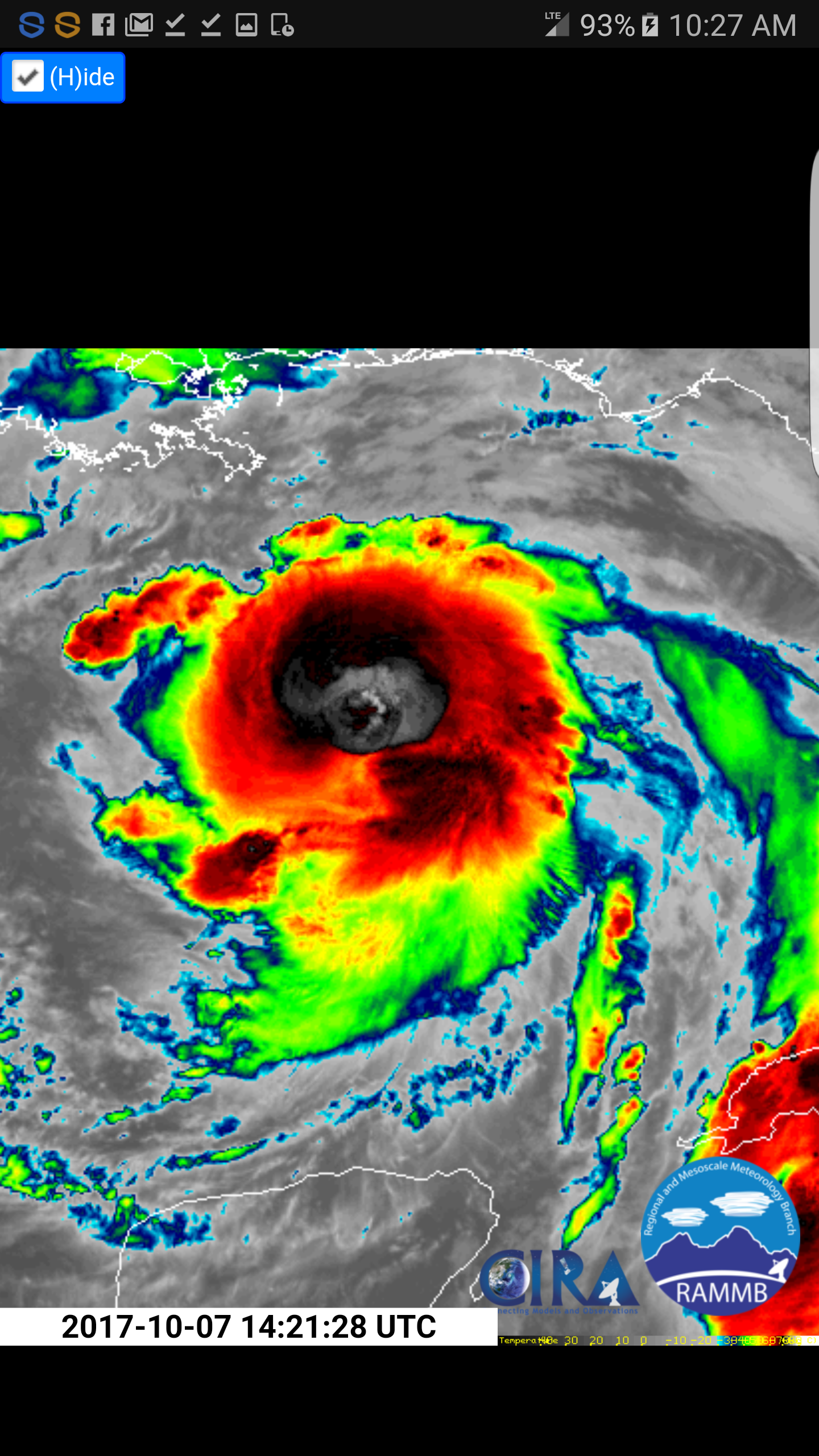
-95c degree cloud topLooking healthy right now cloud top are impressive and should be strengthening little more now. Look as an eye is showing
Yes cause regardless it's gonna move NE after landfall.Charlie, you think my area and yours will see some great impact? Even if it hits west MS landfall?

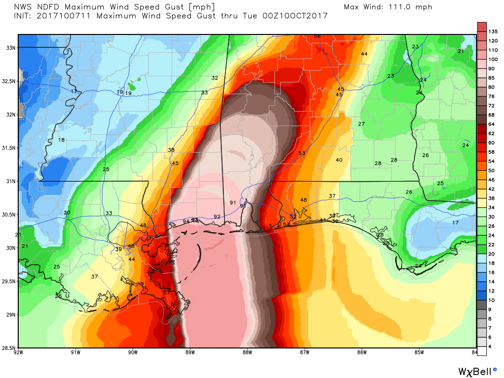
How about everyone else? Do those gusts get weaker further on quickly or maintain?3k nam .... no thanks
Sent from my SM-J320VPP using Tapatalk
The same for us if it goes much farther west. Then probably no rain until Dec.To summarize, all the changes still = sprinkles for SD!
.How about everyone else? Do those gusts get weaker further on quickly or maintain?


What about N GA and SE TN Storm5?3k nam .... no thanks
Sent from my SM-J320VPP using Tapatalk
I just posted them aboveWhat about N GA and SE TN Storm5?
Holy hell 26 mphUp to 90 mph, 984mb. NNW at 26.
Good luck down there
Someone post the updated graphic please
Sent from my SM-J320VPP using Tapatalk

Thanks , wow TS into southern Tennessee