Cadi40
Member
Those wind maps are most definitely overdone. If the severe threat verifies I can foresee some isolated gusts up to 60 or so, but I highly doubt this will be a widespread sustained wind event outside of localized areas.
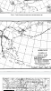
date?12z EURO. Major severe setup. Expect SPC to highlight North Carolina in future outlooks.View attachment 47389
12z Saturday. Ample time for heating that run.date?


That would no doubt be a hefty squall line, a wide spread wind event not out of the question
View attachment 47390
View attachment 47391


ML Cape is so crappy
ML Cape is so crappy
I seem to remember a couple years ago that the strongest winds with Michael across NC was as dryer air was pulling into the storm on the backside. Is that something we could see here. I find it interesting that models drop the pressure lower after its passes the the Ohio Valley, but it’s still on landMost have them pretty much centered over NC and even some down in SC. I wouldn't be surprised to see some wind gusts in excess of 40mph. Especially with any showers. If we can get some storms going though, we could be easily seeing gusts over 60. I have my doubts that winds will be all that crazy non-thunderstorm wise. But I could be wrong.
I seem to remember a couple years ago that the strongest winds with Michael across NC was as dryer air was pulling into the storm on the backside. Is that something we could see here. I find it interesting that models drop the pressure lower after its passes the the Ohio Valley, but it’s still on land
Lets hope it doesnt cause camille like flooding
You do realize Camille did 27” of rain in just 8 hours...
Prob so. But 4-8” would cause serious damage in places like Hickory NC or Martinsville VA where over 12” has occurred this August.
Ok ok ok we get it, point made.... it's old birdman.27” not happening. But some flooding is likely to occur in the west with any training of upslope from WV to NC.
Bojangles parking lot flooding!Actual flooding or just a small drainage wash spilling over?
W KERR SCOTT RESERVOIR FAILUREActual flooding or just a small drainage wash spilling over?
I think the top gust at the airport was 61mph and I had a 64mph gust on my home weather station. I watched a TV documentary on hurricanes years ago and I remember Dr. Bob Sheets saying during it, that you should never underestimate what a remnant tropical low can do when it becomes phased with a jet stream.I remember that. We easily had some gusts over 50mph in Charlotte.
This thread is a train wreck
The track after landfall, has really trended southe since yesterday! I think the Euro 50-60 mph wind gust over NC/SC are way to high, but Sat could be fun for y’allLol. In all seriousness, we really do need to watch out for some significant/severe weather, as @SD, @Rain Cold, @Myfrotho704_ have been speaking of in NE GA, upstate SC and N Carolina. Guess, we’ll know a poop ton tomorrow. Prayers, for all in her hellish path......