• Hello, please take a minute to check out our awesome content, contributed by the wonderful members of our community. We hope you'll add your own thoughts and opinions by making a free account!

Tropical Hurricane Idalia

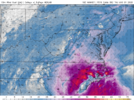
I work 3rd shift this week so I will be up all night, so I have been asleep since 11ish this morning, I expected the NAM to have come back to Earth while I slept but seems it went the other way....still think anything over 50 would be pretty remarkable, but the NAM also keeps this up for a solid 5-6 hrs so even regular gust to 50 for that long would be a issue power wise. Around here it usually takes more than 50ish mph winds to even think of seeing trees falling but big limbs will come down for sure

1693434066198.png
 
The kids will love playing in it, no school tomorrow ?
Yeah, looks like the ones around here are starting to close. Wake will be last like always. Everything is supposed to be clearing out tomorrow morning, though. I guess they don't want to have to worry about any roads being flooded in the morning.
 
Same area as the tornado a few minutes ago
 

Attachments

  • KLTX - Super-Res Correlation Coefficient 1, 6_46 PM.png
    KLTX - Super-Res Correlation Coefficient 1, 6_46 PM.png
    70.7 KB · Views: 6
* Tornado Warning for...
Southeastern Brunswick County in southeastern North Carolina...

* Until 715 PM EDT.

* At 647 PM EDT, a severe thunderstorm capable of producing a tornado
was located near St. James, or near Oak Island, moving north at 15
mph.

HAZARD...Tornado.

SOURCE...Radar indicated rotation.

IMPACT...Flying debris will be dangerous to those caught without
shelter. Mobile homes will be damaged or destroyed.
Damage to roofs, windows, and vehicles will occur. Tree
damage is likely.

* This dangerous storm will be near...
Boiling Spring Lakes around 655 PM EDT.

Other locations impacted by this tornadic thunderstorm include
Bolivia.
 
Back
Top