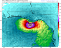
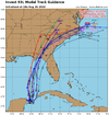
I really think the key is on this organizing over the water today instead of being over land. It’s kinda worrisome that it’s basically going to be over water 24-36 longer than what models were showing yesterdayHurricane models going bonkers, shows potential if all comes together just right, dang
-
Hello, please take a minute to check out our awesome content, contributed by the wonderful members of our community. We hope you'll add your own thoughts and opinions by making a free account!
You are using an out of date browser. It may not display this or other websites correctly.
You should upgrade or use an alternative browser.
You should upgrade or use an alternative browser.
Tropical Hurricane Idalia
- Thread starter weather nerd
- Start date
And any slight shifts west keep it over water a tad longer too, all bad signsI really think the key is on this organizing over the water today instead of being over land. It’s kinda worrisome that it’s basically going to be over water 24-36 longer than what models were showing yesterday
I agree. I think if things continue to develop as we’ve seen today, the area from New Orleans east to the Big Bend is most likely where it’s heading.And any slight shifts west keep it over water a tad longer too, all bad signs
?
buckinbronco
Member
iGRXY
Member
I don’t want to say I told you so or count the chickens before they hatch, but it was forecasted to move over the warmest waters in the Caribbean Sea and going into a scorching GOM this is not very surprising seeing this rapid organization. A stronger storm also favors more western movement. Even I got to admit I didn’t think it was going through look this food this fast. This definitely has a shot to be a good bit stronger than even I originally thought.

Much of Florida under state of emergency as possible tropical storm forms in Gulf of Mexico
Much of Florida is under a state of emergency as a tropical storm is possibly forming in the Gulf of Mexico
accu35
Member
Anyone have the eps
accu35
Member
BHS1975
Member
 Micheal 2?
Sent from my iPhone using Tapatalk
This would be Idalia if it gets named next correct? I mentioned it before in the past, but beware “I” named storms. We got a really ? track record when it comes to named storms that start with the letter “I”.
Isabel
Ivan
Ike
Irene
Irma
Ida
Ian
Isabel
Ivan
Ike
Irene
Irma
Ida
Ian
I could agree more. I’ve kept thinking while watching the models several days ago only showing this maxing out as a strong tropical storm to minimal hurricane how they were showing the same thing a few years ago with Michael at that stage. Now unfortunately I can’t help but notice the similarities in Michael’s path compared to forecasts on this.I don’t want to say I told you so or count the chickens before they hatch, but it was forecasted to move over the warmest waters in the Caribbean Sea and going into a scorching GOM this is not very surprising seeing this rapid organization. A stronger storm also favors more western movement. Even I got to admit I didn’t think it was going through look this food this fast. This definitely has a shot to be a good bit stronger than even I originally thought.
MichaelAndrews
Member
I’m glad I’m not the only one who sees this and think it’s Michael again
Drizzle Snizzle
Member
I wonder whether it being Late August vs October would make a difference. I imagine the waters are warmer than it was when Michael was in the Gulf.I’m glad I’m not the only one who sees this and think it’s Michael again
That was a very hot summer. It was over 100 degrees in the south, in October that year. Michael allowed for the first cool down of the fall.I wonder whether it being Late August vs October would make a difference. I imagine the waters are warmer than it was when Michael was in the Gulf.
I actually think the water temperatures are very similar to when Michael came in… maybe a degree or two warmer now. You got to remember that in 2018, there had been absolutely no cool weather to speak before Michael and all of September and the first few days of October has just been an extended summer for the entire southeast. Coincidentally it was Micheal that caused the pattern to flip.I wonder whether it being Late August vs October would make a difference. I imagine the waters are warmer than it was when Michael was in the Gulf.
Blue_Ridge_Escarpment
Member
Drizzle Snizzle
Member
I wish this system would do the same and cause the pattern to flip but I guess Early September is too early to expect a lot of cool air.I actually think the water temperatures are very similar to when Michael came in… maybe a degree or two warmer now. You got to remember that in 2018, there had been absolutely no cool weather to speak before Michael and all of September and the first few days of October has just been an extended summer for the entire southeast. Coincidentally it was Micheal that caused the pattern to flip.
While I’m the first to say the similarities can be seen, let’s remember that Michael literally had everything possible going for it on its approach to the coast. That RI cycle started at just the right time so that it hit max strength right at the moment of its landfall… something that I can only recall happening 3 times in my lifetime (Hugo going into SC, Andrew going into south Florida, and then Michael)I’m glad I’m not the only one who sees this and think it’s Michael again
While I’m the first to say the similarities can be seen, let’s remember that Michael literally had everything possible going for it on its approach to the coast. That RI cycle started at just the right time so that it hit max strength right at the moment of its landfall… something that I can only recall happening 3 times in my lifetime (Hugo going into SC, Andrew going into south Florida, and then Michael)
This is dead on. Michael had a huge influx of tropical moisture which protected the core from dry air and also a huge amount of ventilation aloft. This one will have plenty, but Michael was a total example of everything going perfect.
lexxnchloe
Member
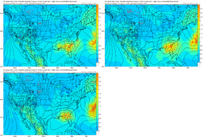
HMMMM something very wierd going on with Franklin and Odalia on the Euro. They are clearly interacting now as Franklin
Here is 12Ztoday

12Z yesterday Instead of zooming away NNE Franklin is interacting with Odalia and crawling ese. I would imagine nothing is set on Odalia yet.

Here is 12Ztoday

12Z yesterday Instead of zooming away NNE Franklin is interacting with Odalia and crawling ese. I would imagine nothing is set on Odalia yet.

And how many times have we seen storms in the Gulf blow up rapidly the last few years?I don’t want to say I told you so or count the chickens before they hatch, but it was forecasted to move over the warmest waters in the Caribbean Sea and going into a scorching GOM this is not very surprising seeing this rapid organization. A stronger storm also favors more western movement. Even I got to admit I didn’t think it was going through look this food this fast. This definitely has a shot to be a good bit stronger than even I originally thought.
Definitely an overall trend west with the clusters, however those far west outliers are beginning to correct east a bit. Certainly looks like to me that New Orleans to Big Bend might be the area to watch
lexxnchloe
Member
12Z yesterday Franklin was at Greenland

Today its here east of bermuda. I would expect massive changes for Odalia


Today its here east of bermuda. I would expect massive changes for Odalia

I thinks that’s more of a reaction to Idalia being a stronger storm and interfering with the steering that would carry Franklin away. Another thing I’m noticing is that the Euro has the center of Idalia in almost the same spot two days from now that it appears to be organizing in now…it doesn’t seem to be in an area that it would just sit and spin for a couple daysHMMMM something very wierd going on with Franklin and Odalia on the Euro. They are clearly interacting now as Franklin
Here is 12Ztoday

12Z yesterday Instead of zooming away NNE Franklin is interacting with Odalia and crawling ese. I would imagine nothing is set on Odalia yet.

lexxnchloe
Member
They are clearly interacting on the Euro. Yes, thats Odalia moving south well SW of Bermuda


Definitely an overall trend west with the clusters, however those far west outliers are beginning to correct east a bit. Certainly looks like to me that New Orleans to Big Bend might be the area to watch
I don’t see any reason to not go with the Panama City area as bullseye ATM.
D-min doing its thing. Cloud tops have warmed quite a bit over the COC at this time. I still say TS by tonight.
Ok if that were to happen then what’s next. Does another trough come in to carry it away or does a ridge build in to its north and steer back into the southeast coastThey are clearly interacting on the Euro. Yes, thats Odalia moving south well SW of Bermuda


lexxnchloe
Member
At least we have fun things to trackI thinks that’s more of a reaction to Idalia being a stronger storm and interfering with the steering that would carry Franklin away. Another thing I’m noticing is that the Euro has the center of Idalia in almost the same spot two days from now that it appears to be organizing in now…it doesn’t seem to be in an area that it would just sit and spin for a couple days
lexxnchloe
Member
This solution is so wierd i have no ideaOk if that were to happen then what’s next. Does another trough come in to carry it away or does a ridge build in to its north and steer back into the southeast coast
Brent
Member
Yeah I mean the only Gulf storm that I have ever seen do that loop around and come back to the west was Ivan in 2004… that however was a remnant low that held back when a trough pulled away.., it moved slowly around a ridge of high pressure and redeveloped into a tropical storm a week later back in the Gulf. This would still be a fairly intact though significantly weakened TC.This solution is so wierd i have no idea
lexxnchloe
Member
It looks like it will head out but we have gfs saying it dies inland to the Euro having it 500 miles off the coast. Inbetween would be us, lol
lexxnchloe
Member
Euro ends right over Bermuda but its safe to say its worth watching after FLA


I think the EURO has the general right idea on the track though I could definitely see it correcting to the west a bit going forward especially now that we have defined center. The bit question I have on it is it’s timing… I just don’t see why it’s holding the center in basically the same spot in two days as it is right now.Euro ends right over Bermuda but its safe to say its worth watching after FLA


