NoSnowATL
Member


Franklin may play a big part in where 93 goes. Euro has Franklin 2 degrees further west this AM closer to NC. Getting close to where they could interact.Well GFS and Euro couldn't be further apart, track wise. GFS outlier atm
Doubt there will be any interaction between the two but further west Franklin is and if future Idalia develops quick enough, less the ridge builds between the two and more NE track. 0z GFS had ringing between them stronger with w track and inland west of apps. 06z GFS already ticking east with LF and inland track east of apps. All bets are off until we have a developed system thoughFranklin may play a big part in where 93 goes. Euro has Franklin 2 degrees further west this AM closer to NC. Getting close to where they could interact.
It looks to be consolidating in the Yucatan Channel so it appears land interaction with the Yucatan Peninsula won't be able to delay development. TS by this evening seems likely.might Be starting.
Four days over the sauna known as the Gulf of Mexico is rather concerning. It'll probably wind up a little faster if it strengthens quicker like it seems poised to do, but still.
The biggest takeaway from that is that it looks like it might be forming a center over water instead of hanging back over the Yucatán Peninsula. If that’s the case it gives it an extra day over that bath watermight Be starting.


It really is. We could see a TD or TS before entering the gulf.This thing is wrapping up quick.
Sent from my iPhone using Tapatalk

This is typically not the case with Gulf storms once they make landfall… the axis of heaviest rain is to the north and northwest of where the center passes. To the east and northeast of the center is where you have the biggest tornado threat.Aren’t typically the wettest part of a tropical system the east side? For eastern Alabama and western Georgia to get the best chance of beneficial rains, we need it as far west as possible?

Just to the naked eye I think we probably have a TD later today. I’m not sure what the recon schedule is, but I’m sure they just want to verify a closed circulation.It does seem to be getting organized ahead of schedule and over open waters. It may become a tropical depression by late tomorrow and then we have a better idea of where it might be going and how strong this tropical system will become.
Something else to watch for inland rainfall effects is how long that front stalls out across the Carolinas. That might already be a focus point if heavy rainfall early in the week and could enhance rainfall later in the week if any moisture from a tropical system gets drawn into as well.Pretty good environment depicted on the GFS. The trough over the western GOM may impart some SW shear, but it may stay far enough west.
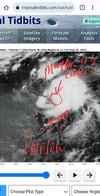
View attachment 136454
Recon going in tommorow.2. SUSPECT AREA (NW CARIBBEAN - AL93)
FLIGHT ONE - NOAA 43 FLIGHT TWO - TEAL 71
A. 27/1400Z A. 27/1500Z
B. NOAA3 01DDAA TDR B. AFXXX 02DDA INVEST
C. 27/1000Z C. 27/1230Z
D. 21.3N 86.5W D. 21.3N 86.5W
E. 27/1330Z TO 27/1630Z E. 27/1430Z TO 27/1900Z
F. SFC TO 15,000 FT F. SFC TO 15,000 FT
G. TAIL DOPPLER RADAR G. LOW LEVEL INVEST
FLIGHT THREE - NOAA 49 FLIGHT FOUR - TEAL 72
A. 28/0000Z A. 28/0530Z
B. NOAA9 03DDA SURV B. AFXXX 0410A CYCLONE
C. 27/1730Z C. 28/0300Z
D. NA D. 21.8N 86.5W
E. NA E. 28/0500Z TO 28/0830Z
F. 41,000 TO 45,000 FT F. SFC TO 10,000 FT
G. SYNOPTIC SURVEILLANCE G. FIX
FLIGHT FIVE - NOAA 49 FLIGHT SIX - TEAL 73
A. 28/1200Z A. 28/1130Z,1730Z
B. NOAA9 0510A CYCLONE B. AFXXX 0610A CYCLONE
C. 28/0530Z C. 28/0900Z
D. NA D. 22.1N 86.5W
E. NA E. 28/1100Z TO 28/1730Z
F. 41,000 TO 45,000 FT F. SFC TO 15,000 FT
G. SYNOPTIC SURVEILLANCE G. FIX
FLIGHT SEVEN - NOAA 43
A. 28/1200Z
B. NOAA3 0710A CYCLONE
C. 28/1000Z
D. 22.1N 86.5W
E. 28/1130Z TO 28/1530Z
F. SFC TO 15,000 FT
G. TAIL DOPPLER RADAR
ThanksThis is typically not the case with Gulf storms once they make landfall… the axis of heaviest rain is to the north and northwest of where the center passes. To the east and northeast of the center is where you have the biggest tornado threat.


.png")