-
Hello, please take a minute to check out our awesome content, contributed by the wonderful members of our community. We hope you'll add your own thoughts and opinions by making a free account!
You are using an out of date browser. It may not display this or other websites correctly.
You should upgrade or use an alternative browser.
You should upgrade or use an alternative browser.
Tropical Hurricane Idalia
- Thread starter weather nerd
- Start date
Brent
Member
For the 1st time the 18z Icon have shifted track inland riding along the coast of SC. Bad conditions expected in SC.
NoSnowATL
Member
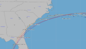
@accu35Slight west shift View attachment 136554
SC_Wildcat
Member
Hoping this thing doesn’t stall like Matthew or Florence.
3k nam sucks with TS I know but it sure has a nice inland track, tons of rain
Probably some clown wind maps with it too
Probably some clown wind maps with it too
3k nam sucks with TS I know but it sure has a nice inland track, tons of rain
Probably some clown wind maps with it too
I don't even think it's that crazy with 90F waters. Haha
Honestly who knows lol, we will find out soon enoughI don't even think it's that crazy with 90F waters. Haha
Shaggy
Member
An amazing tornado threat with that feeder band onshore flow along the coast as well I bet3k nam sucks with TS I know but it sure has a nice inland track, tons of rain
Probably some clown wind maps with it too
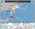
Other than some slight deviations along the SC coast, they have back to moving right along the coast again, the NHC really has kept that track pretty much the same since yesterday morning. They have slowed things considerably once off the NC coast… it will be interesting to see if they start slowing it down over land if the models continue the trend of a slower storm after landfallSlight west shift View attachment 136554
HugeSnowStick
Member
This is going to go way more west than depicted.
I hope you're, but why?This is going to go way more west than depicted.
Wishful thinking? LolI hope you're, but why?
NoSnowATL
Member
Because he lives in Atlanta ???I hope you're, but why?
Tallahassee is the fringe furthest West IMO... as of now at least.
HugeSnowStick
Member
No, that is not it all. Even if it does you are in the NE path, So quit the sarcasm. The upper level low in the N gulf is going to dissipate. Turning it to the NNW.Because he lives in Atlanta ???
Hope he’s better with hurricanes than he is at snow storms! ??Because he lives in Atlanta ???
- Joined
- Jan 23, 2021
- Messages
- 4,602
- Reaction score
- 15,197
- Location
- Lebanon Township, Durham County NC
Outside of the big bend:
If I was from Tifton, GA to about Goldsboro NC I would be really worried about flooding from rain. If I was on the sea islands to Charleston, I’d be really concerned about tidal flooding.
If I was from Tifton, GA to about Goldsboro NC I would be really worried about flooding from rain. If I was on the sea islands to Charleston, I’d be really concerned about tidal flooding.
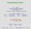
NOAA dropsonde has it at 985 mb with 17 kt so most likely 983 mb.


ForsythSnow
Moderator
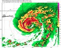
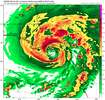
HMON and HWRF, slower and stronger
HAFS, weaker slightly and faster than last run
HAFS, weaker slightly and faster than last run
NoSnowATL
Member
NoSnowATL
Member
Tik tok west she goes
SUMMARY OF 700 PM CDT...0000 UTC...INFORMATION
----------------------------------------------
LOCATION...21.7N 85.1W
ABOUT 20 MI...30 KM SW OF THE WESTERN TIP OF CUBA
ABOUT 250 MI...400 KM SW OF THE DRY TORTUGAS
MAXIMUM SUSTAINED WINDS...70 MPH...110 KM/H
PRESENT MOVEMENT...N OR 360 DEGREES AT 8 MPH...13 KM/H
MINIMUM CENTRAL PRESSURE...983 MB...29.03 INCHES
HugeSnowStick
Member
Going to rocket NE by tomorrow.. So the field may be wide open.That ULL is showing you the way this is going to move.
View attachment 136564
Last edited:
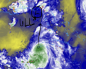
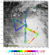
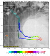
Recon miss the center punch?
This may have been mentioned already but something that is alarming but these hurricane models that are really dropping the pressure near landfall are all initially showing the storm as the lopsided look that it is right now.
8:00 NHC update looked like the track was a tick west.
Getting close.


Interesting looks like center maybe passing over western tip of Cuba, if so, that's a touch east of most models initialization. Minor stuff but minor movements one way or other could have huge implications since it will be paralleling the coastGetting close.
accu35
Member
More Gefs members are s
Someone mentioned on another board the recon saying the center is further west off Cuba. I don’t believe itInteresting looks like center maybe passing over western tip of Cuba, if so, that's a touch east of most models initialization. Minor stuff but minor movements one way or other could have huge implications since it will be paralleling the coast
Stormsfury
Member
accu35
Member
I believe they finding the center little further west off CubaMaybe notView attachment 136566
Sorry, I should have said the other plane.....Maybe not .. might be a realignment of the vertical stacking, tilted east now not north/south.View attachment 136566
Attachments
Looks like the burst might close that eye.


