-
Hello, please take a minute to check out our awesome content, contributed by the wonderful members of our community. We hope you'll add your own thoughts and opinions by making a free account!
You are using an out of date browser. It may not display this or other websites correctly.
You should upgrade or use an alternative browser.
You should upgrade or use an alternative browser.
Tropical Hurricane Ian
- Thread starter severestorm
- Start date
-
- Tags
- tropical
jeremyt
Member
I guess the $ question is where that turn takes place and how the track will effect qpf totals along the way? I’ve seen 2-6 inches in our area based off whi h model you look at. Definitely impossible to nail down!As the trough pulls away and has less effects on the steering, the forward speed would slow, and yes where that NW turn occurs is very important to where that east coast landfall would take place. Earlier models that had the storm out in the Atlantic were turning it later and bringing in a landfall between Myrtle Beach and Cape Fear. Now those have trended to an earlier turn and bringing it in between Savannah and Georgetown.
Shaggy
Member
The hurricane is well east of all model projections from just a couple days ago. The situation is still evolving the trough still has energy dumping down into it through Minnesota tonight so its not lifting any time soon. The H that settles over into NY state will be the big player in that NW turn. If its slower, further north, or weaker then it has more time to move up the coast.I guess the $ question is where that turn takes place and how the track will effect qpf totals along the way? I’ve seen 2-6 inches in our area based off whi h model you look at. Definitely impossible to nail down!
Drizzle Snizzle
Member
Isn't that where Charley hit ?Jim Cantore has relocated to Punta Gorda.
Something I have noted the last 24 hours. Track keeps adjusting SE, also the model guidance has lost the 24-36 hour stall it had on previous runs. Beyond FL, the storm surge risks are increasing for SC.
Sent from my iPhone using Tapatalk
Sent from my iPhone using Tapatalk
648
WTNT44 KNHC 280254
TCDAT4
Hurricane Ian Discussion Number 20
NWS National Hurricane Center Miami FL AL092022
1100 PM EDT Tue Sep 27 2022
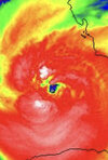
The hurricane continues to have an impressive appearance on satellite imagery, exhibiting considerable deep convection with
numerous cloud tops colder than -80C. An Air Force Hurricane Hunter Aircraft recently penetrated the center and found that the central pressure had not fallen since earlier this evening. Based on a blend of SFMR-observed surface winds and 700 mb flight-level winds from the Air Force plane, the current intensity is held at
105 kt for now.
Ian has turned slightly to the right and the initial motion is now 015/9 kt. Over the next couple of days, the tropical cyclone should move between the western edge of a subtropical high pressure system and a broad trough over the eastern United States. The dynamical model consensus, TVCN, prediction has again shifted a little to the east, and is just slightly slower on this cycle. Therefore the official track forecast has, again, been shifted a few degrees to the east of the one. This does not require any change the watches and warnings over Florida at this time.
Ian's outflow is being restricted over the southwestern portion of its circulation by southwesterly upper-tropospheric flow over the
Gulf of Mexico. Vertical shear over the hurricane is likely to increase up through landfall. The SHIPS guidance and water vapor imagery suggest that there will also be some dry mid-level air in the vicinity. However, it is expected that this large system will be fairly resilient to the shear and dry air before landfall. Therefore, the official intensity forecast continues to show Ian
reaching the coast with category 4 intensity. Since radar imagery indicates that an eyewall replacement is probably underway, this
could result in a larger eye evolving overnight. Interests along the Florida west coast in the Hurricane Warning area should be
prepared for a large and destructive hurricane, and residents in this area should heed the advice of emergency management officials.
Users are reminded to not focus on the exact forecast track as some additional adjustments to the track are possible, and significant
wind, storm surge, and rainfall hazards will extend far from the center.
Key Messages:
1. Life-threatening storm surge is expected along the Florida west
coast where a storm surge warning is in effect, with the highest
risk from Naples to the Sarasota region. Residents in these areas
should listen to advice given by local officials and follow any
evacuation orders for your area.
2. Hurricane-force winds are expected in the hurricane warning area
in southwest and west-central Florida beginning Wednesday morning
with tropical storm conditions expected overnight. Devastating wind
damage is expected near the core of Ian. Residents should rush all
preparations to completion.
3. Heavy rainfall will spread across the Florida peninsula through
Thursday and reach portions of the Southeast later this week and
this weekend. Catastrophic flooding is expected across portions of
central Florida with considerable flooding in southern Florida,
northern Florida, southeastern Georgia and coastal South Carolina.
Widespread, prolonged moderate to major river flooding expected
across central Florida.
FORECAST POSITIONS AND MAX WINDS
INIT 28/0300Z 24.9N 82.9W 105 KT 120 MPH
12H 28/1200Z 26.0N 82.5W 115 KT 130 MPH
24H 29/0000Z 27.2N 81.9W 110 KT 125 MPH...INLAND
36H 29/1200Z 28.2N 81.4W 60 KT 70 MPH...INLAND
48H 30/0000Z 29.3N 80.8W 45 KT 50 MPH...OVER WATER
60H 30/1200Z 30.6N 80.8W 45 KT 50 MPH
72H 01/0000Z 32.7N 81.2W 30 KT 35 MPH...INLAND
96H 02/0000Z 36.0N 82.5W 25 KT 30 MPH...POST-TROP/INLAND
120H 03/0000Z...DISSIPATED
$$
Forecaster Pasch
Not really much change from 5pm on the track… maybe a bit further out over the Atlantic but a sharper turn back NNW.
Nerman
Member
Yeah Charley devastated Port Charlotte and Ian could be worse. A strengthening Cat 4 this far south is going to surprise a lot of people.Isn't that where Charley hit ?
Nerman
Member
It shows a Major going inland now where earlier it just had it as a HurricaneNot really much change from 5pm on the track… maybe a bit further out over the Atlantic but a sharper turn back NNW.
Yeah I just caught that. I guess they are basing that on the EWRC being as clean and quick as it was with the inner core quickly recoveredIt shows a Major going inland now where earlier it just had it as a Hurricane
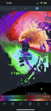
Echo tops really getting higher in the west and NW eyewall.
Wow
Almost to Sarasota
JHS
Member
Into the Atlantic moving east at hour 57 on the GFS. Comes out near the Space Center.
Eyewall rapidly strengthening.


