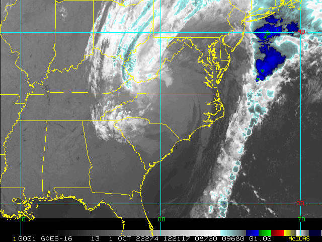
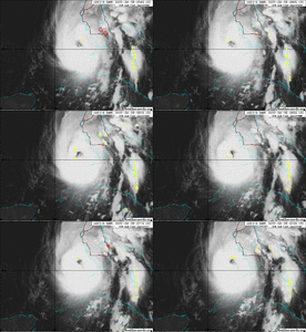
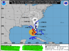
He lookin very raggedy on that satellite presentation! ?
-
Hello, please take a minute to check out our awesome content, contributed by the wonderful members of our community. We hope you'll add your own thoughts and opinions by making a free account!
You are using an out of date browser. It may not display this or other websites correctly.
You should upgrade or use an alternative browser.
You should upgrade or use an alternative browser.
Tropical Hurricane Ian
- Thread starter severestorm
- Start date
-
- Tags
- tropical
IR AND WATERVAPOR STILL SHOWING A STRONG CANE WITH NO DRY AIR FROM WHAT I CAN SEE
iGRXY
Member
Yeah there’s no dry air wrapping in this storm right now.
Belle Lechat
Member
- Joined
- Aug 29, 2021
- Messages
- 1,100
- Reaction score
- 847
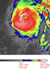
Time : 065020 UTC
Lat : 25:35:24 N Lon : 82:46:47 W
CI# /Pressure/ Vmax
6.7 / 927mb / 132kts
Final T# Adj T# Raw T#
6.7 7.2 7.2
I'm not really knowledgeable about this, how they get the pressure readings.

Lat : 25:35:24 N Lon : 82:46:47 W
CI# /Pressure/ Vmax
6.7 / 927mb / 132kts
Final T# Adj T# Raw T#
6.7 7.2 7.2
I'm not really knowledgeable about this, how they get the pressure readings.
Belle Lechat
Member
- Joined
- Aug 29, 2021
- Messages
- 1,100
- Reaction score
- 847
Time : 072020 UTC
Lat : 25:41:24 N Lon : 82:53:23 W
CI# /Pressure/ Vmax
6.8 (+.1) / 925mb (-2) / 135kts (+3)
Final T# Adj T# Raw T#
6.8 (+.1) 7.0 (-.2) 7.0 (-.2)
Lat : 25:41:24 N Lon : 82:53:23 W
CI# /Pressure/ Vmax
6.8 (+.1) / 925mb (-2) / 135kts (+3)
Final T# Adj T# Raw T#
6.8 (+.1) 7.0 (-.2) 7.0 (-.2)
Pressure is down
Seeing a pressure 939.9 in dropsound but I think they chose to go with 942 officially .. still 10 mb lower from last official reading .. good lord
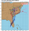
06z NAM with strengthening 964mb off the SC coast vs 990mb same time last run. It's probably crazy though.
Edit: 3KM NAM completely different all the way around, weak etc. Tracks into Southern GA.
Edit: 3KM NAM completely different all the way around, weak etc. Tracks into Southern GA.
I agree, though I will say these guidance plots seem to be fairly consistent since yesterday at 12z with obviously the normal 30-40 mile waffle back and forth from run to run. Also looking at the water vapor it appears to be a bit more on a due north heading for the last little while… could just be a wobble, but I know the latest HWRF was back to a landfall close to Tampa againMight see another eastward shift with track forecast as NHC track is on west side of guidance
View attachment 122374
Fountainguy97
Member
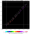
141 kt flight level winds … jesus
HDGator
Member
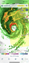
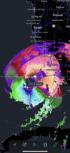
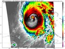
Ian is making a legit run for cat 5. If the eye can clear and these towers continue to fire he may just get there.
View attachment 122375View attachment 122376
140 kt FL in the northeast eyewall.
Ian has been busy the last few hours.
Category 4. 140 mph
Been driving all night no sleep. No fun finally almost to Tampa

