• Hello, please take a minute to check out our awesome content, contributed by the wonderful members of our community. We hope you'll add your own thoughts and opinions by making a free account!

Tropical Hurricane Ian

Hot towers once again right over the center, looking a little better inner core on vis sat and Cuban radar (just coming into sight), let's see if this deep convection can sustain.
 
The ensembles trend west today is undeniable. Where this thing crosses Cuba is going to play a big impact as well. If it continues west of a northerly track, and takes it time across the western tip of Cuba, its going to miss the effects of the trough almost entirely. It may even slow enough that it doesnt get shredded along the northern Gulf coast.....so much left to be ironed out!
 
Things that hold the most credence.. ensembles and hurricane models.. these ensembles are meant to build confidence on general agreement of where things are headed and hurricane models are built for .. well hurricanes.. things like the nam and operational models are really not much help in getting the clear picture
 
The ensembles trend west today is undeniable. Where this thing crosses Cuba is going to play a big impact as well. If it continues west of a northerly track, and takes it time across the western tip of Cuba, its going to miss the effects of the trough almost entirely. It may even slow enough that it doesnt get shredded along the northern Gulf coast.....so much left to be ironed out!
It slowing down will not have an impact on shears effects on the storm.. sheer and dry air will entrain into the system causing weakening to occur before hitting anywhere along the coast. Pretty confident about that.. earlier landfall at a closer location will mean a higher chance of getting a stronger storm to hit. If it slows down that will also create upwelling which will also help to weaken the storm.
 
I am going to go with what this guy says about potential strength/intensification of this storm. It is and will get its act together, it makes no sense not to.. but we'll see I spose'.

 
The ensembles trend west today is undeniable. Where this thing crosses Cuba is going to play a big impact as well. If it continues west of a northerly track, and takes it time across the western tip of Cuba, its going to miss the effects of the trough almost entirely. It may even slow enough that it doesnt get shredded along the northern Gulf coast.....so much left to be ironed out!
It’s gonna get shredded. The trough aloft across the gulf actually gets stronger as the week progresses.
 
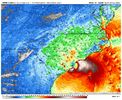
The most interesting kind of tip where the models are showing their hand of what might be realistic is when both the icon and gfs really start dropping pressure in the GoM the system starts leaning right with its track as it feels the weakness and may be directed east of North by the 500-250 layer while a slightly weaker system may continue due north as the 700-500 flow is more S->N or even SSE->NNW
 
Just a few ?s I have:

Why do the icon and gfs drop sfc pressure west of FL? Is that why they turn E?
What's the deal with the convective explosion north of the Bahamas on the gfs/icon is that why they turn E?
Are the answers to the questions above why the cmc stays due north?
Why does the uk beat the WAR back so much the system gets into the Atlantic before resuming a northward motion?
How does the upper level system north of the islands racing west affect the track if at all?
 
It slowing down will not have an impact on shears effects on the storm.. sheer and dry air will entrain into the system causing weakening to occur before hitting anywhere along the coast. Pretty confident about that.. earlier landfall at a closer location will mean a higher chance of getting a stronger storm to hit. If it slows down that will also create upwelling which will also help to weaken the storm.
Slowing down allows for retrograding of the cold front associated with the trough, minimizing the shear/dry air effects......by how much is the question. Maybe minimal, maybe not.
 
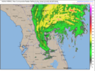
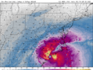
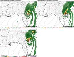
Just realized that the HMON maybe the worst and strongest landfall of any model yet in Florida with 120knts.

Probably not right, but shows how much location will impact landfall. The HWRF looks like it’s stalling and rotting across the NE GOM.
 
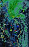
The Isle of Youth is gonna get scary close to having the center pass over it.....the NHC cone has the very western edge in the cone. Imagine things are going to get sporty there the next few hrs.
 
Just a few ?s I have:

Why do the icon and gfs drop sfc pressure west of FL? Is that why they turn E?
What's the deal with the convective explosion north of the Bahamas on the gfs/icon is that why they turn E?
Are the answers to the questions above why the cmc stays due north?
Why does the uk beat the WAR back so much the system gets into the Atlantic before resuming a northward motion?
How does the upper level system north of the islands racing west affect the track if at all?
So many moving parts here.
 
Back
Top