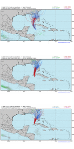
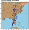
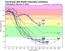
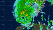
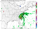
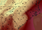
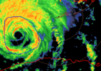
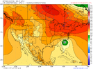
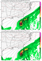
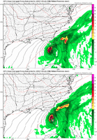
Pretty classic along and LOT heavy rain setup. You probably do better than the Euro has, we probably all do. Dry slot looks like it kicks in for much of NC and Central/eastern SC but that's likely to be accompanied by low topped bands of convection in the afternoon leading to localized high 4-6 inch amounts. The real key for us will be how quickly we can overcome the residual wedge and go to town with rain and any mesoscale enhancements and banding from the retreating mid level trough/fgen and any sfc convergence along the retreating coastal front. 1-2 from the euro is probably too low I'd guess a widespread 2-4 is more reasonable for much of NC
-
Hello, please take a minute to check out our awesome content, contributed by the wonderful members of our community. We hope you'll add your own thoughts and opinions by making a free account!
You are using an out of date browser. It may not display this or other websites correctly.
You should upgrade or use an alternative browser.
You should upgrade or use an alternative browser.
Tropical Hurricane Ian
- Thread starter severestorm
- Start date
-
- Tags
- tropical
Shaggy
Member
Yeah looking at his current position compared to that first ens he is to the east of almost every memberEPS trends...really can't trust anything past 36 hours. Can't recall EPS shifting this much at this range.
View attachment 122305
Henry2326
Member
I think we have seen shifts with the track like this more and more often the past few years.EPS trends...really can't trust anything past 36 hours. Can't recall EPS shifting this much at this range.
View attachment 122305
smast16
Member
We really haven’t…this is one of the few impactful storms that the NHC has been significantly off on the track inside 5 days in the last few years. For they most part, there tracks five days out have ended up being within 50 miles of the landfall pointI think we have seen shifts with the track like this more and more often the past few years.
And it happens again. Same as the past few years.
Yeah and those brighter returns are starting to wrap back around to the west of the eye… wouldn’t be suprised to see a couple wobbles to the NNW in the next few hours
With regards to the track and the difficulty with prediction....when is the last time we had a true air mass changing trough envelop the Eastern half of the continent this time of year while a significant TC was approaching from it's "normal" shoot the gap spot? Just a thought, who knows?
This is actually a great point…as has been pointed out, there are a lot of things about this storm that just seem to be out of the ordinary which I’m sure makes forecasting it, that much more difficult. This may actually be the set up that puts a landfall of a hurricane on the GA coast… some models are very close to doing just that.With regards to the track and the difficulty with prediction....when is the last time we had a true air mass changing trough envelop the Eastern half of the continent this time of year while a significant TC was approaching from it's "normal" shoot the gap spot? Just a thought, who knows?
Shaggy
Member
Yeah yeah I know it's the nam but it is gonna exit Florida right on cape Canavrral
I don't remember a lot that were chasing the tail of the trough then getting steer back west by the rebuilding WAR. Systems like Matthew, Wilma, sandy, hazel, Charley were all typically on the front end of troughs or between.This is actually a great point…as has been pointed out, there are a lot of things about this storm that just seem to be out of the ordinary which I’m sure makes forecasting it, that much more difficult. This may actually be the set up that puts a landfall of a hurricane on the GA coast… some models are very close to doing just that.
Henry2326
Member
It's been doing that the last couple of cycles.Yeah yeah I know it's the nam but it is gonna exit Florida right on cape Canavrral
- Joined
- Jan 23, 2021
- Messages
- 4,577
- Reaction score
- 15,106
- Location
- Lebanon Township, Durham County NC
NAM landfalls in Georgetown this run. Around 965-970 and heads up into the pee dee.
Henry2326
Member
- Joined
- Jan 23, 2021
- Messages
- 4,577
- Reaction score
- 15,106
- Location
- Lebanon Township, Durham County NC
Likely *overdone* but NAM shows hurricane force gusts in the triad.
Loganville Winter
Member
With regards to the track and the difficulty with prediction....when is the last time we had a true air mass changing trough envelop the Eastern half of the continent this time of year while a significant TC was approaching from it's "normal" shoot the gap spot? Just a thought, who knows?
This is very true. Early season hurricane set up timing a late season like front. People speed reading through the record books as we post.
Sent from my iPhone using Tapatalk
Henry2326
Member
Icon was at 965....its in the zip code.Likely *overdone* but NAM shows hurricane force gusts in the triad.
I would expect with the jet dynamics coming in from the west that that rain shield will expand further west as the NAM gets closer.
Taylor C
Member
You can see the secondary eyewall taking shape here
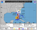
New come at 5pm update, considerable NW lean to the come from NHC
severestorm
Member
GoDuke
Member
Dry air?
Heelyes
Member
This thing is not gonna cross Florida and come out the other side. It’s just not going to happen.
Henry2326
Member
5 pm discussion
This new NHC track
is close to the corrected model consensus and between the quicker
ECMWF and slower GFS models. It should be emphasized that this
track remains uncertain, with a typical spread in the steering
features leading to big speed and track differences down the line,
not to mention the oblique angle of approach to Florida.
In a few
days, more of the guidance is showing Ian interacting with a
shortwave trough over the southeastern United States, causing the
system to move back over the northwestern Atlantic in the longer
range, before turning northwestward back over land. The day 3-5
track forecast is also shifted eastward, although significant
re-strengthening is not expected at long range.
FORECAST POSITIONS AND MAX WINDS
INIT 27/2100Z 24.0N 83.2W 105 KT 120 MPH
12H 28/0600Z 25.3N 82.9W 115 KT 130 MPH
24H 28/1800Z 26.6N 82.5W 115 KT 130 MPH
36H 29/0600Z 27.6N 82.0W 70 KT 80 MPH...INLAND
48H 29/1800Z 28.5N 81.5W 55 KT 65 MPH...INLAND
60H 30/0600Z 29.4N 81.2W 45 KT 50 MPH...INLAND
72H 30/1800Z 31.0N 81.1W 45 KT 50 MPH...OVER WATER
96H 01/1800Z 34.5N 82.0W 25 KT 30 MPH...POST-TROP/EXTRATROP
120H 02/1800Z...DISSIPATED
iGRXY
Member
New eyewall. It’s going through a replacement cycleDry air?
Henry2326
Member
Sometimes they never recover and the eye stays big, I wouldn’t be suprised if it peaks at 130 mphNew eyewall. It’s going through a replacement cycle
Lots of shear to the NW of the storm
Henry2326
Member
Looks like Charleston
- Joined
- Jan 23, 2021
- Messages
- 4,577
- Reaction score
- 15,106
- Location
- Lebanon Township, Durham County NC
Wow.
Nerman
Member
NHC calling for strengthening Cat 4 into landfall now
New eyewall. It’s going through a replacement cycle
Yep, remnants of the original SW portion are pretty much done, a little bit of a moot to clear out but new maxima about 35 miles SW of the center is taking over. Certainly appears to be one the cleaner ERCs we have seen on radar, often times the remnants bounce around and disrupt the core significantly for a period, the NW side being firmly rooted in the heavier convection helped here.
Actually where the shear is located in relation to the storm, it could actually help to vent the outflow and aide in strengtheningSometimes they never recover and the eye stays big, I wouldn’t be suprised if it peaks at 130 mph
Lots of shear to the NW of the storm
Cary_Snow95
Member
Nerman
Member
Port Charlotte, Cape Coral, Fort Myers could all be getting the biggest storm surge they've had since 1960
Cary_Snow95
Member

