-
Hello, please take a minute to check out our awesome content, contributed by the wonderful members of our community. We hope you'll add your own thoughts and opinions by making a free account!
You are using an out of date browser. It may not display this or other websites correctly.
You should upgrade or use an alternative browser.
You should upgrade or use an alternative browser.
Tropical Hurricane Ian
- Thread starter severestorm
- Start date
-
- Tags
- tropical
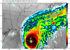
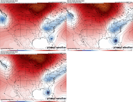
Looks like the GFS landfalls the corpse into the big bend, SE of 18z.
Def a bit EAST in the GOM vs the 18z and 12z runs. Very strong coming into the GOM and slowly weakening over N GOM
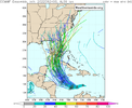
Still GFS vs EURO camp.
Still GFS vs EURO camp.
Considering the fact that the GFS is thinking that a cold front can steer a tropical cyclone, I'm going with the Euro camp for now.Def a bit EAST in the GOM vs the 18z and 12z runs. Very strong coming into the GOM and slowly weakening over N GOM
Still GFS vs EURO camp.
weatherboyy
Member
Canadian leftmost outlier..landfalls in Panama City Beach
Well the GEFS tells us that the GFS has completely figured it out.
Amazing model.
Amazing model.
IR is starting to light up, about to start seeing some progress.
Taylor C
Member
I hope this stays making landfall during daytime hours. I’m ready for daylight views of the storm’s fury.
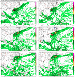
Looks like OP Euro may have a substantial shift. Still goes into FL, but grinds through and much slower instead of going immediately off the coast from what I see.
bad maps, though. high def soon
bad maps, though. high def soon
DadOfJax
Member
Well that was completely wrongThis is coming together North of Forecast. Take a look at the lightening data. The energy is clearly focusing to the N and NW of TD9. The SW convection and vorticity isn't going to survive long enough to pull this storm back down to 13.5-14N. The 18z Initialization is more NE than every GEFS member, and I believe the system is actually at 15N near that big area of lightening. I also think we have a quickly organizing Tropical System at the moment, and I would not be surprised if this is a 65MPH TS in 12 Hours.
View attachment 121882ter.php?stormid=AL092022
The GFS solution of reformation is definitely off the table now.
Henry2326
Member
Henry2326
Member
Tropical Storm Ian Discussion Number 5
NWS National Hurricane Center Miami FL AL092022
500 AM EDT Sat Sep 24 2022
Ian is still being affected by some north-northeasterly, however
short-wave infrared imagery suggests that the center is located
beneath the eastern edge of the colder convective cloud tops.
Deep convection over the western portion of the circulation has
increased overnight but there is still little banding evident in
conventional satellite imagery. Subjective Dvorak satellite
classifications from TAFB and SAB, and objective estimates from
UW-CIMSS have changed little this cycle, but given that the center
is more involved with the deep convection, the initial intensity
has been increased to 40 kt, which is between the objective
estimates and a TAFB Dvorak T-number of 3.0 or 45 kt.
A NOAA Hurricane Hunter aircraft is scheduled to investigate Ian this morning, and should provide additional data on Ian's structure
and intensity.
Recent satellite fixes indicate that Ian has turned westward
(270/12 kt) overnight to the south of a narrow ridge centered
near Hispaniola. By early Sunday, Ian is expected to reach the
western portion of the ridge, and the storm should turn
west-northwestward, and then northwestward over the northwestern
Caribbean in 36 to 48 hours. After that time, Ian is forecast to
turn north-northwestward and northward around the western portion
of the ridge. This will bring Ian near or over Western Cuba and
into the southeastern Gulf of Mexico. Late in the period, the
guidance indicates the storm will begin to recurve toward Florida.
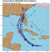
As mentioned before, the track models are in general agreement with
this scenario, however there is a large amount of cross-track
spread at 72 hours and beyond. In fact, the east-west spread in
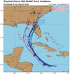
the guidance at 96 hours is about 180 n mi, with the CTCI and ECMWF along the eastern side of the envelope, and the GFS, HWRF, and GFS ensemble mean along the western side.
The overall guidance envelope has shifted slightly westward this cycle, and the NHC track has been nudged in that direction and lies just east of the various consensus aids. Given the spread in the guidance, and the still shifting dynamical models, additional adjustments to the track forecast may be needed in subsequent advisories. Users are Reminded that the long-term average NHC 4- and 5-day track errors are around 150 and 200 n mi, respectively.
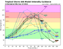
The shear that has been plaguing Ian is forecast to continue to
decrease over the next day or two while the cyclone moves over the
warm waters of the central and northwestern Caribbean Sea. This
should allow for strengthening, with steady to rapid
intensification (RI) quite possible once an inner core becomes
established. Although the updated NHC forecast is just shy of
forecasting RI (30 kt or greater increase over 24 h) during any 24-h
period over the next few days, it calls a 45-kt increase in wind
speed between 24 and 72 hours, and Ian is likely to be near major
hurricane intensity when it approaches western Cuba. Since Ian is
not expected to remain over Cuba long, little weakening is expected
due to that land interaction, and the forecast again shows Ian as a
major hurricane over the eastern Gulf when it is approaching the
west coast of Florida.
Yet another westward jump by the 06Z GFS. It weakens from here as it slowly pushes NNE to Apalachicola.


Some tree snapper gust under these 5000' winds into Ga. too verbatim.


Blue_Ridge_Escarpment
Member
Dang what a westward shift in the models overnight and the last 24 hours.
Def a little west trend in models. Looks like they are slowing a little bit slower Ian and that would help to miss that trof and landfall further north over FL and should be weaker. Plenty of time left for sure.
Shocking that the models would overdo an eastern trough 5 days out...not.Def a little west trend in models. Looks like they are slowing a little bit slower Ian and that would help to miss that trof and landfall further north over FL and should be weaker. Plenty of time left for sure.
A sobering reminder for when the epic 5-day snowstorms this winter wind up in the Ohio Valley lol.
Blue_Ridge_Escarpment
Member
When I made the comment the other day if the NW trend was only applicable in the winter it was tongue in cheek but also knew in my mind, I’ve seen this movie waaaaay too many times.Shocking that the models would overdo an eastern trough 5 days out...not.
A sobering reminder for when the epic 5-day snowstorms this winter wind up in the Ohio Valley lol.
And just like winter, we're left with a CAD rain along with a miserable NE wind to chill ya to the bone.When I made the comment the other day if the NW trend was only applicable in the winter it was tongue in cheek but also knew in my mind, I’ve seen this movie waaaaay too many times.
Well, that's an interesting-looking satellite pic. Best looking fake eye I think I've ever seen.


Good! We need it!And just like winter, we're left with a CAD rain along with a miserable NE wind to chill ya to the bone.
lexxnchloe
Member
Im hoping it just gets stuck in the GOM and dies out. Sunny is better than rain.
Clearly still a long way to go here but looking more likely the SE in general will deal with a bigger flood threat than anything from this
Overnight, shear has been replaced with outflow in every quadrant. As has been modeled, once a core consolidates, it's clear it's bombs away.
Winds are still light and I think LLC is still messy. Recon kind of agrees. It will be interesting to see
Where a LLC can truly take ownership and where that is within the convection will be super key for track as well.
Where a LLC can truly take ownership and where that is within the convection will be super key for track as well.
Man waking up to see that a sheared TC is finally surrounded by convection is like running into an old high school friend at the bar who was a loser then but got it together and has a nice job and a girlfriend now. Proud of you ian ?
iGRXY
Member
I love the EURO and EPS just as much as the next guy and 9/10 times you’re smart to go with that but when those 2 were clearly the furthest eastern outliers especially compared to the hurricane models/spaghetti graphs, I think it was safe to say that the GFS may have been on to something with the more western track. Especially when it was showing deep slow moving troughs that let’s face it, rarely materializes here. Still plenty of time to see changes and I could see a slight tick to the east but it appears the big bend to down around Tampa look prime for a landfall then a quick turn to the N and NW
I agree.....I only say be careful, because the hurricane models run off the GFS conditions *I am pretty sure* someone correct me if I am wrong please.I love the EURO and EPS just as much as the next guy and 9/10 times you’re smart to go with that but when those 2 were clearly the furthest eastern outliers especially compared to the hurricane models/spaghetti graphs, I think it was safe to say that the GFS may have been on to something with the more western track. Especially when it was showing deep slow moving troughs that let’s face it, rarely materializes here. Still plenty of time to see changes and I could see a slight tick to the east but it appears the big bend to down around Tampa look prime for a landfall then a quick turn to the N and NW
Blue_Ridge_Escarpment
Member
I think something near 15N could take over the center at some point today.
BHS1975
Member
The UK met has nailed tracks in the past and looks like it may nail this one.
Sent from my iPhone using Tapatalk
Sent from my iPhone using Tapatalk
The only thing I’m confused about is the idea that with this western shift the storm should be weaker. Why? Just days ago this was forecasted to be a major hurricane anywhere in the gulf? Why now all the sudden it has shear to deal with?
I haven't studied the naps, but my guess is shear.The only thing I’m confused about is the idea that with this western shift the storm should be weaker. Why? Just days ago this was forecasted to be a major hurricane anywhere in the gulf? Why now all the sudden it has shear to deal with?
There is a LOT of very cool dry and stable air to be ingested if it landfalls on the northern gulf coast.The only thing I’m confused about is the idea that with this western shift the storm should be weaker. Why? Just days ago this was forecasted to be a major hurricane anywhere in the gulf? Why now all the sudden it has shear to deal with?

Henry2326
Member
A NOAA Hurricane Hunter aircraft is scheduled to investigate Ian this morning, and should provide additional data on Ian's structure
and intensity.
and intensity.

