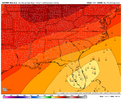
Definitely a possibility. IMO it’s a little early for a call as there are a lot of wrinkles to be ironed out. Will be bad for whoever gets the initial landfall if intensity is close to being modeled correctly. I know the Carolinas could sure use the rain but my wishing has never led to being correct in the end.Somewhere along the FL panhandle.
-
Hello, please take a minute to check out our awesome content, contributed by the wonderful members of our community. We hope you'll add your own thoughts and opinions by making a free account!
You are using an out of date browser. It may not display this or other websites correctly.
You should upgrade or use an alternative browser.
You should upgrade or use an alternative browser.
Tropical Hurricane Ian
- Thread starter severestorm
- Start date
-
- Tags
- tropical
The HWRF depicts two LLCs with the SW circulation becoming dominant while the LLC we've been watching in visible sat slides to the NW and dissipates.


Something crazy is it may not even be a hurricane at landfall on the 18z GFS, but a tropical storm. Would definitely look like a hybrid on satellite and radar.
stboo6
Member
per my young daughter working/living in Fort Myers water is sold out.I'm gong with EPS. The model has been much closer to reality over the last 6 Hours, and I suspect we'll see more northern forecast points. The 500Mb vorticity is actually getting influenced to the north per latest maps. I can clearly see the system getting stacked on Satellite, because the both the LLC and MLC are converging from two opposite directions.
I actually hope those eastern solutions are correct, because people are not prepared. I got my supplies like waters and batteries at 8AM. I actually panicked a few people that so me rolling out 12 cases of water. lol. This is going to be a very bad system for the new transplants.
View attachment 121883
If it doesn’t make landfall until it’s up to the panhandle, that would be a distinct possibility… though I would suspect we would be dealing with a hybrid that still is equivalent strength of a category 1, like Sandy was. The problem with that is that while you may not have as strong a storm, the effects would be spread over a much wider areaSomething crazy is it may not even be a hurricane at landfall on the 18z GFS, but a tropical storm. Would definitely look like a hybrid on satellite and radar.
I’m not even sure that would be the case. Winds at 850mb quickly wind down as well. Probably some gusty winds inland and some heavy rain to the north and Northwest of the center, but doesn’t look like a huge deal.If it doesn’t make landfall until it’s up to the panhandle, that would be a distinct possibility… though I would suspect we would be dealing with a hybrid that still is equivalent strength of a category 1, like Sandy was. The problem with that is that while you may not have as strong a storm, the effects would be spread over a much wider area
True if the GFS is taken verbatim on this. However, it has had issues in the past of resolving the effects of tropical systems being absorbed into troughs. Just something to keep in an eye on as this gets closerI’m not even sure that would be the case. Winds at 850mb quickly wind down as well. Probably some gusty winds inland and some heavy rain to the north and Northwest of the center, but doesn’t look like a huge deal.
View attachment 121905
severestorm
Member
shearOk why are we talking about a weak hurricane when just earlier today we were talking about major?
As he said above shear and a boatload of dry/stable air. A major hurricane hit is still very much on the table, but it will depend of landfall location. A hit on central FL is much more environmentally conducive to a major hurricane hit, but should the track veer toward the panhandle, that chance drops substantially.Ok why are we talking about a weak hurricane when just earlier today we were talking about major?
If it goes by the GFS solution, it would sent into higher wind shear in the northern Gulf of Mexico but if it goes by the Euro solution, it will experience less wind shear before landfall and will potentially still be a intensifying major hurricane upon landfall.Ok why are we talking about a weak hurricane when just earlier today we were talking about major?
This will still become imo a major hurricane the question is where does it go past Cuba. If east towards a landfall on SW Florida coast I would expect a major hurricane landfall.. if it stays west over the eastern gulf I would expect strengthening but an eventual weakening trend as it starts to feel the impacts of shear from the trough more. Still I believe where ever this goes there will be high impacts in terms of a possible tornado threat and obvious flooding threat for a lot of the SE especially along the track on the storm.Ok why are we talking about a weak hurricane when just earlier today we were talking about major?
I’ve been wondering since that 18z GFS came out earlier, what kind of effect the sharp contrast in airmasses would have on the tornado potential. You always watch the right front quadrant of a landfalling system and the GFS has dewpoints in the 40s quickly going to dewpoints in the 70s over an extremely short distance. What are your thoughts?This will still become imo a major hurricane the question is where does it go past Cuba. If east towards a landfall on SW Florida coast I would expect a major hurricane landfall.. if it stays west over the eastern gulf I would expect strengthening but an eventual weakening trend as it starts to feel the impacts of shear from the trough more. Still I believe where ever this goes there will be high impacts in terms of a possible tornado threat and obvious flooding threat for a lot of the SE especially along the track on the storm.
That actually looks like more members to the west.
AL, 09, 2022092400, , BEST, 0, 148N, 715W, 35, 1005, TS
Ian at 11.
Ian at 11.
So fun fact, if this storm makes landfall as a hurricane, it would be the third straight year that a I named made landfall in the US as a hurricane.
metfascination
Member
Why;would you cancel? Trip of a lifetime
Couldn’t convince the other party to go down and ride out a storm

Sent from my iPhone using Tapatalk
HugeSnowStick
Member
Atl could be smashed with that track..I’m not even sure that would be the case. Winds at 850mb quickly wind down as well. Probably some gusty winds inland and some heavy rain to the north and Northwest of the center, but doesn’t look like a huge deal.
View attachment 121905
I would highly suggest rescheduling. My wife and I have been twice…both times in mid February and it’s absolutely gorgeousCouldn’t convince the other party to go down and ride out a storm
Sent from my iPhone using Tapatalk
- Joined
- Jan 23, 2021
- Messages
- 4,602
- Reaction score
- 15,196
- Location
- Lebanon Township, Durham County NC
Not without a hell of a lot more forward speedAtl could be smashed with that track..
Henry2326
Member
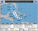
I don’t think they make any changes to the forecast cone until the 11pm advisory. I think the 8am/pm advisories keep the same forecast cone as the 5pm/am advisories.8 pm NHC....hanging with their story.
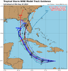
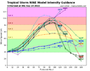
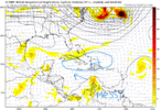
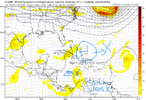
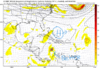
00z models.....more confidence.
View attachment 121909
View attachment 121910
View attachment 121911
Shaggy
Member
Pretty clear indication this isn't gonna be much as it runs the gulf or the east coast depending on track. Initial landfall if central or southern Florida will be bad though8 pm NHC....hanging with their story.
00z models.....more confidence.
View attachment 121909
View attachment 121910
View attachment 121911
- Joined
- Jan 23, 2021
- Messages
- 4,602
- Reaction score
- 15,196
- Location
- Lebanon Township, Durham County NC
I will say this with confidence….. panhandle landfall=weaker cane
Central or S FL landfall= possible major
Central or S FL landfall= possible major
Man this is incorrect.Pretty clear indication this isn't gonna be much as it runs the gulf or the east coast depending on track. Initial landfall if central or southern Florida will be bad though
Taylor C
Member
00z tropical intensity models show as follows:
7am CST Sunday= tropical storm
7pm CST Sunday= tropical storm nearing hurricane strength
7am CST Monday= category 1
7pm CST Monday= category 2
7am CST Tuesday= category 3
7pm CST Tuesday= category 3
7am CST Wednesday= category 3
7pm CST Wednesday= weakening
7am CST Sunday= tropical storm
7pm CST Sunday= tropical storm nearing hurricane strength
7am CST Monday= category 1
7pm CST Monday= category 2
7am CST Tuesday= category 3
7pm CST Tuesday= category 3
7am CST Wednesday= category 3
7pm CST Wednesday= weakening
Now Ian!
Shear definitely decreasing now.
Shaggy
Member
Found this to be am interesting tidbit.
The track models
agree on this general scenario, and the guidance envelope is
flanked by the major global models, with the ECMWF taking a route
over South Florida and the GFS farther west, remaining over the
eastern Gulf of Mexico by day 5. The new NHC forecast lies between
these two scenarios and is not much different from the previous
forecast. The GFS and ECMWF ensembles both show a similar amount
of spread as the deterministic guidance, but both ensemble means
are close to the multi-model consensus aids, which helps to give
more credence to the position of the official forecast.
I agree!Shear definitely decreasing now.
Man what the hell is recon doing right now, is it movie night at the base
Brent
Member
Man what the hell is recon doing right now, is it movie night at the base
I know it had mechanical issues earlier. Those planes are so old
iGRXY
Member
Through 33 the GFS is a touch weaker and southeast of 18z
Major hurricane at landfall? Didn't expect that with the curve into FL instead of going further in the Gulf.
Last edited:

