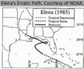
I believe Elena in the mid 80s… I think in ‘85 to be exact, had temperatures in the 50s in the Carolinas as it moved into the Florida panhandle and then up inland through GA and the Carolinas. That storm was in November though and only a few days before ThanksgivingHasn't this happened before? At least in NC
Sent from my LM-Q730 using Tapatalk
-
Hello, please take a minute to check out our awesome content, contributed by the wonderful members of our community. We hope you'll add your own thoughts and opinions by making a free account!
You are using an out of date browser. It may not display this or other websites correctly.
You should upgrade or use an alternative browser.
You should upgrade or use an alternative browser.
Tropical Hurricane Ian
- Thread starter severestorm
- Start date
-
- Tags
- tropical
You must have been to iowa!? They won’t let the Birkenstock’s rest until about November and it’s so stupid!Bet he wears white socks with sandals.
Hope the West track continues, so it can save Shetleys grass! And seriously give all y’all some rain
Banter guys
Close to LF around Fort Myers, trough might leave it behind too...
This probably gonna be real close to 2nd landfall along NC coast
Tornadocane
Member
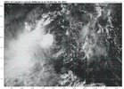
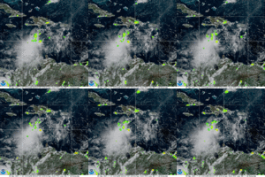
COC is now jumping into the convection at 15N, 70.8W. Broad Circulation is stretching to the W to SW under that Ball of Convection. The 950-700Mb Vorticity Map seems to demonstrate that the 700Mb has shifted to the N and NE. You can see the spin within the convection is starting to become more vigorous nearer to the COC, and SW convection near 73W is dying. The outflow is also starting to look better from NW to the SE of the system. This is starting to organize, and will continue to do so as it move away from the shear. https://www.tropicaltidbits.com/sat/satlooper.php?region=09L&product=vis

Shaggy
Member
taking a blend of the euro/gfs this would feasibly ride the entire Florida pennisula
Giddy up lol


NoSnowATL
Member
Banter guys. # TeamMetGetsoneGiddy up lol

Shaggy
Member
windfield distribution?Giddy up lol

Don't think I was discussing sandals with white socks, etc #haterBanter guys. # TeamMetGetsone
Now whether any of this mixes to the surface, idk.... it's just the Euro has been hinting at this bend back west with 2nd landfall off and on nowwindfield distribution?

Shaggy
Member
Fiona now moving northeast at almost 40mph so her effects on 9 should start to lessen quickly
NoSnowATL
Member
Hey I’m on your team. Let’s do this.Don't think I was discussing sandals with white socks, etc #hater
These swings aren't really that wild they just look incredibly dramatic bc of the shape of FL imoThis could end up as as LA hit, or even more west! These wild run to run swings just mean there are a lot of tiny variables, that can lead to major changes, if the trough misses it, anything in the gulf is possible, IMO
Stormsfury
Member
Yeah I think you're right. Ironically, had we evacuated, Gastonia was our landing spot and I know Gastonia had 100mph wind gusts there that morning.Yes, my mistake! I was in Gastonia. I remember it being cold and rainy at some point and still being without power, it could of been a week after! ??
Yep and even up here, 7 days out a couple hundred miles isn't huge just huge implications for sensible weather. Euro back to solid rain event, some gust but probably big time Tor threat in ENCThese swings aren't really that wild they just look incredibly dramatic bc of the shape of FL imo
I believe it was Elena in '85 that was progged to hit central gulf coast then took a right turn toward FL peninsula. It then stalled for a couple of days and then finally landed around Biloxi. I was headed to Gulf Shores with a friend's family to their beach house for Labor Day and we got the news that Elena had turned back towards us. We of course had to cancel trip.

Yeah I mean days 5-7 if the models are within 200 miles at verification that isn't bad.Yep and even up here, 7 days out a couple hundred miles isn't huge just huge implications for sensible weather. Euro back to solid rain event, some gust but probably big time Tor threat in ENC
The euro is actually right over my house at D7.
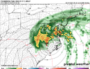
It would be an impressive system especially on the east side where you can bust the likely sfc wedge inversion
Shaggy
Member
Yeah that would be a good look at 24 to 48 hours out but that's 168 hours away so it's good eye candy and nothing moreYep and even up here, 7 days out a couple hundred miles isn't huge just huge implications for sensible weather. Euro back to solid rain event, some gust but probably big time Tor threat in ENC
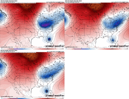
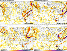
Such a big difference at 500mb across the eastern US between the euro and the gfs/cmc camp. Typically I would want to lean euro the verification scores say you should but I'm just not sure it's such a perfect scenario for this area it's hard to believe
Agreed. Something else that should be discounted is the possibility of a stall close to the coast or just inland if the trough does pull away faster.These swings aren't really that wild they just look incredibly dramatic bc of the shape of FL imo
Such a big difference at 500mb across the eastern US between the euro and the gfs/cmc camp. Typically I would want to lean euro the verification scores say you should but I'm just not sure it's such a perfect scenario for this area it's hard to believe
I feel like lines are definitely starting to blur for weather in our back yards when it comes to the Euro vs GFS. Maybe on a complete global scale, Euro may still verify better at 500mb, but man.. it's getting hard to just assume it is right vs gfs these days.
Yeah the euro has really had an over amplification issue the past couple of years in my eyes. How many times in the D5-10 has it had a big eastern ridge/trough only to back downI feel like lines are definitely starting to blur for weather in our back yards when it comes to the Euro vs GFS. Maybe on a complete global scale, Euro may still verify better at 500mb, but man.. it's getting hard to just assume it is right vs gfs these days.
iGRXY
Member
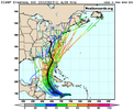
That's another big shift to the west for the 2nd landfall in the Carolinas. Another shift like that and Anywhere from Savannah to Myrtle beach will quickly be in the landfall.
Is that 2nd landfall near Myrtle Beach a Cat2? Thought I saw 955mb but the graphic was moving pretty quick.
Tornadocane
Member
This is coming together North of Forecast. Take a look at the lightening data. The energy is clearly focusing to the N and NW of TD9. The SW convection and vorticity isn't going to survive long enough to pull this storm back down to 13.5-14N. The 18z Initialization is more NE than every GEFS member, and I believe the system is actually at 15N near that big area of lightening. I also think we have a quickly organizing Tropical System at the moment, and I would not be surprised if this is a 65MPH TS in 12 Hours.
 ter.php?stormid=AL092022
The GFS solution of reformation is definitely off the table now.
 ter.php?stormid=AL092022
The GFS solution of reformation is definitely off the table now.
Last edited:
Brent
Member
Looks like this will be Ian. We all know how many I names have been retired lately
Hermine is gonna be Ten out by Africa
Hermine is gonna be Ten out by Africa
Oh no.Looks like this will be Ian. We all know how many I names have been retired lately
Hermine is gonna be Ten out by Africa
Shaggy
Member
I would tend to agree but this is a later season trough so it's strength is a bit more believableYeah the euro has really had an over amplification issue the past couple of years in my eyes. How many times in the D5-10 has it had a big eastern ridge/trough only to back down
This is a large difference in the trough between the euro and the rest with not much support from the ops but some of the gefs did look like this. I don't think its unbelievable but you are kind of looking at a south displaced sandy or Hazel type scenario here for usI would tend to agree but this is a later season trough so it's strength is a bit more believable
Tornadocane
Member
I'm gong with EPS. The model has been much closer to reality over the last 6 Hours, and I suspect we'll see more northern forecast points. The 500Mb vorticity is actually getting influenced to the north per latest maps. I can clearly see the system getting stacked on Satellite, because the both the LLC and MLC are converging from two opposite directions.
I actually hope those eastern solutions are correct, because people are not prepared. I got my supplies like waters and batteries at 8AM. I actually panicked a few people that so me rolling out 12 cases of water. lol. This is going to be a very bad system for the new transplants.
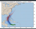
North Atlantic - 500mb Vorticity - Latest Available - Large Scale
tropic.ssec.wisc.edu
I actually hope those eastern solutions are correct, because people are not prepared. I got my supplies like waters and batteries at 8AM. I actually panicked a few people that so me rolling out 12 cases of water. lol. This is going to be a very bad system for the new transplants.

Z
Zander98al
Guest
Looked like a Michael now it looks like a Andrew, hopefully not as strong as either.
Looks like it landfalls in the 960s. There's a lot going on though with it going across FL, potentially eating dry air from the west, maybe some jet assistance hard to guess what we would truly be looking atIs that 2nd landfall near Myrtle Beach a Cat2? Thought I saw 955mb but the graphic was moving pretty quick.
Cary_Snow95
Member
Wow big uptick in east coast members. NC is buried in members this run
BHS1975
Member
Looks like it landfalls in the 960s. There's a lot going on though with it going across FL, potentially eating dry air from the west, maybe some jet assistance hard to guess what we would truly be looking at
Most if not all NC canes ingest decent amounts of dry air.
Sent from my iPhone using Tapatalk

