• Hello, please take a minute to check out our awesome content, contributed by the wonderful members of our community. We hope you'll add your own thoughts and opinions by making a free account!

Tropical Hurricane Dorian

Can you imagine if it was forecast to turn away from Miami so they didn’t evac then when you wake up it accidentally hits as a Cat 5 by sliding west too much?

If things change and people from Miami want/need to evacuate, is there enough infrastructure on the GoM side of Florida to support the move North? I would expect much of the infrastructure on the Atlantic side to be overwhelmed or shutdown in anticipation of the eye hitting Melbourne - Space Coast.
 
If euro is right could you imagine the beach erosion in Florida. It takes 5 days for the hurricane to get to Georgia


Sent from my iPhone using Tapatalk
 
If things change and people from Miami want/need to evacuate, is there enough infrastructure on the GoM side of Florida to support the move North? I would expect much of the infrastructure on the Atlantic side to be overwhelmed or shutdown in anticipation of the eye hitting Melbourne - Space Coast.
No - Sarasota and Jupiter are not set up that way; Tampa is booked (son lives there and he's saying all sorts of traffic is showing up). It would be a bad evac ...
 
So CNN is saying Dorian will make landfall as a category 4. This this true?

That is what the NHC is predicting.

FORECAST POSITIONS AND MAX WINDS

INIT 29/1500Z 21.4N 67.2W 75 KT 85 MPH
12H 30/0000Z 22.9N 68.1W 85 KT 100 MPH
24H 30/1200Z 24.5N 69.6W 100 KT 115 MPH
36H 31/0000Z 25.6N 71.4W 105 KT 120 MPH
48H 31/1200Z 26.3N 73.4W 110 KT 125 MPH
72H 01/1200Z 27.0N 76.9W 115 KT 130 MPH
96H 02/1200Z 27.5N 79.8W 115 KT 130 MPH
120H 03/1200Z 28.1N 81.5W 65 KT 75 MPH...INLAND
 
Still ridging overhead Dorian as it heads into GA, has nowhere to really go, just gonna float wherever it wants until it can get kicked out, man What a run

Finally slowly kicking out at 216 but not after 5 days of raking the eastern SE from FL to NC. Devastating rains would be as much, if not the biggest story with it being a very slow mover. My maps have 12-14" in a long strip from Canaveral up through Jax metro to just south of Waycross. Hogtown gets 8". SAV area gets 6".
 
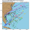
So after moving more SW from 72 to 120 on the 12Z Euro we actually end up east of the 00Z last night from there and instead of inland up the middle of the state the storm now rides just off or half on the coast.....the run from GA north is similar as well with it a tiny bit more inland over SC/NC...I mean it would only take 75 miles or so of a east shift to make first landfall Charleston to ILM somewhere and that would have huge implications for the Carolina folks....
 
One time warning only - this is a serious thread and sure there will be a little banter from time to time, we're all guilty. But it's not going to turn into a hurricane whamby 2.0 thread. We've picked up a good number of new members over the last several days and I'm sure primarily so they could get some good analysis on Dorian, think before you post please and if it's banter, use one of the banter threads. Too much going on too for us to move a bunch of post so in here they will get deleted. Thank you and if you have complaints..... too bad. :cool:
 
So after moving more SW from 72 to 120 on the 12Z Euro we actually end up east of the 00Z last night from there and instead of inland up the middle of the state the storm now rides just off or half on the coast.....the run from GA north is similar as well with it a tiny bit more inland over SC/NC...I mean it would only take 75 miles or so of a east shift to make first landfall Charleston to ILM somewhere and that would have huge implications for the Carolina folks....
Agree 100%. Too far out and with such little wiggle room the door is open for many potential tracks still because of how the coast is aligned. NC and out to sea too.
 
Back
Top