• Hello, please take a minute to check out our awesome content, contributed by the wonderful members of our community. We hope you'll add your own thoughts and opinions by making a free account!

Tropical Hurricane Dorian

The second trough would have to be a complete whiff and the high would have to build stronger from the east for that to happen. I wouldn't rule that out until tomorrow. I wouldn't rule any path out until it makes a different move, or simply keeps going.
I feel better now ... though I was nuts here the past couple days ... :eek:
 
The second trough would have to be a complete whiff and the high would have to build stronger from the east for that to happen. I wouldn't rule that out until tomorrow. I wouldn't rule any path out until it makes a different move, or simply keeps going.
To your point.....hate to say it, but look at 06z ICON. IMO worse case scenario of this west movement.
 
Look how bad some of the modeling has been again in the short term. They keep trying to push this further away from the coast (have been) but look how its correcting every run...
Remember when this was safely out to sea and anyone saying it could still be west was wishcasting. Fun times

Sent from my SM-G975U using Tapatalk
 
It also amazes me how Globals have an awful time representing true pressures. I know thats not really there job to do that for sure, but someone who is smarter than me tell me this.....I believe the EURO is ran on with a 9km RES, is that right? If so, how cant even the new 6z euro run show a pressure (in the short term) even CLOSE to what the hurricane is. Check out that euro run, almost a 35-50mb difference. I wonder if thats **PART** of the reason why globals struggle a lot with tropics. (and yes I know its harder because there is no upper drops usually until closer to land)
 
It also amazes me how Globals have an awful time representing true pressures. I know thats not really there job to do that for sure, but someone who is smarter than me tell me this.....I believe the EURO is ran on with a 9km RES, is that right? If so, how cant even the new 6z euro run show a pressure (in the short term) even CLOSE to what the hurricane is. Check out that euro run, almost a 35-50mb difference. I wonder if thats **PART** of the reason why globals struggle a lot with tropics. (and yes I know its harder because there is no upper drops usually until closer to land)

Yeah, it has some impact for sure, stronger storm > better outflow/ventilation that almost pumps and strengthens the ridge in a way to it’s north, which a weaker storm like some models showed wouldn't since the pressure was wrong
 
Woke up to this. I thought if it made it to 30/80 it was going to be tough to miss land

View attachment 22711
ok...I know I am getting older in age...lol but look how slow the doc is....so does that say it is suppose to be hitting that bigger island, in like 18 hours from 6z this morning (6z run)? so if my math is right, this euro run has it hitting that island at like 8pm tonight? Dorian is approaching the island in the next few hours unless it really slows down.
 
ok...I know I am getting older in age...lol but look how slow the doc is....so does that say it is suppose to be hitting that bigger island, in like 18 hours from 6z this morning (6z run)? so if my math is right, this euro run has it hitting that island at like 8pm tonight? Dorian is approaching the island in the next few hours unless it really slows down.
Yes sir....you nailed it.....and these time differences continued to exist over the past 2 days. IMO, the storm continued to outrun the models.
 
I guess I mentally caved to the OTS trend at the wrong time lol.

If it hits, its your fault.

1960s-man-wearing-dunce-cap-vintage-images.jpg
 
Dorian still seems relatively small to me, have there not been that many EWRC? Seems to have maintained it's almost perfect shape with very little fluctuation and no expansion of the wind field for quite some time now
I was thinking that as well. To be honest that is kind of weird...
 
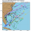
This was Matthew. Bulk missing the landfall in SC.

View attachment 22718
Difference, it came from the south at a different angle. It started the forward north motion at a different angle. And at Jax, it took a jog to the east that moved it off the coast. Charleston expected a direct hit until it moved at Jax.
There was no stall with a right turn that I remember....

MatthewStormHistory.png
 
Yes sir....you nailed it.....and these time differences continued to exist over the past 2 days. IMO, the storm continued to outrun the models.
I would agree with you. The timing on the models has been awful the entire storm.
 
ok...I know I am getting older in age...lol but look how slow the doc is....so does that say it is suppose to be hitting that bigger island, in like 18 hours from 6z this morning (6z run)? so if my math is right, this euro run has it hitting that island at like 8pm tonight? Dorian is approaching the island in the next few hours unless it really slows down.

Euro is correcting. Past 4 runs, all valid 6z Tues.

EuroTrendFloridaview.gif
 
I'm a little torn about how much rain will get on land. I feel that models are underestimating the strength of Dorain so storm shield should be tighter. However, I remember most coastal systems verify precip much west farther overland. Thoughts?
 
I was thinking that as well. To be honest that is kind of weird...
Good and bad I think. The good news is, few EWRC and less wind field expansion.... good IF it does not hit Fl, more compact less wind impact, but obviously if this beast doesn't turn then that's the bad news of it
 
No signs at all of an EWRC and structure continues improving.

View attachment 22721
I am taking a guess at this, but I think that the eyewall thickness is what's holding it together and preventing an ERC entirely. Storms that have constant or even occasional ERCs have thinner eyewalls. Every time it might try to make a new one, it probably gets absorbed into the current one, or falls apart into a band. ERCs are still unpredictable, so there could even be the chance we don't see one again.
 
One thing to monitor will be how neutral the ridge in the GOM will get. That will lead to a tighter trough and a further Inland track like the Nam depicts. However, that would only be if the Atlantic high is strong and fast which is likely. Though If the Atlantic High is weak a positive/neutral tilted trough would push It OTS.
Nam 250.png
 
Last edited:
This crossed my mind yesterday....because of the small size overall it almost reminds me of Charlie and how unpredictable that was. *not saying that is going to happen*, but makes you wonder a little bit because Dorian is a smaller hurricane in size.
 
I'm a little torn about how much rain will get on land. I feel that models are underestimating the strength of Dorain so storm shield should be tighter. However, I remember most coastal systems verify precip much west farther overland. Thoughts?
Kind of my point I just made about the fewer EWRC, more compact wind field..... same for the rain shield (not that EWRC have anything to do with that but the compact part). Anyway as it moves north it will begin weaken due to shear, trough interaction, etc but that should also start to cause the wind field to expand some and I think goo possibility of precip shield expanding inland. That's just how we roll up here, TC + trough = flooding rains...
 
Back
Top