NBAcentel
Member
18z CMC 

This confused me. Is the yellow ZR OR IP?
Yeah, looks like in NC, we’ll get some precip off WAA itself over the CAD dome (which is the process to get a cooler SFC) that may screw GA/SC with precip in between the transferThat dry hole though....geez.
its called the dry slot...What the heck is that dry hole and why is it there? And do those usually verify?
Brad upping his wording View attachment 57557
Align that map pretty much with 85/north and make a circle for a more significant area in the foothills and there’s the finished productLol he went from Trace-0.05" amts at best to now up to 0.25" in just several hours. K
Brad upping his wording View attachment 57557
Was about to post this! That’s very bullish for him! And 3 days out, wowBrad upping his wording View attachment 57557
Yeah I’d probably push the ZR-RN line a little further SE but keep it just barely NW of CLT-RDU, maybe add an additional area just outside that for trace ZR or IP. GSO-Statesville-Hickory-Marion and pts north and west id go with at least 0.1-0.2” ZR with potential for 0.25”-0.3” or so and numerous-widespread power outagesAlign that map pretty much with 85/north and make a circle for a more significant area in the foothills and there’s the finished product

Must be nice.Can't believe Philly is already under a Winter Storm Watch for Wednesday !

@Robert WestBooking my hotel room in Allentown, PA.View attachment 57561
Just know if we ever get a run like this again for our area you better walk outside, look up, and get ready because Jesus himself is coming back right then.Booking my hotel room in Allentown, PA.View attachment 57561
The same, it weirdly warms up surface temps before precip moves in during the night....Any change on the 18z euro?
I used to live right under that 28.6 in nw nj. Good times there.Booking my hotel room in Allentown, PA.View attachment 57561
I'd honestly forget about that model. It's not going to come around. It'll either bust horribly or be the messiah.Any change on the 18z euro?
Is it weird though ? Looks like Tuesday night temps drop as it will be clear . Perhaps the Euro is just showing the onset of a low level system and some wind stirring up what would have been a perfect night of radiational cooling which results in the rise in temps as precip and clouds ( wind?!) arrive ?The same, it weirdly warms up surface temps before precip moves in during the night....
Anyone have a link to current soil temps?Is it weird though ? Looks like Tuesday night temps drop as it will be clear . Perhaps the Euro is just showing the onset of a low level system and some wind stirring up what would have been a perfect night of radiational cooling which results in the rise in temps as precip and clouds ( wind?!) arrive ?
Anyone have a link to current soil temps?


Anyone have a link to current soil temps?

We will make our own wedge!
Thanks man, that was just what I was looking for.You’ve got to select the parameter it defaults to temps.NC SCO Weather Map
climate.ncsu.edu
View attachment 57565

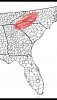
There's a difference between a little ice and an ice storm. So you believe Greenville, SC will see major ice accumulations ?My prediction. Ice storm for the areas in red and further north. We will see.
There's a difference between a little ice and an ice storm. So you believe Greenville, SC will see major ice accumulations ?
Here’s my first call map (blend of the NAM/GFS/CMC/RGEM/UK/ICON)
*note this could get warmer or I could get more aggressive, depends on trends the next 2 days !*
-thinking for Right near Charlotte and north, a glaze to .10 with a few sleet pellets is possible, this extends into the upstate and perhaps GA
-as you get towards LKN/huntersville up the 85 corridor to High point/GSO, you start increasing to 0.1 to 0.2 and perhaps 0.25 of ice along with some sleet, also @Sleet City USA favorite place landrum SC and those areas in the extreme northern upstate stand a better chance more ice
-As you get towards hickory/statesville up to the I-40 corridor, the chances of a more significant ice storm (0.25>) increase along with maybe up to 0.25 of sleet as those areas will be around 29-31 View attachment 57572
The forecast for Wednesday and Wednesday night for Bethlehem, PA. Maybe I should go see my father.