Jessy89
Member
Between now and the time it happens. It probably will be suppressed them move back nw. That’s usually the way it happens
Sent from my iPhone using Tapatalk
Sent from my iPhone using Tapatalk
The timing of the Pacific waves are very important. Getting everything to happen too early will allow for an Aleutian ridge, therefore lower heights to the east and west of a s/w, which again shears it out. So many minor details are not locked in, so don’t be surprised if this run doesn’t produce. If it does, I will admit it, and adjust my thinking.he’s probably thinking the extreme cold will suppress the moisture which is often the case in the south

Canadian has something too FWIW...Gfs with a mixed bag in the midsouth early next week


I really don’t think ground temps are going to be a problem if we do get a storm next week. Soil temps right now in the Piedmont and Upstate are basically right around 40 and we’re not looking at any multiple days of well above normal temperatures between now and the end of next week.If the cold air doesn’t retreat before the storm. Then it be great to have cold here before hand to cool the ground temps
Sent from my iPhone using Tapatalk

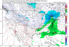
Canadian has something too FWIW...View attachment 70902
Storm is moving up in time . Icon and gfs now have it around Thursday
Sent from my iPhone using Tapatalk
Why would the quicker timing make it further north? It looks like the cold push is coming in quicker too.A little quicker timing will make it a little further north this run? but hey...its there!!
Begining to think that boundry , while the press gets hung up,waffles for 5 or 6 days deciding if it wants to dump west verse east, may be a blessing in disguise. Messing with the models for sure.Storm is moving up in time . Icon and gfs now have it around Thursday
Sent from my iPhone using Tapatalk
That would sound about right because of dealing with shallow artic air. Kinda like the feburary 1994 ice storm that did major damage. Hey @Ollie Williams you have animated maps of that storm??That’s a nasty ice storm on the GFS for many
Sent from my iPhone using Tapatalk


Wonder if that would be a record??How about that 1062 mb high pressure...View attachment 70913

January 2014 all over again

February*January 2014 all over again
The biggest is Friday/Saturday next week on GFSStorm is moving up in time . Icon and gfs now have it around Thursday
Sent from my iPhone using Tapatalk