accu35
Member
GFS/CMC both low country
We say it so many times but this just shows how everything has to be perfect to snow in the south.At hour 210, it is plenty cold for much of us. But, we'd have to worry about the storm being pushed to far south/east. **BUT--great for 8 days out.
View attachment 145873
Might be too much suppression at this range but this is a good look right now
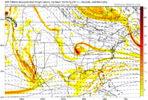
If this model run is correct there seems to be an artic high an good track for the low so there is a chance for someone in the southeast to get winter wx.Back to Winter weather in Savannah. Only up from here. Lol
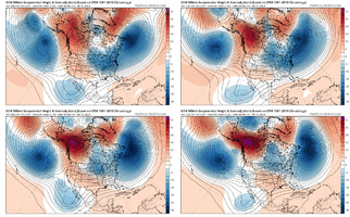
Yeh let's not drop the Arctic circle in Dallas again.We’re gonna need that high to keep sliding east. WonkyView attachment 145876
Wouldn't a triple pull it too far north or with blocking we just get a pasting monster off the se coast?I still stand by this. The probability of at least phasing 2/3 seems elevated if we can pull this setup forward.
View attachment 145882
I still stand by this. The probability of at least phasing 2/3 seems elevated if we can pull this setup forward.

You get the wave spacing and timing perfectly wrong and everything just ends up flatIn what alternate reality would this not produce a east coast winter storm View attachment 145885
It's like synchronized swimming getting all these pieces to line up. We've got no business trying to follow these things from 10 days out, but we're just deranged snow hounds afflicted with a disease and can't help it. I will say this...because we have to look ahead so far into the future to see opportunities, many of the posters on here develop a feel over time with respect to which setups at range have real potential and are worth spending time investigating and which ones aren't.We say it so many times but this just shows how everything has to be perfect to snow in the south.

I personally think this is the deep souths best chance in a while and I'm still on the fence if moisture is even going to get to the upstate+ region.It's like synchronized swimming getting all these pieces to line up. We've got no business trying to follow these things from 10 days out, but we're just deranged snow hounds afflicted with a disease and can't help it. I will say this...because we have to look ahead so far into the future to see opportunities, many of the posters on here develop a feel over time with respect to which setups at range have real potential and are worth spending time investigating and which ones aren't.
Would depend on timing and sequencing most likely. Would need the northern stream to drive hard and turn it neutral and probably negative tilt at the right time to get it to work for the biggest portion of the board. @griteater is right that we really have no business trying to track something like this at such lead times, but it's hard to look away when you see the pieces staring you right in the face.Wouldn't a triple pull it too far north or with blocking we just get a pasting monster off the se coast?
Here's what I would say Jimmy - drop the big incoming Gulf of Alaska wave south a little > that would change the tilt of our wave running from Baja to TX to negative tilt > plow the wave into the 5050 complex that is a little more NEast than curent > then slide the wave due east because of the confluence with the 5050 low. It would be kind of a blend between the GEM here and the Euro / Euro ControlIn what alternate reality would this not produce a east coast winter storm View attachment 145885
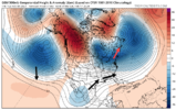
Yea but Negative Tilt brings the Cadillacs to CAD regions GA/SC/NCHere's what I would say Jimmy - drop the big incoming Gulf of Alaska wave south a little > that would change the tilt of our wave running from Baja to TX to negative tilt > plow the wave into the 5050 complex that is a little more NEast than curent > then slide the wave due east because of the confluence with the 5050 low. It would be kind of a blend between the GEM here and the Euro / Euro Control
The Deep South crew wouldn't want as much negative tilt there (too warm).
View attachment 145889
Cause its been using common core math in its programing. Needs some of that AVN hooked on phonics, programed back in it from the 90s.It’s insane that the GEFS is so much colder despite rather minimal changes at H5
View attachment 145890
4 run trend of the GEFS 24 hour precip accumulationCouple of SE hits on the GEFS View attachment 145892

Uh oh...well atleast we getting a foot for the day 8-9 deal.
GEPS wants to crank up our nemesis...the GOA ridge.
View attachment 145895View attachment 145896
EPS too.
EPS too.
This appears to be the opposite… this animation shows the ridge being replaced by a trough
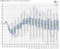
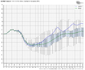
I'm sure nobody really wants to look at this but the ensembles are clearly showing a flip of EPO to + around the 22-24th and the weeklies keep it positive through the first week of March. Would be tough to overcome that.
So yeah, AK ridge replaced with trough. Hopefully the weeklies are wrong.
View attachment 145899View attachment 145900
